
Images


September 21, 2025 - Late Summer in Italy
 Tweet
Tweet
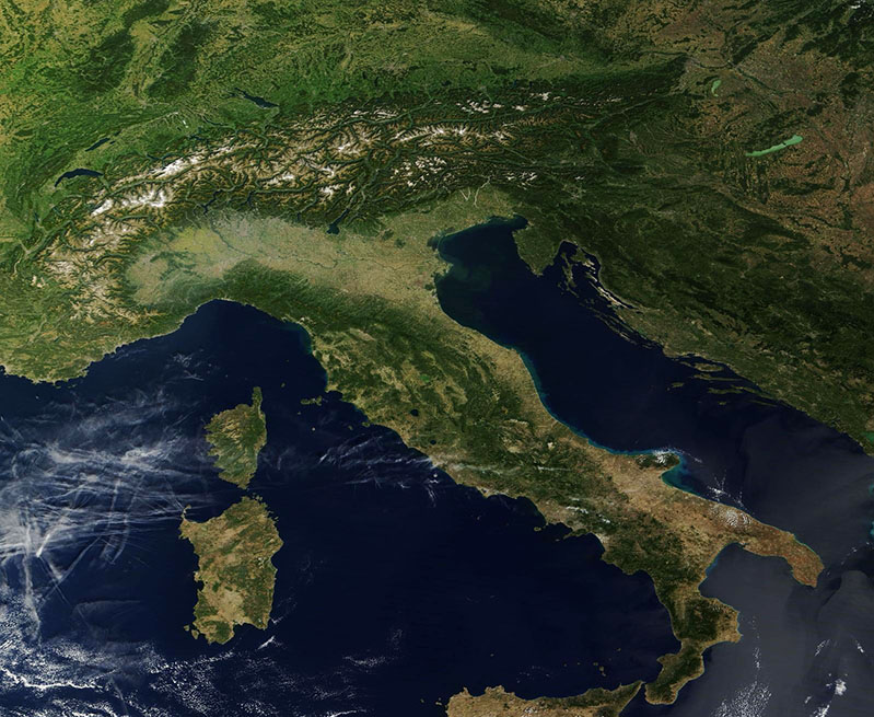
On September 19, 2025, the Moderate Resolution Imaging Spectroradiometer (MODIS) on NASA’s Terra satellite acquired this gorgeous true-color, clear-sky image of Italy.
The image captures nearly the entire country, from the snow-spatted Alps in the north to the tip of the “boot” in the south. The broad and agriculturally rich Po Valley fills northern Italy south of the Alps. The Po River sweeps across this region, while the pale green pasture and cropland reach across the coast to Slovenia in the east and south along the coast of the Italian (Apennine) Peninsula.
The Apennine Peninsula is bounded in the northeast by the Adriatic Sea and in the southwest by the Tyrrhenian Sea, an arm of the Mediterranean Sea. The islands of Corsica and Sardinia sit between the Tyrrhenian Sea, and the Mediterranean Sea proper and Sicily are located just off the tip of the “boot”. Sicily and Sardinia belong to Italy while the smaller island of Corsica is a part of France.
Image Facts
Satellite:
Terra
Date Acquired: 9/19/2025
Resolutions:
1km (66.1 KB), 500m (178.5 KB), 250m (482 KB)
Bands Used: 1,4,3
Image Credit:
MODIS Land Rapid Response Team, NASA GSFC
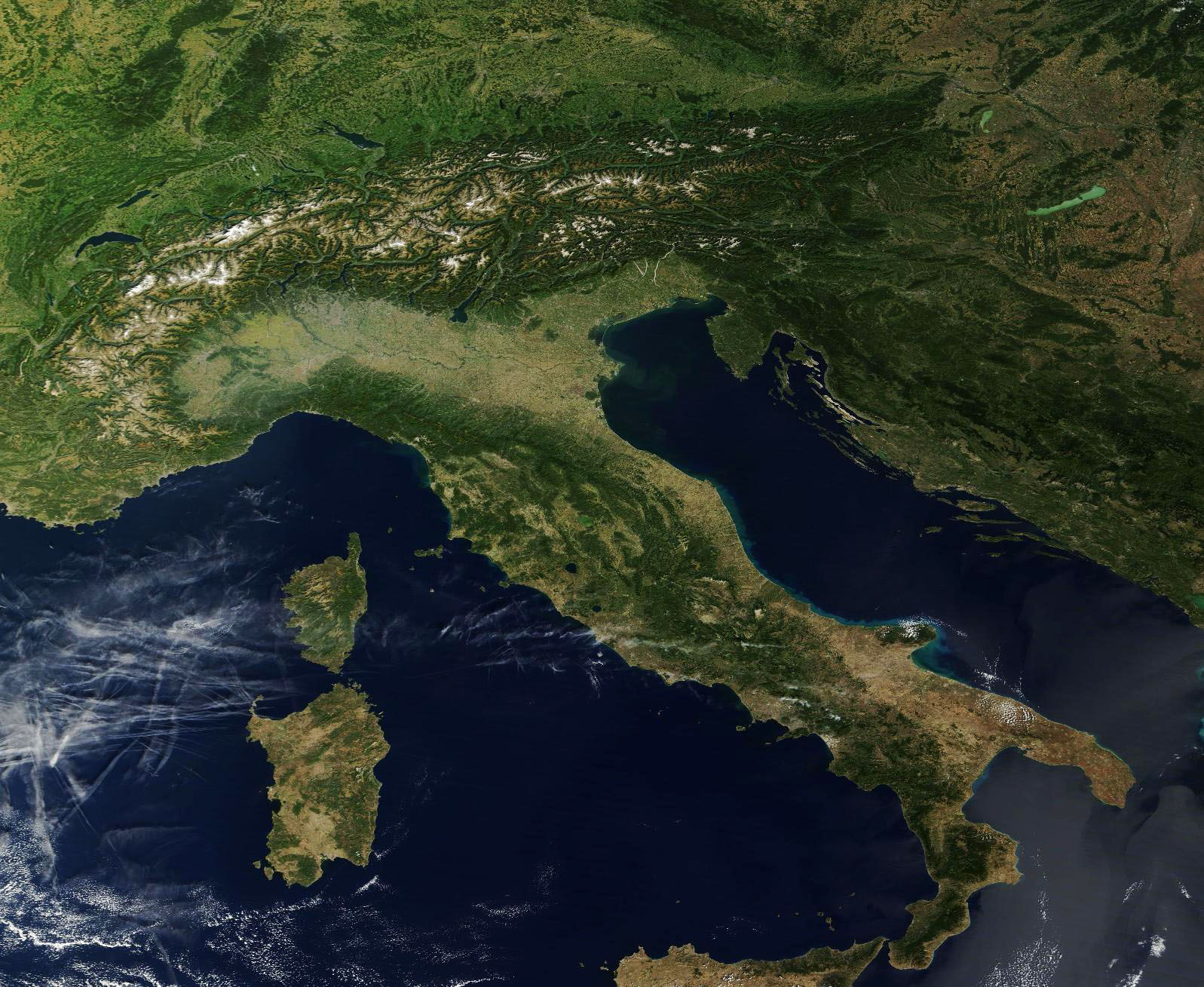
