
Images


September 24, 2025 - Flooding in Northwestern Nigeria
 Tweet
Tweet
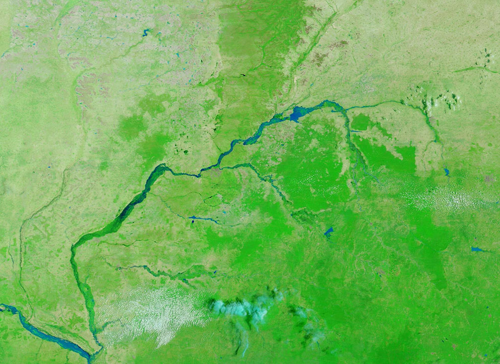
From mid-August 2025, extended heavy rain has triggered flooding in northern Nigeria. According to a situation update by United Nations Children’s Fund (UNICEF), by August 15, flash floods impacted five communities in Yobe State, with more than 2,550 households and 12,785 people affected. Two days later, floods threatened more than 2,900 people in Garin Kolo and Ajim. These communities were in northeast Nigeria.
In September, rivers also rose in northwestern Nigeria, expanding the destruction. Between 15 and 16 September 2025, multiple floods and windstorms were reported across four communities in the local government areas of Bagwai, Bichi, and Rano in Kano State, according to a report published on ReliefWeb. These incidents affected 1,136 individuals across 222 households. This included 589 children, 277 women, and 270 men. A total of 192 shelters were damaged, and 120 casualties were reported, including 73 injuries and 47 fatalities.
A separate report published on September 23 on ReliefWeb states that the National Emergency Management Agency (NEMA) reported two fatalities, two injuries, and the displacement of several people, with affected residents sheltered in two locations in the Rabah Local Government Area of Sokoto State, north-western Nigeria.
Aside from the direct impact on human life and welfare, the 2025 Nigeria floods have damaged critical infrastructure, including the destruction of a major road that has isolated some communities. Farmlands have been inundated, destroying crops and pasture. Rain is predicted to continue for the next several days, at least.
On September 19, the Moderate Resolution Imaging Spectroradiometer (MODIS) on NASA’s Terra satellite acquired this false-color image of flooding in northern Nigeria. This type of image is used to easily separate water (which looks blue) from vegetation (bright green) and open land (tan). The image captures several of the major and minor rivers of northwestern Nigeria, all in flood stage. The most obvious are the Rima River, in the northeast portion of the image, which flows into the Sokoto River, which then meets the Niger River in the lower left (southwest).
Image Facts
Satellite:
Terra
Date Acquired: 9/19/2025
Resolutions:
1km (80.3 KB), 500m (229.5 KB), 250m (380.5 KB)
Bands Used: 1,4,3
Image Credit:
MODIS Land Rapid Response Team, NASA GSFC
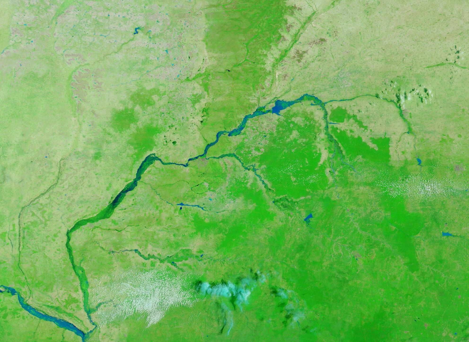
