
Images


September 22, 2025 - Fires in Washington
 Tweet
Tweet
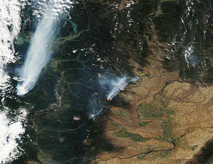
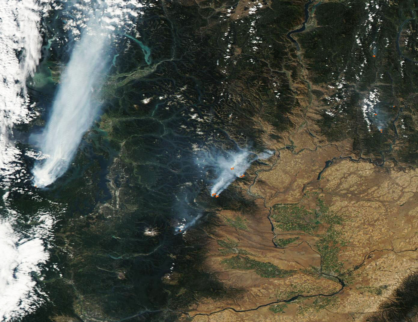
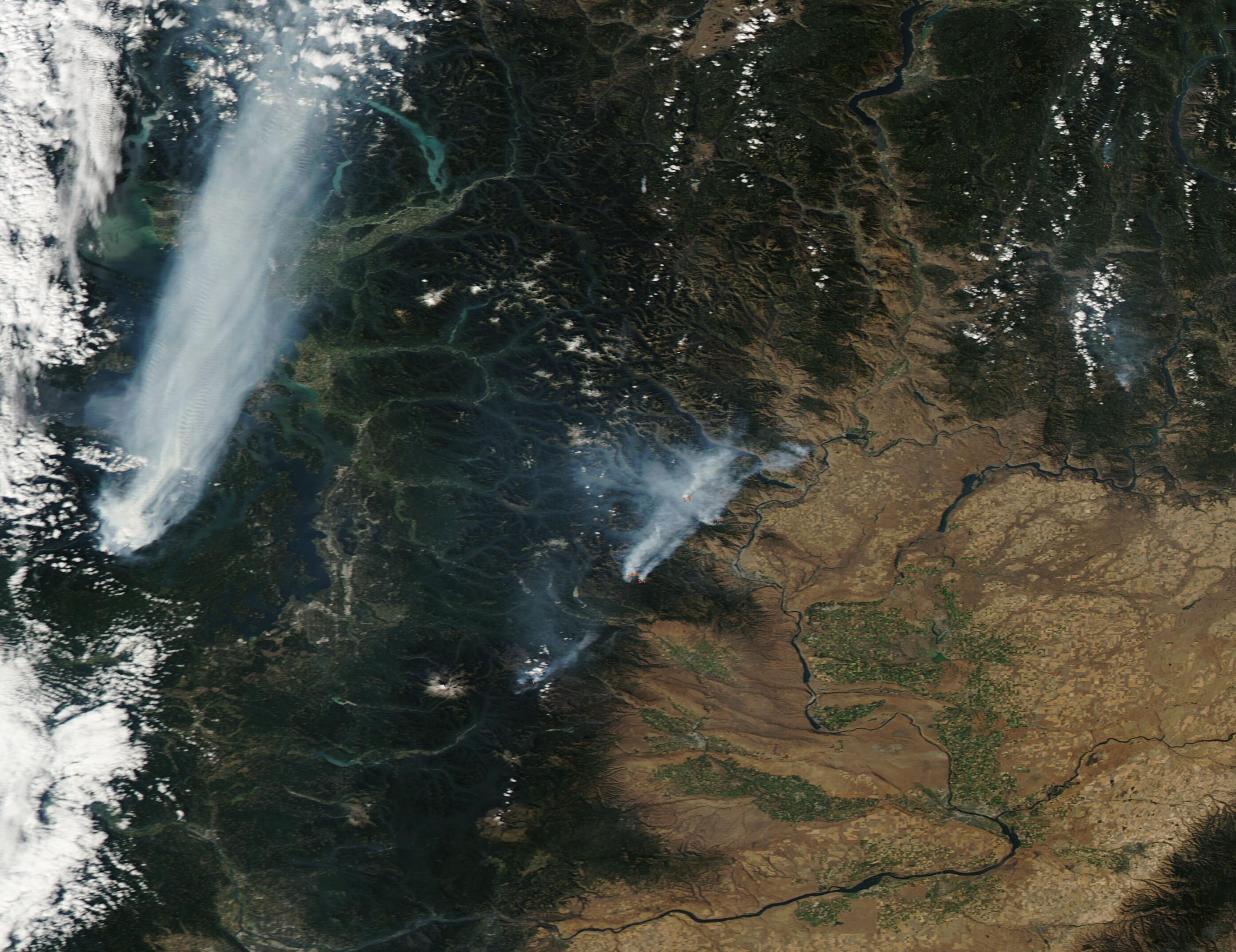
High summer temperatures, low humidity, and widespread drought set the stage for a difficult fire season in Washington state in 2025. According to the U.S. Drought Monitor, 100 percent of the state was in drought on September 16, with 79.32 percent in “severe” drought and 18.08 in “extreme” drought. None of the state was in “exceptional” drought, the most severe category. The report went on to explain that more than 6.7 million people were living under drought conditions in Washington in mid-September. In areas of extreme drought, the stage can be set for unprecedented and devastating wildfires.
The National Interagency Fire Center reported, on September 21, that there were 35 large uncontained fires burning throughout the United States on that date. Sixteen of these were located in Washington state, and 4 new fires had ignited in the previous 24 hours in the state.
The Moderate Resolution Imaging Spectroradiometer (MODIS) on NASA’s Aqua satellite acquired this true-color image of several fires actively burning across Washington on September 17. Heavy gray smoke pours from all of the fires and blows strongly to the northeast, suggesting widespread heavy winds aloft. Red “hot spots” mark actively burning fire, especially in the eastern section of the image. In the west, the lack of a hot spot is likely due to the dense smoke.
The fire emitting the most massive amount of smoke, located in the west in this image, is the Bear Gulch Fire. It was first noticed near the Mt. Rose Trailhead along the Lake Cushman Corridor in Olympic National Forest on July 6, according to InciWeb. As of September 20, the fire had burnt 19,092 acres and was only 9 percent contained. It has caused several road closures and evacuations. The Bear Gulch Fire was caused by human activity and that activity remains under investigation.
Several fires can be seen in the east, many burning in the Okanogan-Wenatchee National Forest and most ignited by lightning. The largest and northernmost of these is the Lower Sugarloaf Fire, which began on September 1 from lightning. It is burning in dry timber about 12 miles northeast of Leavenworth. As of September 21, the fire has spread over 26,872 acres and is 20 percent contained.
Image Facts
Satellite:
Aqua
Date Acquired: 9/17/2025
Resolutions:
1km (151.1 KB), 500m (332.7 KB), 250m (734.1 KB)
Bands Used: 1,4,3
Image Credit:
MODIS Land Rapid Response Team, NASA GSFC
