
Images


December 1, 2025 - Complex Clouds over Mississippi
 Tweet
Tweet
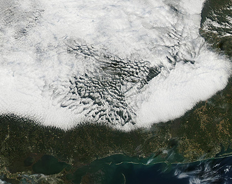
On November 23, 2025, the Moderate Resolution Imaging Spectroradiometer (MODIS) on NASA’s Aqua satellite acquired this true-color image of a complex and fascinating bank of low cloud (fog) across southern Mississippi and western Alabama.
In early morning imagery from Terra MODIS, a large bank of fog stretched from Missouri, in the north past Hattiesburg, Mississippi to approach the Gulf coast. By the afternoon pass of Aqua MODIS, all of the fog had lifted, except for a northern band that lingered over parts of Missouri, Illinois, and western Kentucky and the southern band, seen in this image, over Mississippi and Alabama. The streaky pattern at the southern edges of cloud bank suggests that strong wind is affecting the cloud, causing it to line up with the prevailing wind.
According to Weather Underground, Hattiesburg reported fog on November 23 as well as November 24-26. Temperatures were cool on November 23, dipping to a high of 69°F (20.5°F) and a low of 53°F (11.7° ) on November 23 after a high of 83°F (28.3°F ) the previous day. No precipitation was reported.
Image Facts
Satellite:
Aqua
Date Acquired: 11/23/2025
Resolutions:
1km (110.1 KB), 500m (307.6 KB), 250m (395.3 KB)
Bands Used: 1,4,3
Image Credit:
MODIS Land Rapid Response Team, NASA GSFC
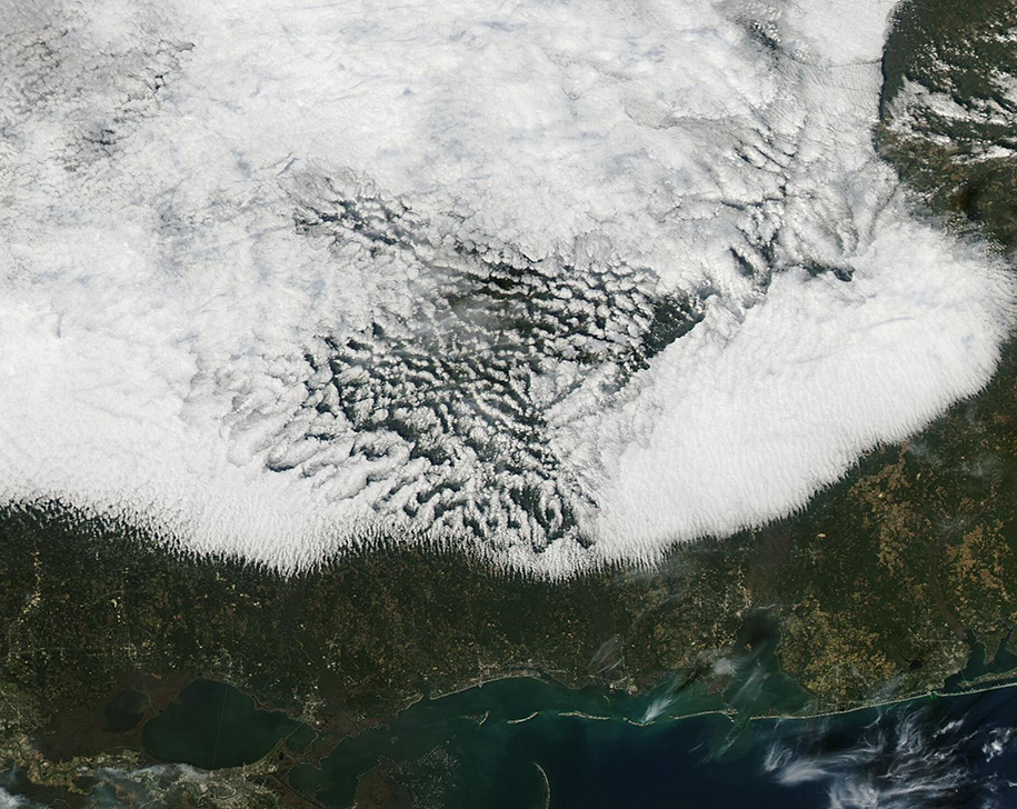
