
Images


May 17, 2016 - Scotland
 Tweet
Tweet
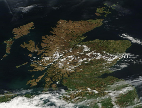
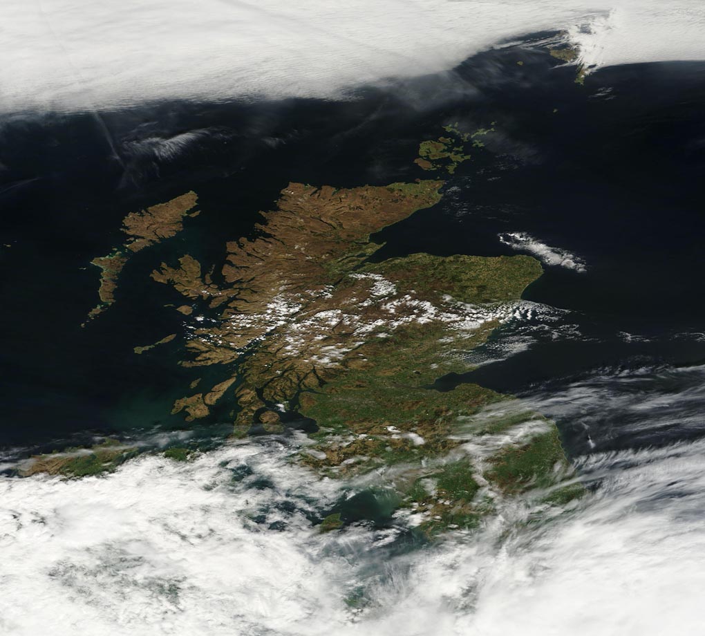
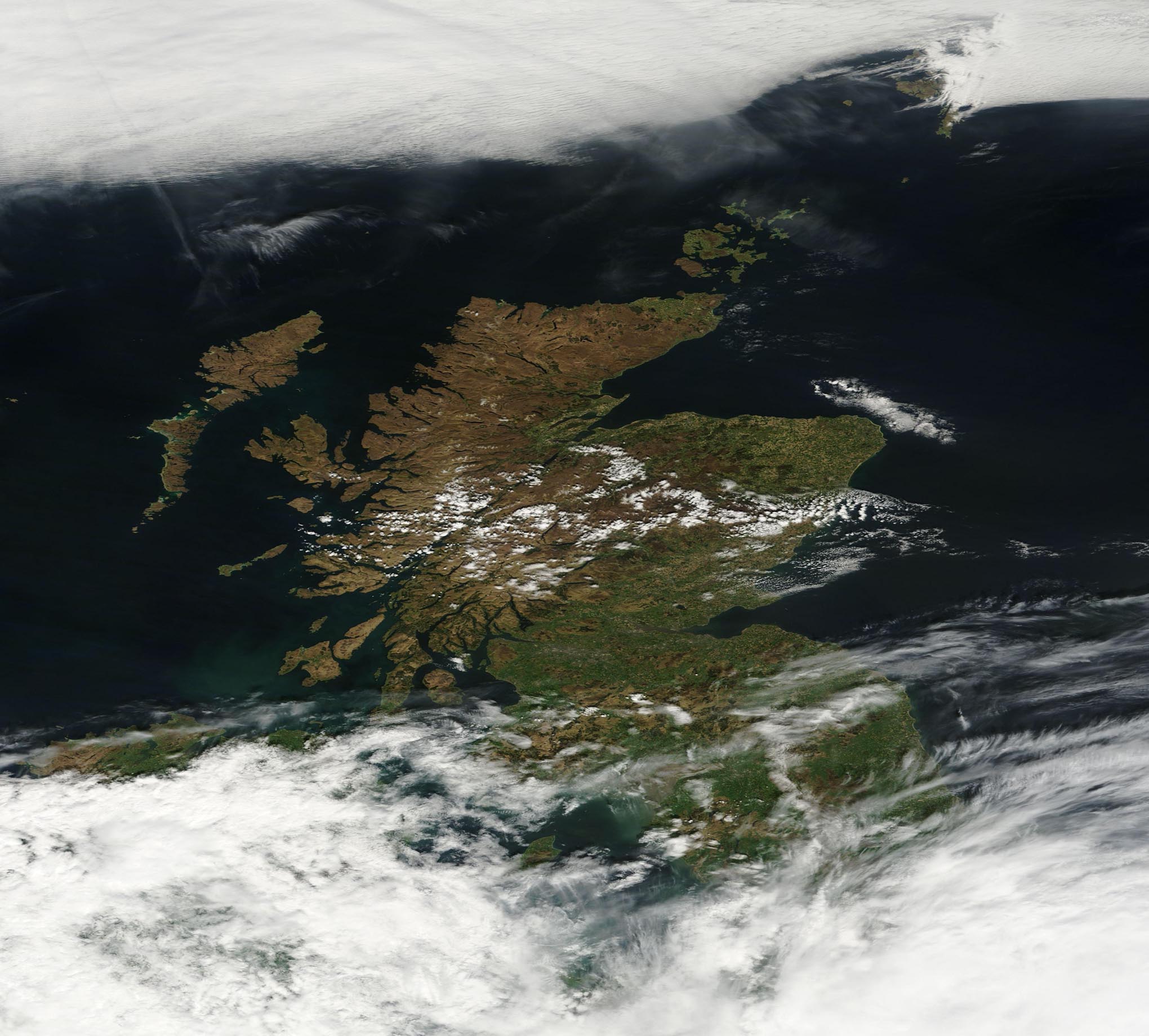
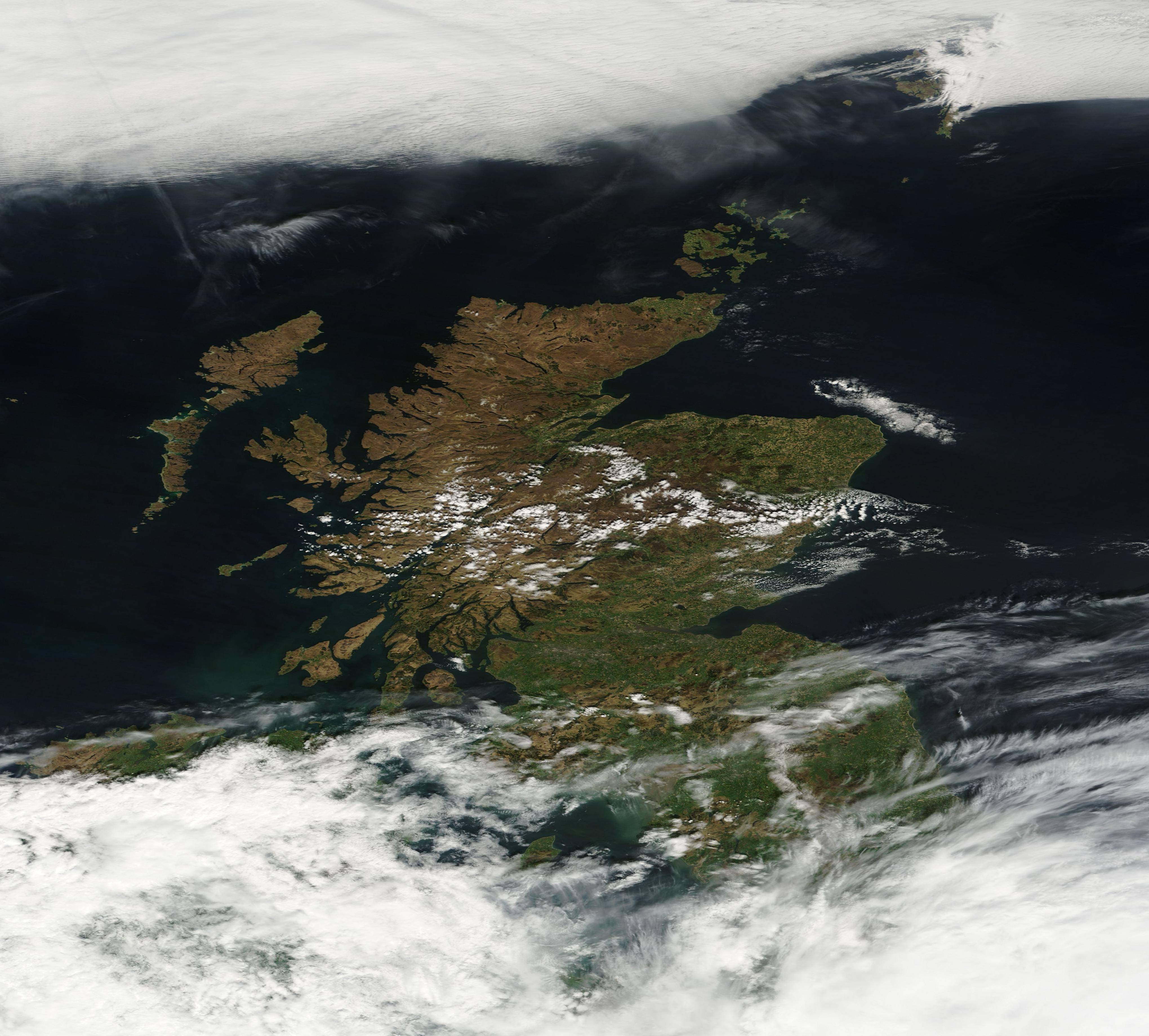
A few light clouds lingered over central Scotland on May 10, 2016, when the Moderate Resolution Imaging Spectroradiometer (MODIS) on the Terra satellite passed overhead and acquired this true-color image.
Scotland encompasses about one-third of the island of Great Britain, or 78,772 sq km (30,414 sq mi). Although the Scottish Highlands might be its most famous geographic feature, Scotland has a close relationship with water. The Atlantic Ocean wraps around its west and north, with many islands lying off the ruggedly indented west coast. On the east side lies the waters of the North Sea. Reaching inward from the oceans are deep firths (estuaries) and sea loch (lakes) which cut into the landscape. Because of the sea lochs and firths, most locations in Scotland are within 50 miles (80 km) of the sea.
Image Facts
Satellite:
Terra
Date Acquired: 5/10/2016
Resolutions:
1km (156.5 KB), 500m (390.8 KB), 250m (1.2 MB)
Bands Used: 1,4,3
Image Credit:
Jeff Schmaltz, MODIS Land Rapid Response Team, NASA GSFC
