
Images


July 14, 2016 - Dust storms off northern Chile
 Tweet
Tweet
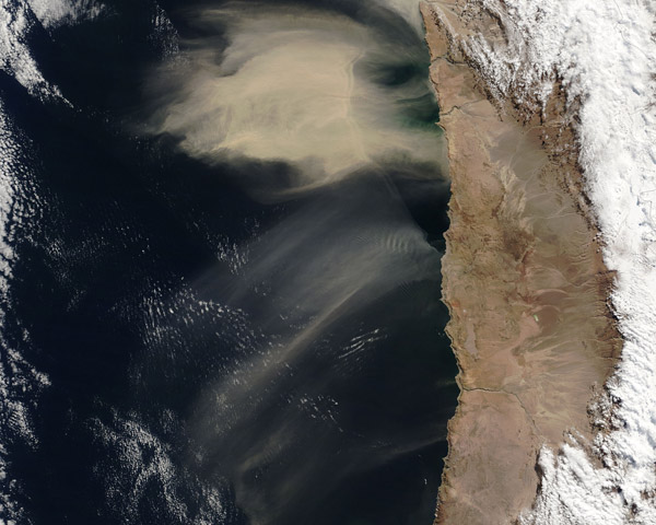
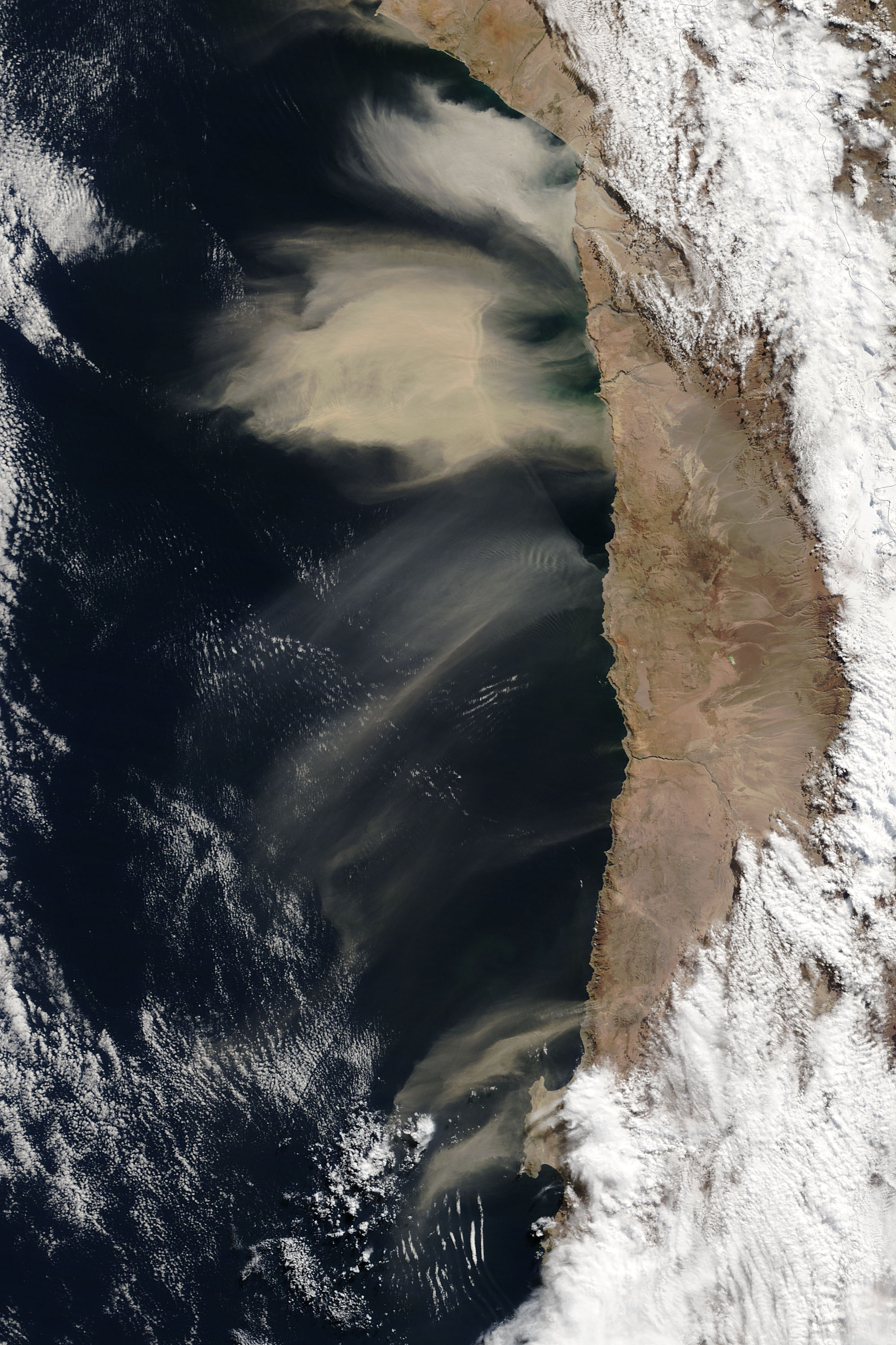
On July 8, 2016, the Moderate Resolution Imaging Spectroradiometer (MODIS) on NASA's Terra satellite acquired this true-color image of airborne dust off the coast of Chile.
It is unusual to see such large dust events emerge from the west coast of South America, according to atmospheric scientists, because winds there are not conducive to developing major dust storms like those more typically seen in North Africa or in Asia.
The local topography hinders the formation of dust storms, as the Andes Mountains run along South America's western flank and block winds arising in the east. The mountain range stretches more than 7,000 kilometers (4,400 miles) from north to south and stands more than 500 kilometers (300 miles) wide in some areas.
Globally, natural sources account for roughly 75 percent of dust emissions, while anthropogenic (manmade) sources account for roughly 25 percent, according to research published in Reviews of Geophysics. On July 8, the source was likely natural.
The image suggests that the dust source is located between the Andes and the Pacific coast. The slice of land there is narrow, with steeply rising walls. The dust source could be on an elevated slope, making it easier for dust to lift and travel far. It also could be driven by low-level winds-possibly katabatic winds, which blow downslope off the continent. The term katabatic comes from the Greek "katabaino", meaning "to descend". Such winds develop as air that comes in contact with cold, high-altitude ground cools by radiation. The air increases in density and flows downhill. It can pick up speed, causing gale-force winds.
The stormy conditions that lofted the dust on July 8 also brought wind, rain, and snow leading to the closure of at least two airports, Chile's Teletrece news site reported. Dust caused low-visibility conditions in nearby cities, as shown by ground-based photos from the Iquique Meteorological Center.
Image Facts
Satellite:
Terra
Date Acquired: 7/8/2016
Resolutions:
1km (120.5 KB), 500m (433.1 KB), 250m (1 MB)
Bands Used: 1,4,3
Image Credit:
Jeff Schmaltz, MODIS Land Rapid Response Team, NASA GSFC
