
Images


July 31, 2016 - Dust storms off West Africa
 Tweet
Tweet
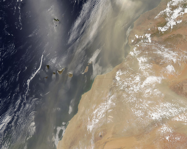
Massive amounts of dust poured off of West Africa throughout the month of July 2016, with strong winds lofting dust and sand high into the atmosphere and across the Atlantic Ocean. By mid-July the Saharan dust had travelled more than 5,000 miles to reach the coast of Texas in the United States and the Yucatan Peninsula, Mexico.
The Weather Channel reported on July 13 that African dust was causing hazy skies and beautiful sunsets in Texas, thanks to the transport of sand through the Saharan air layer (SAL) – a dry, dusty air mass which pushes westward off Africa into the tropical Atlantic Ocean every three to five days from spring through early fall. While not all dust storms extend across the Atlantic, it is not a rare phenomenon.
The Moderate Resolution Imaging Spectroradiometer (MODIS) aboard NASA’s Aqua satellite captured this true-color image of a broad band of Saharan dust blowing off of Morocco and Western Sahara and shrouding the Canary Islands and Atlantic Ocean in a veil of tan dust on July 19, 2016.
The slivery cast to the image is not due to dust, but is another phenomenon associated with remote sensing. Called sunglint, it is an optical effect caused by the mirror-like reflection of sunglint off the water surface directly back at the satellite sensor. Sunglint can reveal details about the water surface and wind that are otherwise hidden. In this case, the rough terrain of the Canary Islands block the free flow of air – blocking, slowing and redirecting the air flow as it pushes by the islands. The pattern of airflow is written in the tan, dusty wakes on the leeward (southerly) side of the islands as well as the swirling patterns of the clouds behind the islands.
Image Facts
Satellite:
Aqua
Date Acquired: 7/19/2016
Resolutions:
1km (1.1 MB), 500m (3.6 MB), 250m (8.6 MB)
Bands Used: 1,4,3
Image Credit:
Jeff Schmaltz, MODIS Land Rapid Response Team, NASA GSFC
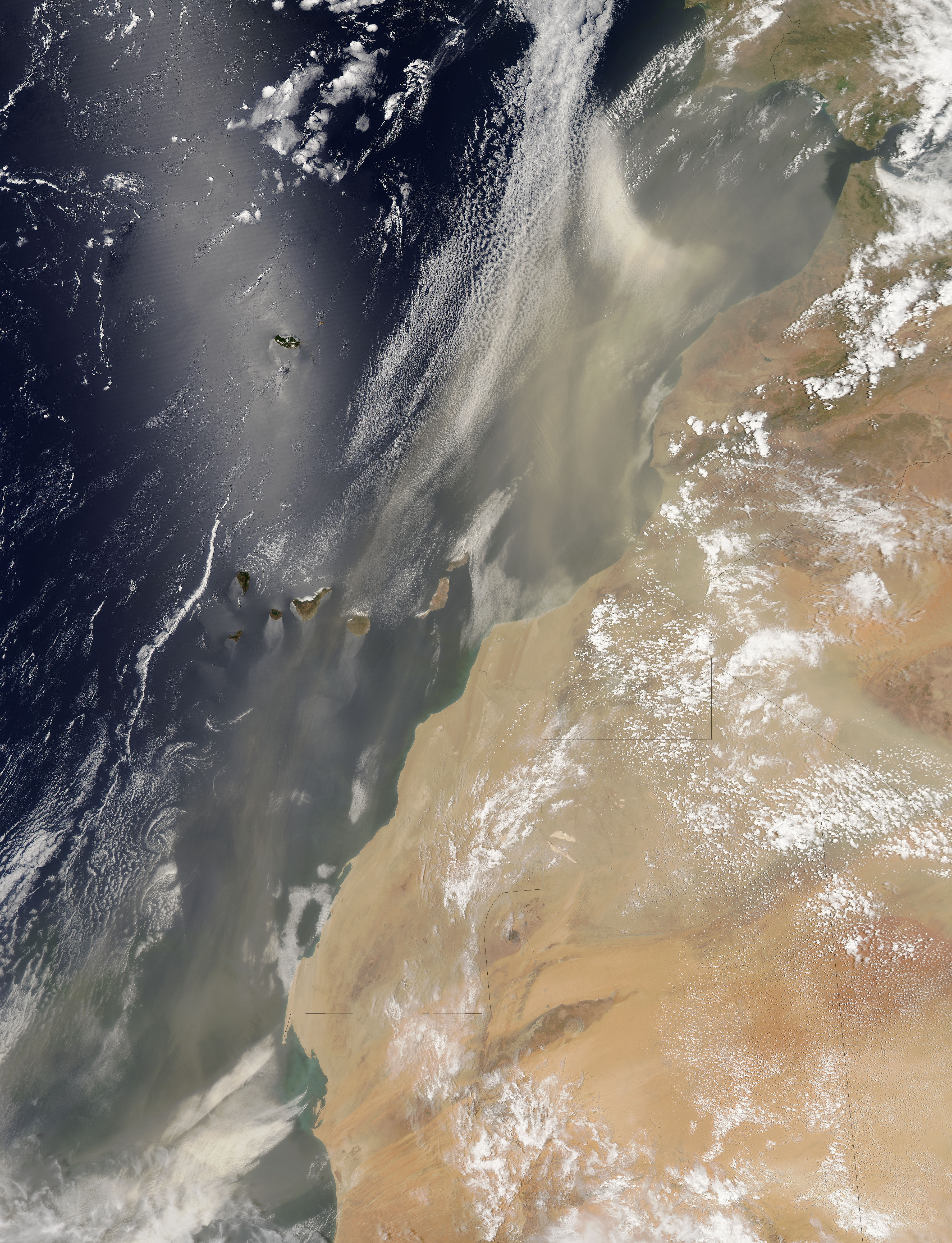
