Images
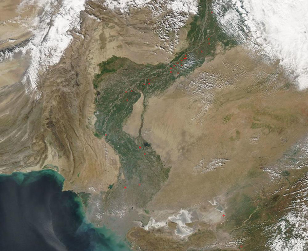
February 1, 2020 - Fires along the Indus River
Tweet
The Indus River Basin in Pakistan is an ancient seat of civilization. People have lived and farmed in the river’s fertile floodplain for millennia, in spite of the arid conditions that make it difficult to grow food in the rest of the region. While many of the nation’s largest cities and towns are clustered in the Indus River Basin, agriculture remains important along the floodplains.
On January 28, 2020, the Moderate Resolution Imaging Spectroradiometer (MODIS) on board NASA’s Terra satellite acquired a true-color image of fires burning along the Indus River. Marked by red “hot spots”, these fires are most likely agricultural in origin. Agricultural fires are deliberately set and controlled to help manage land. They may be used to open new cropland or pasture, to renew pasture, or to burn the old crop stubble to prepare land for planting.
Image Facts
Satellite:
Terra
Date Acquired: 1/28/2020
Resolutions:
1km (146.1 KB), 500m (526.5 KB), 250m (1.7 MB)
Bands Used: 1,4,3
Image Credit:
MODIS Land Rapid Response Team, NASA GSFC


