
Images


February 11, 2017 - Tropical Cyclone Carlos (04S) off Madagascar
 Tweet
Tweet
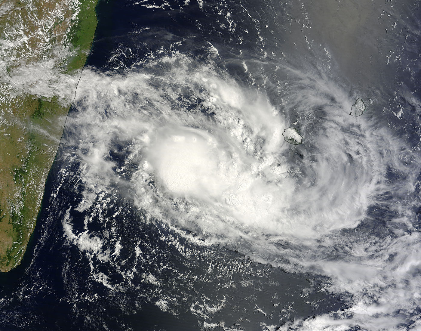
On February 8, 2017, the Moderate Resolution Imaging Spectroradiometer (MODIS) aboard NASA’s Terra satellite captured a true-color image of Tropical Cyclone Carlos spinning off of Madagascar’s eastern coast. At the time the image was captured, the storm was beginning to elongate but retained a tight and compact low-level center of circulation.
Tropical Cyclone Carlos (04S) formed north of La Reunion Island on February 4 and tracked westward for the next several days. On February 8 at 1500 UTC (10 a.m. EST) Tropical Storm Carlos' maximum sustained winds were near 51.7 mph (83.3 km/h). Carlos was centered near 22.8 degrees south latitude and 52.5 degrees east longitude, about 197 nautical miles southwest of St. Denis, La Reunion Island. Carlos was moving to the southwest at 6.9 mph (11.1 km/h). Carlos’ winds peaked at about 55 mph (88.5 km/h) on February 9.
On February 10 at 1500 UTC (10 a.m. EST) Tropical Storm Carlos' maximum sustained winds were near 51.7 mph (83.3 km/h) and Carlos was centered near 28.5 degrees south latitude and 60.8 degrees east longitude, about 502 nautical miles southeast of Port Louis, Mauritius.
JTWC forecasters expect Carlos to rapidly erode, then dissipate by Sunday, February 12 because of increasing vertical wind shear and movement over cooler sea surface temperatures.
Image Facts
Satellite:
Terra
Date Acquired: 2/8/2017
Resolutions:
1km (428.2 KB), 500m (1.4 MB), 250m (3.5 MB)
Bands Used: 1,4,3
Image Credit:
Jeff Schmaltz, MODIS Land Rapid Response Team, NASA GSFC
On February 8, 2017, the Moderate Resolution Imaging Spectroradiometer (MODIS) aboard NASA’s Terra satellite captured a true-color image of Tropical Cyclone Carlos spinning off of Madagascar’s eastern coast. At the time the image was captured, the storm was beginning to elongate but retained a tight and compact low-level center of circulation.
Tropical Cyclone Carlos (04S) formed north of La Reunion Island on February 4 and tracked westward for the next several days. On February 8 at 1500 UTC (10 a.m. EST) Tropical Storm Carlos' maximum sustained winds were near 51.7 mph (83.3 km/h). Carlos was centered near 22.8 degrees south latitude and 52.5 degrees east longitude, about 197 nautical miles southwest of St. Denis, La Reunion Island. Carlos was moving to the southwest at 6.9 mph (11.1 km/h). Carlos’ winds peaked at about 55 mph (88.5 km/h) on February 9.
On February 10 at 1500 UTC (10 a.m. EST) Tropical Storm Carlos' maximum sustained winds were near 51.7 mph (83.3 km/h) and Carlos was centered near 28.5 degrees south latitude and 60.8 degrees east longitude, about 502 nautical miles southeast of Port Louis, Mauritius. JTWC forecasters expect Carlos to rapidly erode, then dissipate by Sunday, February 12 because of increasing vertical wind shear and movement over cooler sea surface temperatures.
Image Facts
Satellite:
Terra
Date Acquired: 2/8/2017
Resolutions:
1km (428.2 KB), 500m (1.4 MB), 250m (3.5 MB)
Bands Used: 1,4,3
Image Credit:
Jeff Schmaltz, MODIS Land Rapid Response Team, NASA GSFC
