
Images


March 13, 2016 - Dust from the Gobi Desert over Russia (afternoon overpass)
 Tweet
Tweet
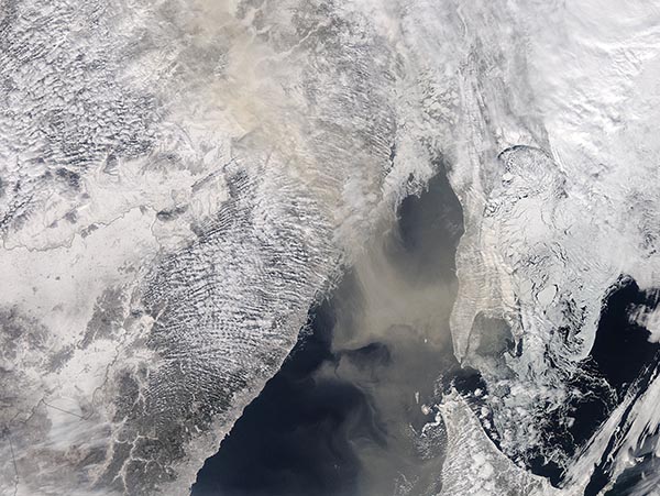
Dust raised from a storm over the Gobi Desert in early March 2016 continued a long-distance trek in the upper atmosphere, passing above the iced-over Strait of Tartary and Russia’s Sakhalin Island three days after being lifted from the sandy desert. The Moderate Resolution Imaging Spectroradiometer (MODIS) aboard NASA’s Aqua satellite captured this true-color image on March 7.
White snow lays on the landscape of eastern Siberia, including the mainland (west), Sakhalin Island (northeast) and Japan’s Hokkaido Island. Streaks of cloud also cover portions of the landscape. Water appears blue while the sea ice which covers much of the frigid waters also appear white. The white-and-blue tableau is broken by a thick, swirling river of smoke which blows from China, in the southwest corner of the image, arcs over Hokkaido and Sakhalin, then streams to the northwest over Siberia.
The dust rose into the atmosphere by strong winds accompanying a storm passing over the region on March 4 – 6. The storm dropped snow on parts of Mongolia and China while the wind whipped over the Gobi Desert. The dust was so thick that, according to local reports and photographs, the mid-afternoon sky turned red over parts of eastern Mongolia on March 4, forcing drivers to use headlights and citizens to cover their mouths with scarves to mitigate the effect of the severe dust storm. By March 5 most of the dust had travelled higher in the atmosphere and spread across parts of China (east) and southeastern Russia (north).
The Gobi Desert straddles the China-Mongolia border and is one of the world’s most abundant sources of dust. Dust storms tend to be most frequent in the unsettled weather of springtime, especially in March and April.
Earlier images of the dust storm were published as the MODIS Image of the Day on March 11 and March 12, 2016.
Image Facts
Satellite:
Aqua
Date Acquired: 3/7/2016
Resolutions:
1km (480.6 KB), 500m (1.6 MB), 250m (3.8 MB)
Bands Used: 1,4,3
Image Credit:
Jeff Schmaltz, MODIS Land Rapid Response Team, NASA GSFC
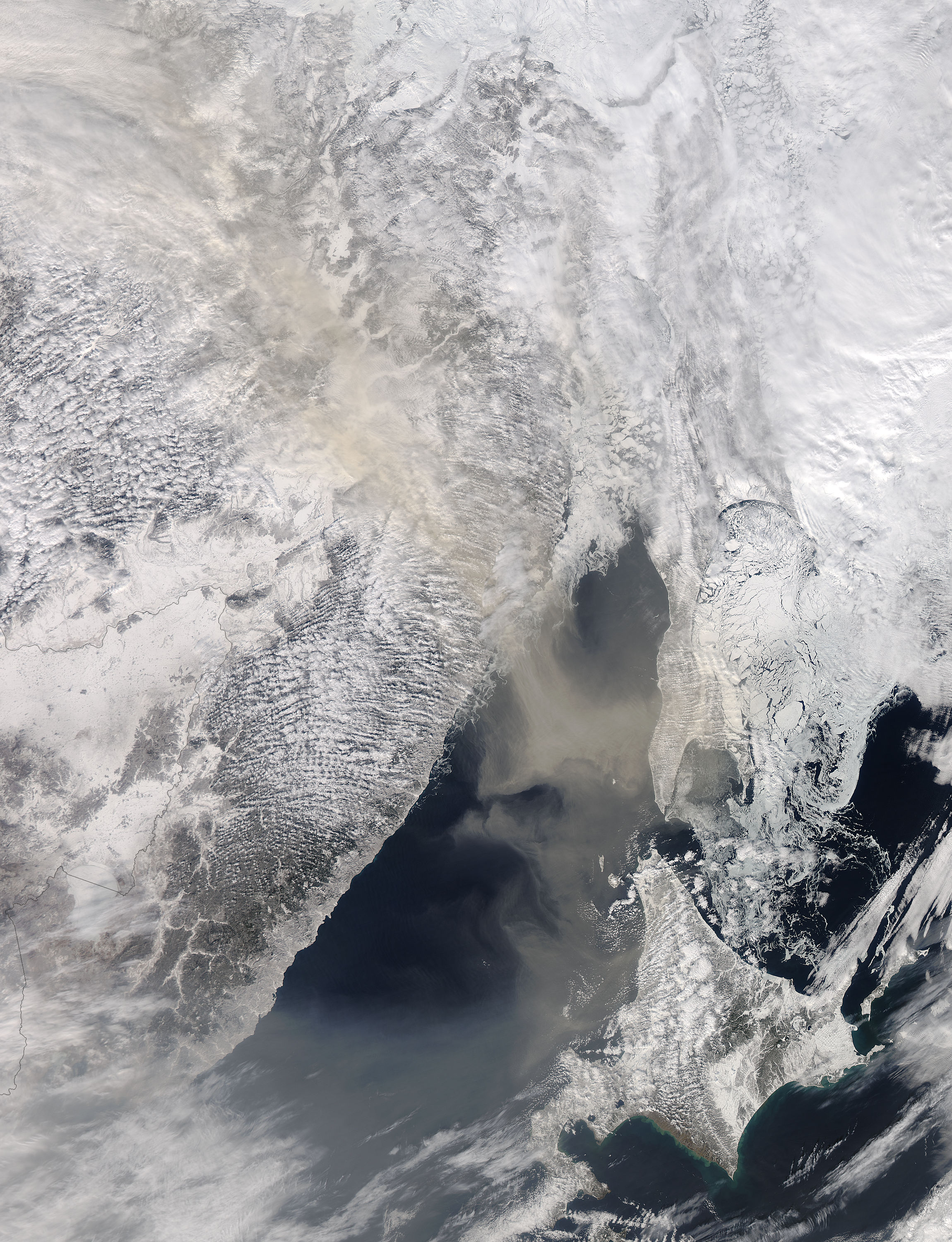
