
Images


April 19, 2016 - Lake Balkash
 Tweet
Tweet
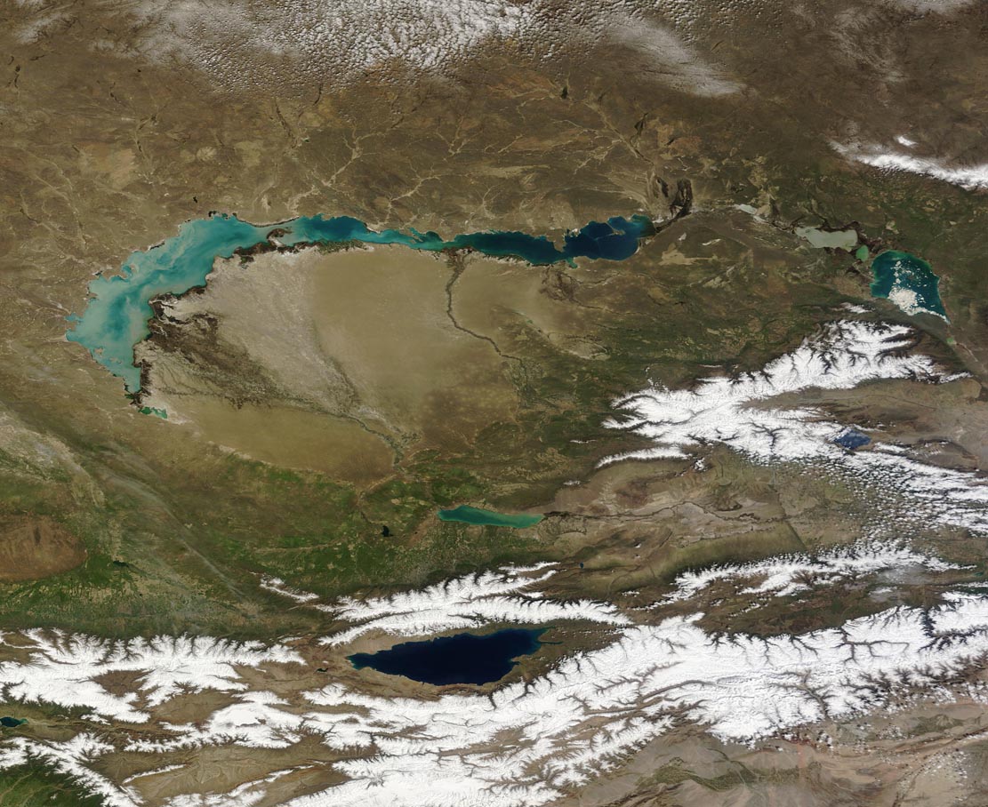
The crescent-shaped Lake Balkhash, the second largest lake in Central Asia, sits in the Balkhash-Alakol depression in southeastern Kazakhstan. The spectacular lake stretches over 7,115 square miles (18,428 sq. km), about 85% of which is in Kazakhstan, about 15% in China, and a small bit of waterfront can be found in Kyrgyzstan. Balkhash is quite long - about 376 mi (605 km) - but it is narrow. At its widest, the lake reaches 50 miles (80 km) across but only 15 mi (24 km) at its narrowest points.
The basin in which the lake sits is endorheic, which means that water flows into the basin from various sources but there is no water outflow. Instead, water disperses by evaporation or seepage. Lake Balkhash has several inflows from rivers, with the largest being the Ili River. The Ili is fed by from snowmelt and precipitation in the mountains of Xinjiang Province, China. The green Ili River Delta can be seen on the southwest coast of Lake Balkhash.
The striking difference in water color between the east and the west reflects the very different hydrology of the two parts. The western section of the lake is shallow, and the substantial water influx from the Ili and other rivers keeps the salinity low. Although the water is discolored from sediment and also, at times, algae or phytoplankton blooms, it is suitable for drinking or industrial use. In contrast, the water in the east is very saline and not suitable for drinking or agricultural use.
The Moderate Resolution Imaging Spectroradiometer (MODIS) aboard NASA's Terra satellite captured this true-color image on April 14, 2016.
Image Facts
Satellite:
Terra
Date Acquired: 4/14/2016
Resolutions:
1km (259 KB), 500m (683.8 KB), 250m (2.2 MB)
Bands Used: 1,4,3
Image Credit:
Jeff Schmaltz, MODIS Land Rapid Response Team, NASA GSFC
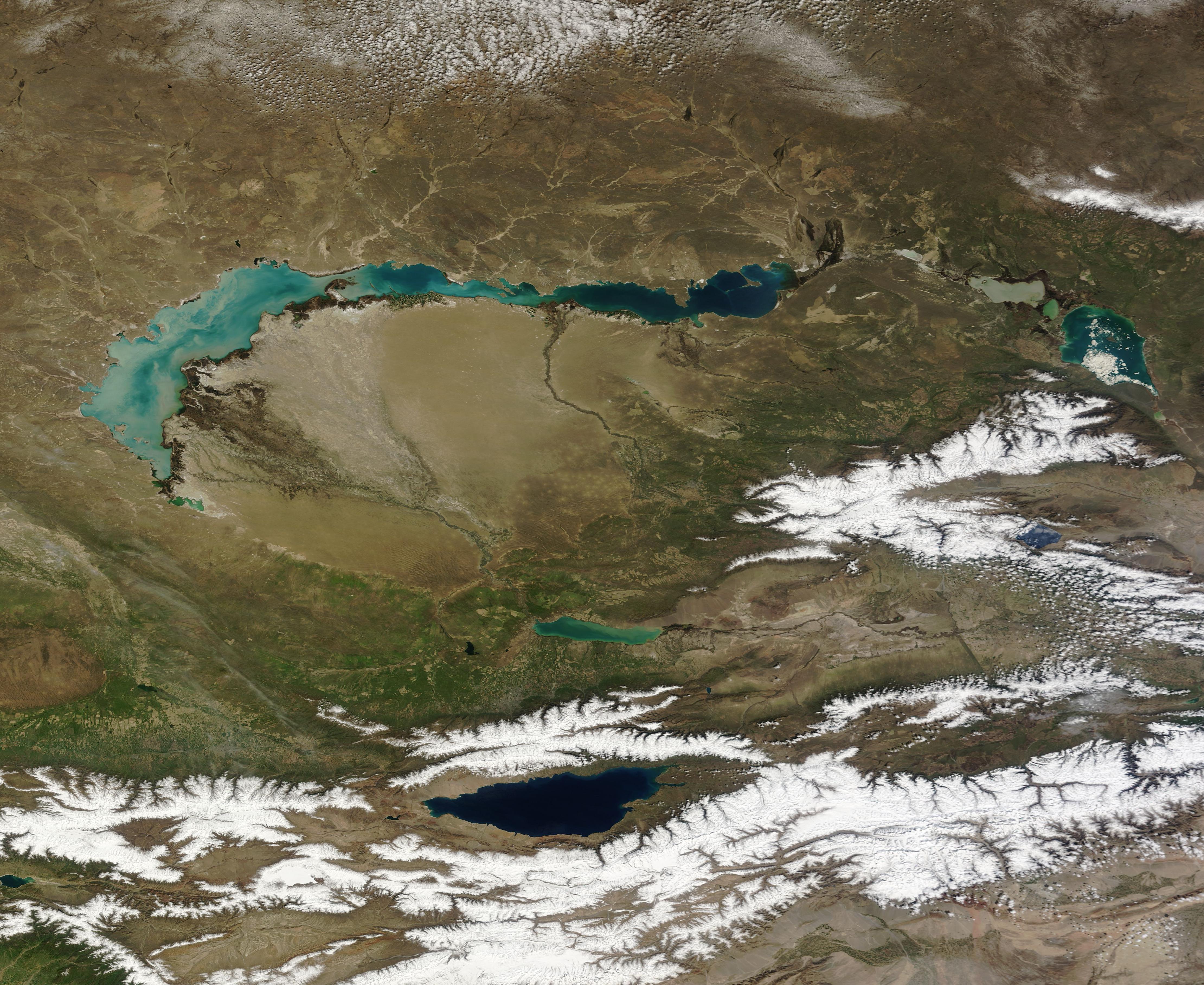
