Images
September 23, 2017 - Tropical Storm Jose (12L) off northeastern United States
Tweet
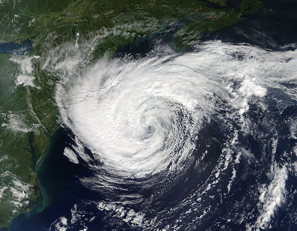
The long-lived Tropical Storm Jose stubbornly spun off the coast of New England in late September, 2017. The Moderate Resolution Imaging Spectroradiometer (MODIS) aboard NASA’s Terra satellite acquired this true-color image of the storm on September 21.
The center of circulation appeared almost due east of New Jersey while convective bands carrying rain covered most of Massachusetts, Rhode Island, Connecticut, and Vermont. Lighter rain covered much of New York, New Hampshire, and parts of Maine. The clouds in the northeastern quadrant reach just south of Nova Scotia, Canada. Tropical Storm Warnings were in effect from Woods Hole to Sagamore Beach, including Cape Cod, Block Island, Martha’s Vineyard, and Nantucket Island.
Jose formed on September 2, and the system been moving through the Atlantic for 20 days. The National Hurricane Center issued their 70th and final advisory on the Jose late in the day on September 22.
Image Facts
Satellite:
Terra
Date Acquired: 9/21/2017
Resolutions:
1km (699.6 KB), 500m (2.3 MB), 250m (5.7 MB)
Bands Used: 1,4,3
Image Credit:
Jeff Schmaltz, MODIS Land Rapid Response Team, NASA GSFC


