
Images


October 9, 2017 - Atmospheric gravity waves in the Atlantic Ocean, northeast of Brazil
 Tweet
Tweet
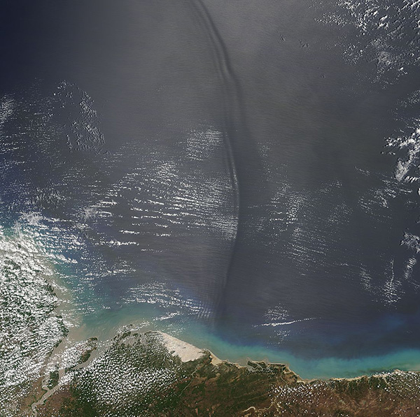
On October 4, 2017, the Moderate Resolution Imaging Spectroradiometer (MODIS) aboard NASA’s Terra satellite flew over the coat of Brazil and captured a spectacular image of a sinuous wave pattern in the Atlantic Ocean.
Although the wave that stretches along the ocean appears to be water rolling forward, like a wave at the beach, that is not what is happening. Instead, the pattern is being created by atmospheric gravity waves interacting with the surface of the ocean. As the name implies, atmospheric gravity waves form when buoyancy pushes air up, and gravity pulls it back down. On its descent into the low-point of the wave (the trough), the air touches the surface of the ocean, roughening the water. The long, vertical dark lines show where the troughs of gravity waves have roughened the surface. The brighter regions show the crests of the atmospheric waves.
Atmospheric gravity waves are not uncommon, but catching a glimpse of them requires special viewing conditions. Such waves are best seen from space in areas of “sunglint”, a phenomenon that occurs when the sun reflects off the surface of the ocean at the same angle that a satellite sensor is viewing the surface. In the affected area of the image, smooth ocean water becomes a silvery mirror, while rougher surface waters appear dark. Sometimes the sunglint region of satellite images reveals interesting ocean or atmospheric features that the sensor does not typically record, such as this atmospheric gravity wave off the coast of Brazil.
Image Facts
Satellite:
Terra
Date Acquired: 10/4/2017
Resolutions:
1km (83 KB), 500m (335.9 KB), 250m (842.3 KB)
Bands Used: 1,4,3
Image Credit:
Jeff Schmaltz, MODIS Land Rapid Response Team, NASA GSFC
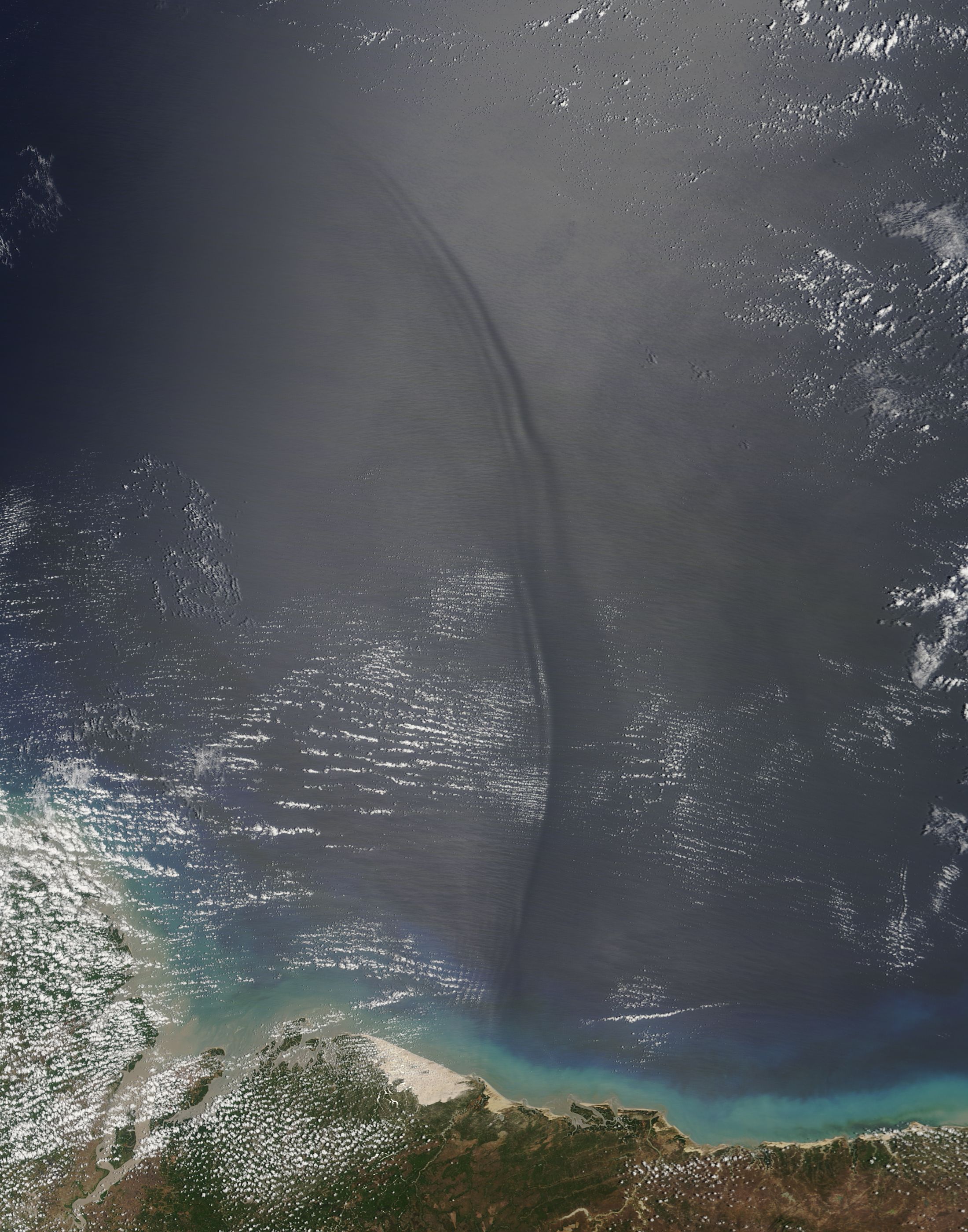
