
Images


March 13, 2018 - Manicouagan Impact Crater
 Tweet
Tweet
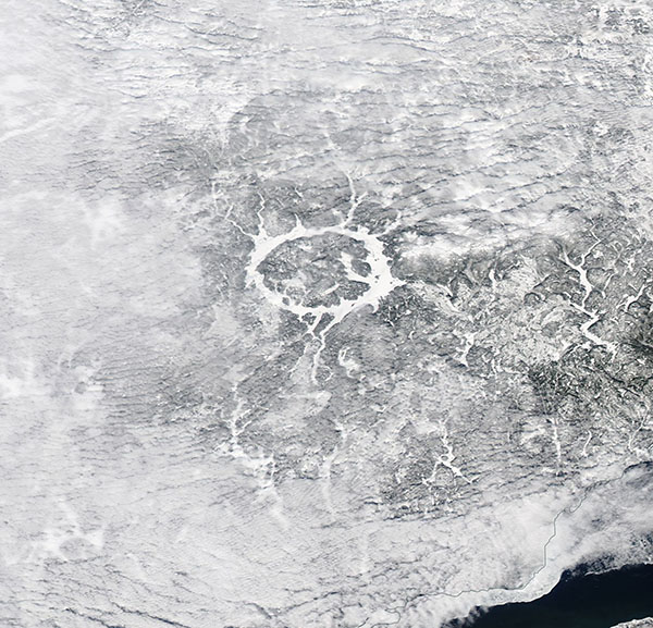
The stunning “eye of Quebec” wore a layer of ice on March 5, 2018. The Moderate Resolution Imaging Spectroradiometer (MODIS) aboard NASA’s Aqua satellite acquired this true-color winter image of the annular lake on that same day.
Lake Manicouagan, located in northern Quebec, Canada, represents the remnants of one of the largest impact craters still visible on the surface of the Earth. Ice that overlies the lake water appears bright white, while the landscape, which is dusted in snow, appears gray. A bank of white clouds lies to the southwest of the lake and prevents visualization of the ground beneath.
The icy waters form a ring around a central uplift of the impact structure. The crater is about 43.5 miles (70 km) in diameter and composed of what is known as “impact brecciated rock” – or relatively large pieces of rock embedded in finer grained material which is created by high-speed, high-temperature impacts. Glaciation and other erosional processes have reduced the extent of the crater over time. The original diameter has been estimated at about 62 miles (100 km).
The impact that formed Manicouagan is thought to have occurred about 212 million years ago, toward the end of the Triassic period. It has been proposed that the impact was created by an asteroid with a diameter of about 5 kilometers. The lake is bounded by erosion-resistant metamorphic and igneous rocks, and shock metamorphic effects are abundant in the target rocks of the crater floor. Today Lake Manicouagan serves as a reservoir and is one of Quebec’s most important regions for Atlantic salmon fishing.
Image Facts
Satellite:
Aqua
Date Acquired: 3/5/2018
Resolutions:
1km (106.1 KB), 500m (296.6 KB), 250m (606 KB)
Bands Used: 1,4,3
Image Credit:
Jeff Schmaltz, MODIS Land Rapid Response Team, NASA GSFC
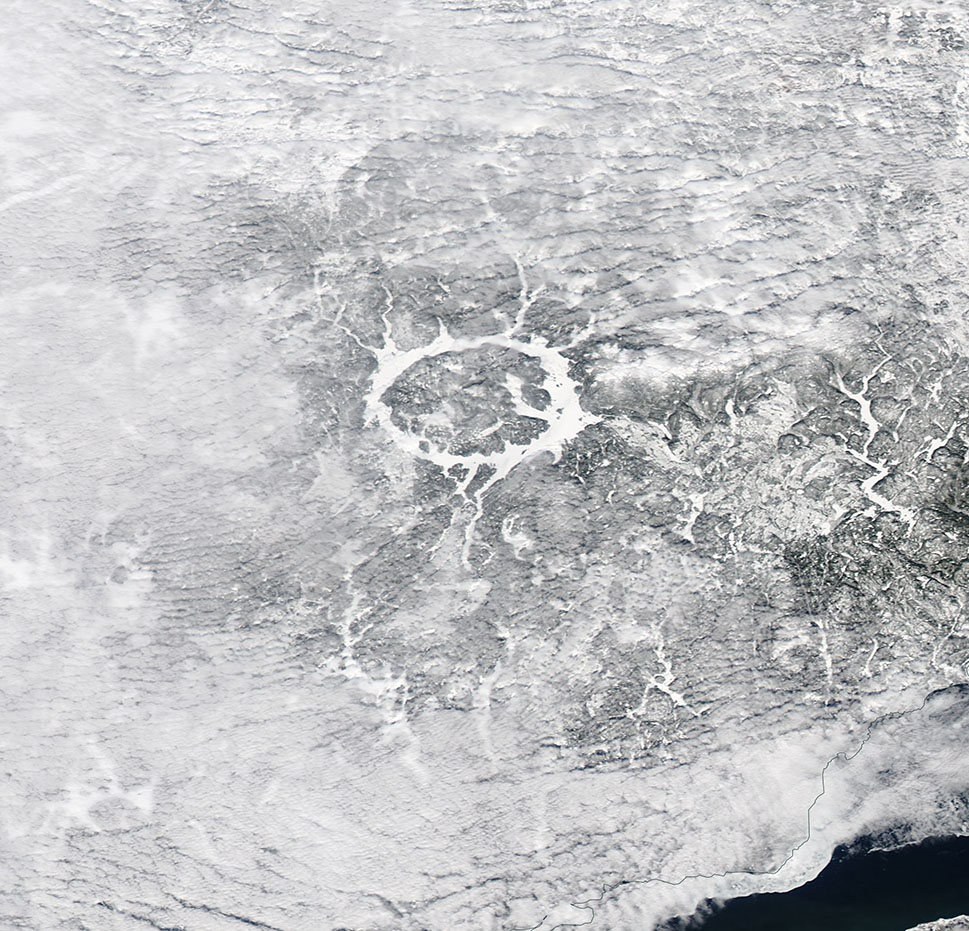
