
Images


March 28, 2018 - Low clouds over the Yellow Sea
 Tweet
Tweet
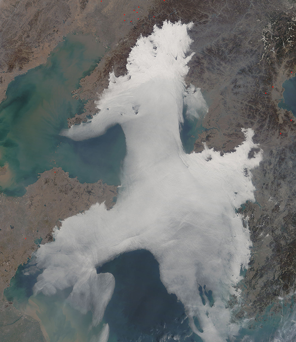
Springtime on the Yellow Sea typically means the arrival of sea fog – a dense low cloud that frequents the region from roughly April until July each year. It has been reported that an average of 50 days of fog occur on the Chinese coast from April through July.
In springtime, the land warms much faster than the cool ocean waters while the prevailing west-southwesterly winds often create conditions that are perfect for the formation of a temperature inversion over parts of the Yellow Sea. When a tongue of warm air blows from the land over the cooler sea and under the inversion, conditions are perfect for the formation of fog. Later in the summer – typically by late July or August – the prevailing winds shift making conditions unfavorable for the formation of large banks of fog.
The Moderate Resolution Imaging Spectroradiometer (MODIS) aboard NASA’s Terra satellite acquired a true-color image of a very large bank of fog over the Yellow Sea on March 26, 2018. The north- and south-western portions of the bank low cloud also crept over the coast of China and, to the east, hung over much of the Korean Peninsula.
Image Facts
Satellite:
Terra
Date Acquired: 3/26/2018
Resolutions:
1km (127.1 KB), 500m (442 KB), 250m (1.2 MB)
Bands Used: 1,4,3
Image Credit:
Jeff Schmaltz, MODIS Land Rapid Response Team, NASA GSFC
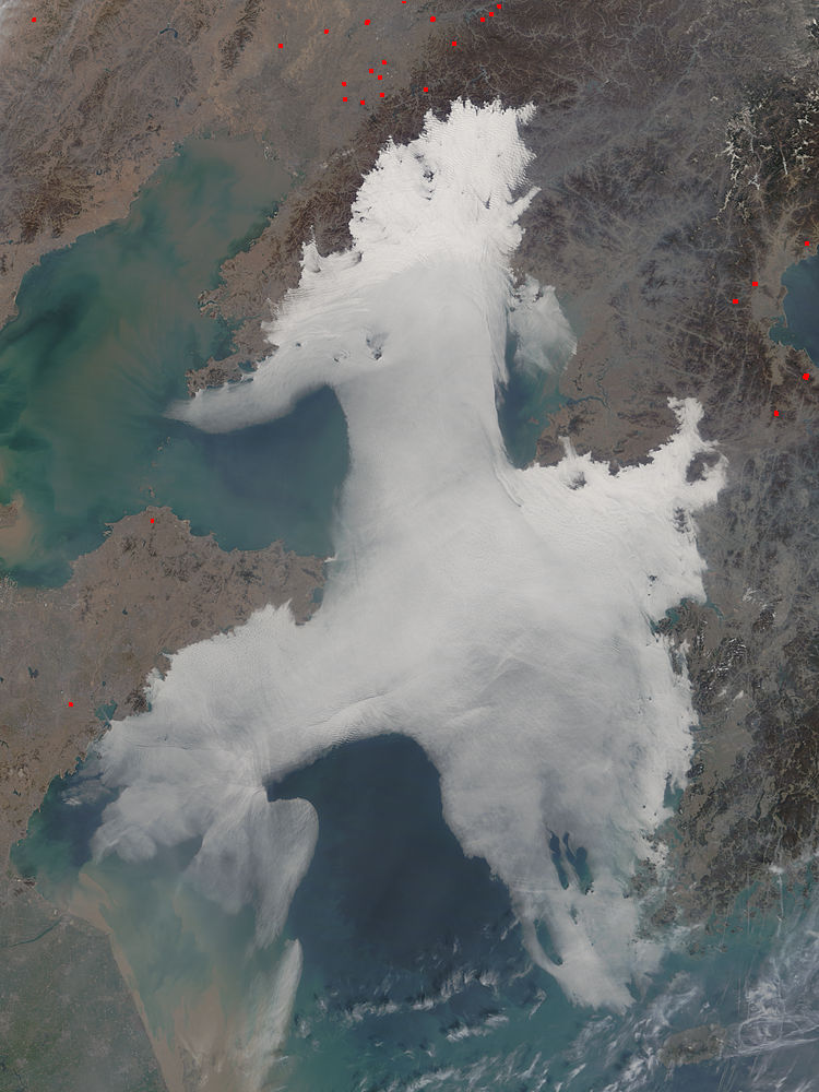
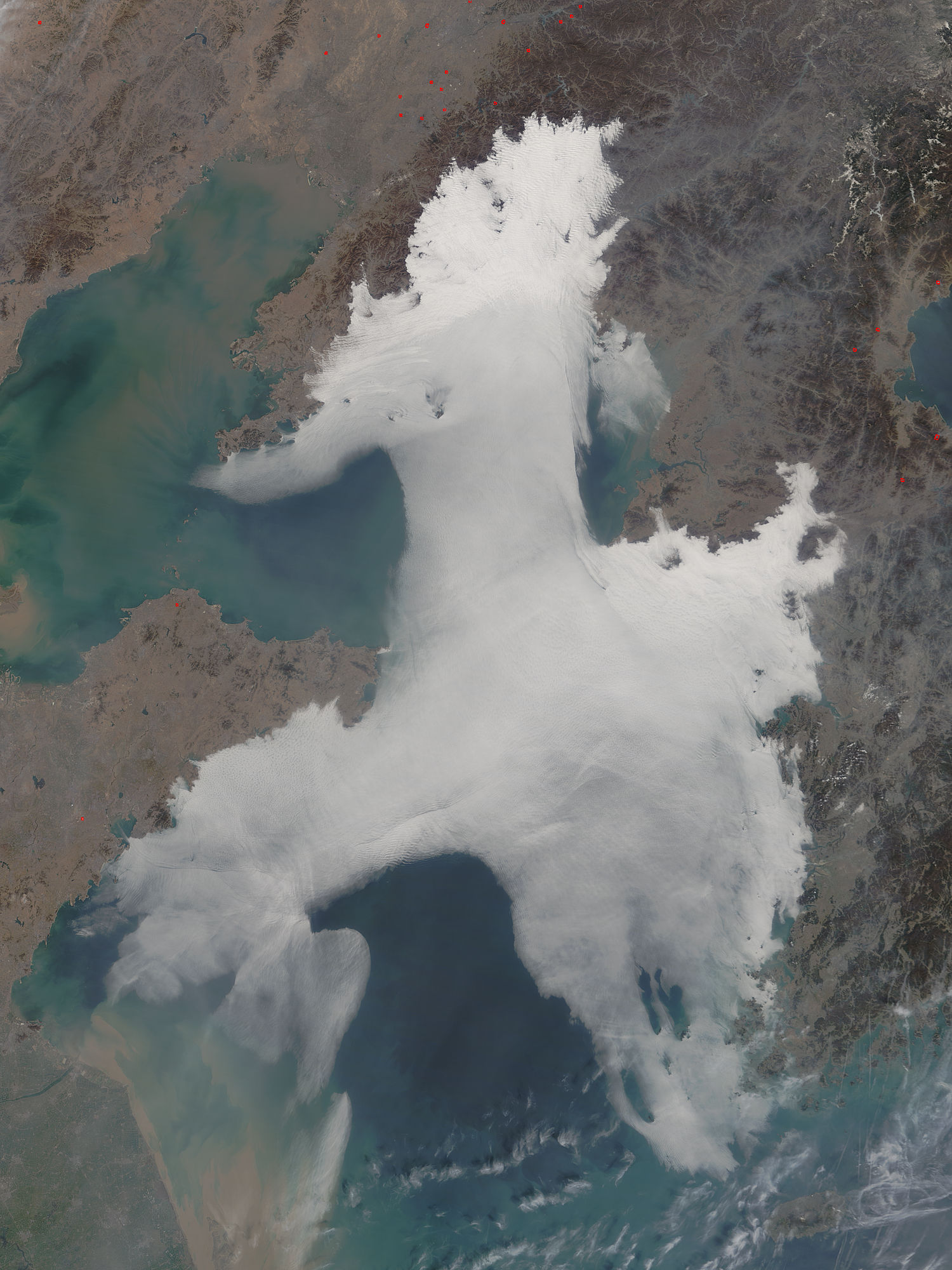
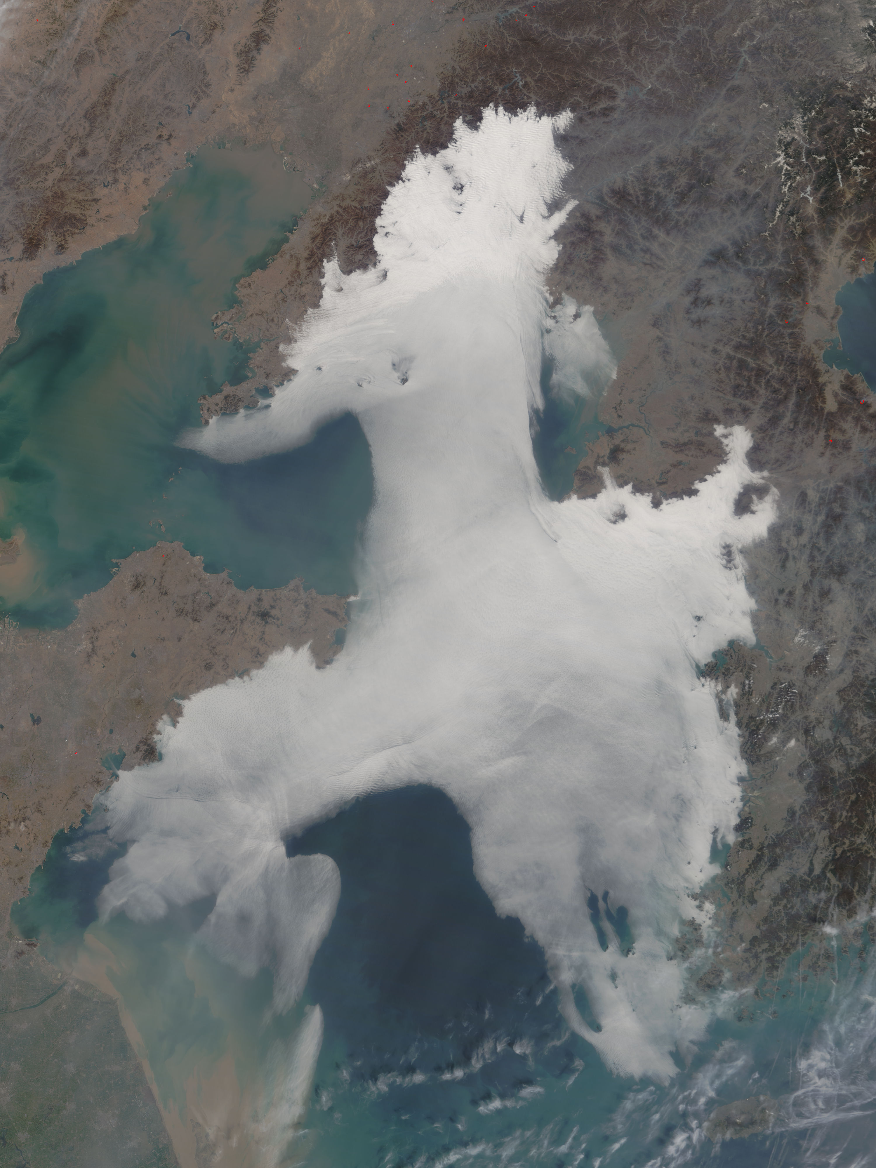
