
Images


April 9, 2018 - "River" of sea ice in the Weddell Sea
 Tweet
Tweet
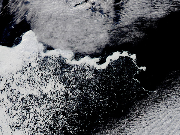
As autumn brings shortening daylight and falling temperatures to the Antarctic, sea ice has begun to grow along the eastern Weddell Sea ice edge. On April 4, 2018, the Moderate Resolution Imaging Spectroradiometer (MODIS) on board NASA’s Aqua satellite acquired a true-color image of a long, snake-like “river” of sea ice crossing the northern Weddell Sea.
According to the National Snow and Ice Data Center (NSIDC), the Antarctic sea ice minimum was reached on February 20 and 21, 2018. This is just slightly earlier than the 1981 to 2010 median date of February 24 for the minimum. The Antarctic minimum has occurred as early as February 15 and as late as March 6, as viewed from the satellite record.
The NSIDC also reported, “Compared to the Arctic, air temperatures over the sea ice regions of Antarctica over the past season (austral summer) have been closer to their climatological average, hovering within 2 degrees Celsius (4 degrees Fahrenheit) of the 1981 to 2010 average. Relatively rapid and early growth of ice along the eastern Weddell Sea ice edge led the beginning of the autumn sea ice expansion.”
Image Facts
Satellite:
Aqua
Date Acquired: 4/4/2018
Resolutions:
500m (173.9 KB), 250m (444.8 KB)
Bands Used: 1,4,3
Image Credit:
Jeff Schmaltz, MODIS Land Rapid Response Team, NASA GSFC
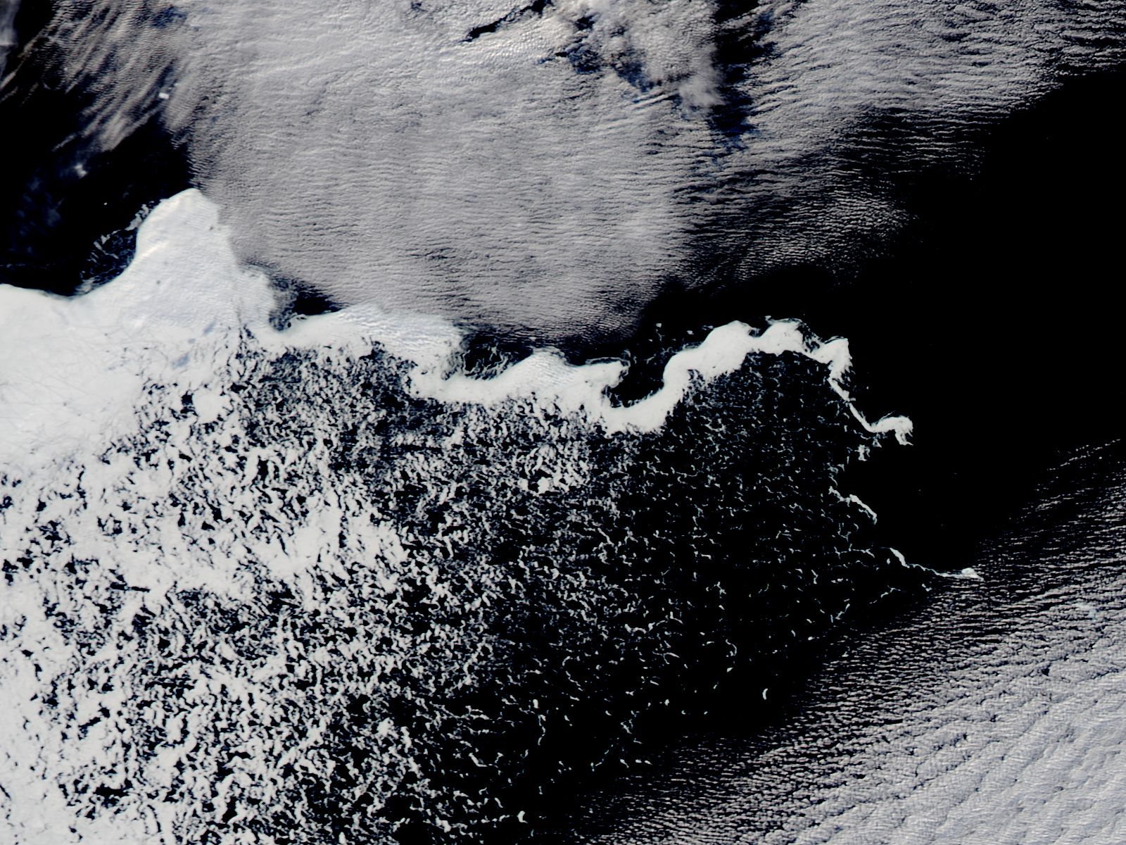
