
Images


July 25, 2018 - Iberian Peninsula
 Tweet
Tweet
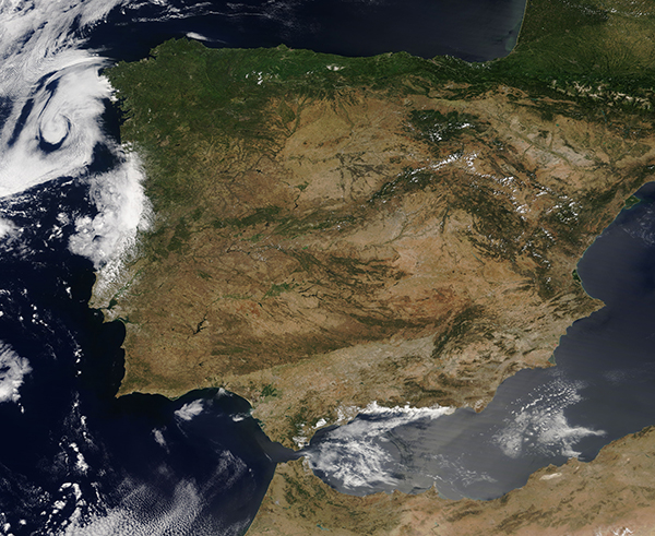
On July 23, 2018, the Moderate Resolution Imaging Spectroradiometer (MODIS) aboard NASA’s Terra acquired a true-color image of the Iberian Peninsula.
This unobstructed view of Spain, Portugal, Andorra, southern France, and northern Morocco allows visualization of a number of natural features. Meseta Central, the broad mountainous plateau at the center of the Iberian Peninsula appears brown compared to the greener coastal lowlands. The tall, green-topped Pyrenees Mountains in the northeast form a natural barrier between France and Spain. West of the Pyrenees are the Cantabrian Mountains of Spain. At the southern tip of the Peninsula, the Strait of Gibraltar separates Spain from Morocco by a mere 8.9 miles (14.3 km) at its narrowest point.
Image Facts
Satellite:
Terra
Date Acquired: 7/23/2018
Resolutions:
1km (1.5 MB), 500m (4.1 MB), 250m (3.8 MB)
Bands Used: 1,4,3
Image Credit:
Jeff Schmaltz, MODIS Land Rapid Response Team, NASA GSFC
