
Images


August 11, 2018 - California Fires
 Tweet
Tweet
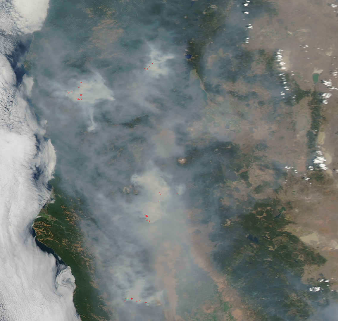
On August 9, 2018, the Moderate Resolution Imaging Spectroradiometer (MODIS) on board NASA’s Aqua satellite flew over northern California and acquired a true-color image of a land shrouded in smoke.
Although heavy rains ended the lengthy drought that parched California, trees and vegetation killed during that dry spell remain standing in the state’s forests. The increased fuel load combined with hot, windy weather and low humidity created conditions ripe for record-breaking burns.
One of the fires – the Mendocino Complex – has become California’s largest fire on record. As of August 10, 2018, the fire had charred 312,448 acres and was only 60% contained. Another blaze, the Carr fire near Redding, had torched more than 1,000 homes, making it California’s sixth most destructive fire on record. It has burned more than 183,600 acres, capturing eighth place for largest fires recorded in California.
The heat generated by intense wildfires can churn up towering pyrocumulus and pyrocumulonimbus clouds, which lift smoke above the boundary layer, the lowest part of the atmosphere. The hotter a fire burns, the higher smoke can rise and the higher it rises, the further it can spread. The intense heat of these fires has also been demonstrated by the appearance of huge “fire tornadoes” - whirling eddies of wind created by extreme heat. Fire tornadoes have been reported in both the Carr Fire and the Holy Fire. The Holy Fire began August 6 in the Cleveland National Forest and has charred more than 18,000 acres with only 5% containment as of August 10.
Once smoke rises above the boundary layer it can travel hundreds or thousands of kilometers away from the source before descending. By August 9, smoke had spread over much of the northeast coast, even reaching over the Atlantic Ocean. Much of that smoke remains in higher levels and is not yet felt at ground level by residents of the eastern states.
The smoke isn’t staying aloft in California, however. On August 8, Kaiser Health News reported, “At least 17 large fires are burning across California, destroying hundreds of thousands of acres, sending toxic pollutants into the air and contaminating water supplies. The air quality in certain areas — particularly near the massive Mendocino Complex Fire in the northern part of the state — is among the worst officials have ever seen”.
Poor air quality creates difficulty for all residents, animals, and birds. People with lung disease or compromised breathing, as well as the very young and elderly are at highest risk. Many districts around the state have issued warning to stay indoors, under air conditioning, and to limit outdoor activities. Kaiser Health News also reported that in many places, kids’ ball games, riding lessons, and summer camps have been cancelled.
Image Facts
Satellite:
Aqua
Date Acquired: 8/9/2018
Resolutions:
1km (229.5 KB), 500m (545.8 KB), 250m (344 KB)
Bands Used: 1,4,3
Image Credit:
MODIS Land Rapid Response Team, NASA GSFC
