
Images


August 18, 2018 - Hurricane Lane in the Pacific
 Tweet
Tweet
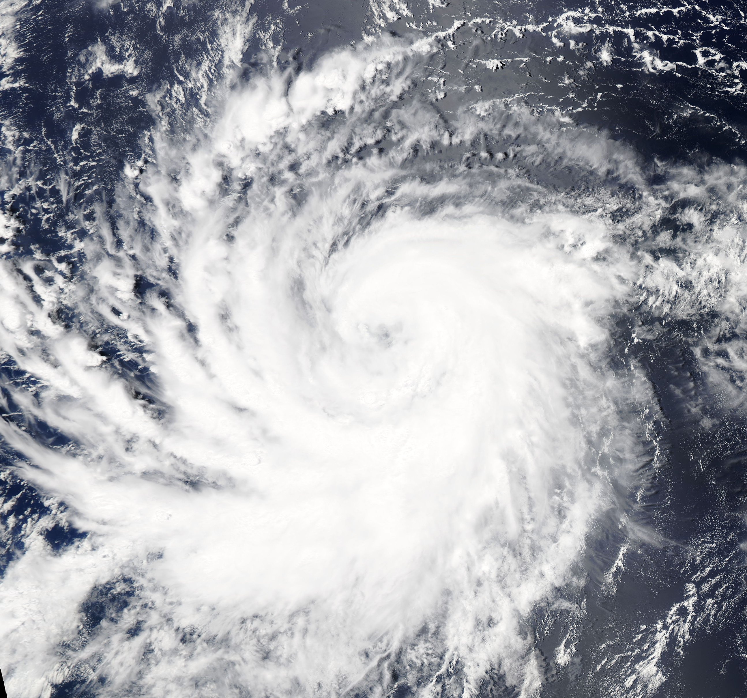
Hurricane Lane was rapidly intensifying when NASA’s Aqua satellite passed overhead in mid-August 2018. The Moderate Resolution Imaging Spectroradiometer (MODIS) on board that satellite acquired a true-color image of the storm on August 16. Lane sported a cloud-filled eye and a distinct apostrophe shape at that time. It was moving over open ocean, well away from land.
Tropical Depression 14-E developed about 1,115 mi (1,795 km) southwest of the southern tip of Baja California on August 14 and strengthened to tropical storm strength on August 15. Late in the day on August 16, Lane became the sixth hurricane of the 2018 Pacific season. By 11:00 p.m. EDT on August 17, Hurricane Lane was packing maximum sustained winds of about 121 mph (194.7 km/h) making it a Category 3 storm on the Saffir-Simpson hurricane wind scale. The storm is expected to strengthen over the next 24 hours before starting to weaken sometime on August 19. While the Hawaiian Islands are expected to feel both wind and rain from the storm, the center of Hurricane Lane is forecast to pass south of the islands starting August 20.
Image Facts
Satellite:
Aqua
Date Acquired: 8/16/2018
Resolutions:
1km (1.2 MB), 500m (3 MB), 250m (2.5 MB)
Bands Used: 1,4,3
Image Credit:
MODIS Land Rapid Response Team, NASA GSFC
