Images
November 4, 2018 - Strait of Tartary
Tweet
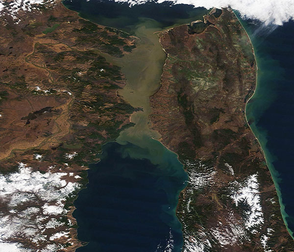
On November 1, 2018, NASA’s Terra satellite passed over eastern Russia, allowing the Moderate Resolution Imaging Spectroradiometer (MODIS) flying on board to acquire a true-color image of the Strait of Tartary.
The Strait of Tartary separates the Russian mainland from Sakhalin Island and connects the Sea of Okhotsk (north) from the Sea of Japan (south). The strait stretches about 213 miles (342 km) at the widest point and constricts to 4.5 mi (7 km) at the narrowest, and is about 393 mmi (632 km) long. The shallow strait is an important summer-time shipping center and the home to several Russian ports. Typically by mid-November ice begins to impede the waterway and it may stay frozen until May.
The brown color comes from sediment flowing in from the Amur River, which winds more than 2,700 miles (4,444 km) from its source in Mongolia, through China, and through Russia’s Far East before it pours into the Tartary Strait. It is the tenth longest river in the world.
Image Facts
Satellite:
Terra
Date Acquired: 11/1/2018
Resolutions:
1km (140.3 KB), 500m (392 KB), 250m (702.4 KB)
Bands Used: 1,4,3
Image Credit:
MODIS Land Rapid Response Team, NASA GSFC


