
Images


April 4, 2019 - Mediterranean Sea
 Tweet
Tweet
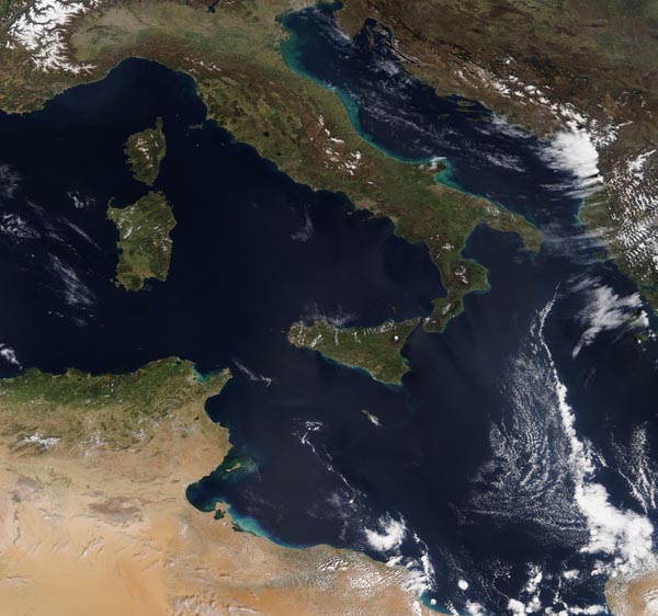
On March 30, 2019, the Moderate Resolution Imaging Spectroradiometer acquired a true-color image centered on the Mediterranean Sea.
Covering an area of about 965,300 square miles (2.5 million square km), the Mediterranean is a semi-enclosed sea. The major opening to the Atlantic Ocean measures only 8.7 miles (14 km) at the shallow Strait of Gibraltar. It also has a small connection with the Red Sea via the Suez Canal. With so little mixing of waters, and due to the fact that more water evaporates from the Mediterranean than enters, the waters of the Mediterranean are unusually saline.
The Mediterranean Sea is divided into two basins, with the long “boot” of Italy separating the eastern basin from the western basin. The Strait of Sicily, which flows between Sicily and Tunisia, connects the two basins. Countries which have a coastline along the richly biodiverse and stunningly beautiful Mediterranean waters include Turkey, Tunisia, Syria, Slovenia, Spain, Montenegro, Monaco, Malta, Libya, Lebanon, Bosnia and Herzegovina, Algeria, and Albania.
Image Facts
Satellite:
Terra
Date Acquired: 3/30/2019
Resolutions:
1km (396.3 KB), 500m (1.3 MB), 250m (4.2 MB)
Bands Used: 1,4,3
Image Credit:
MODIS Land Rapid Response Team, NASA GSFC
