
Images


October 29, 2019 - Tropcial Cyclone Kyarr
 Tweet
Tweet
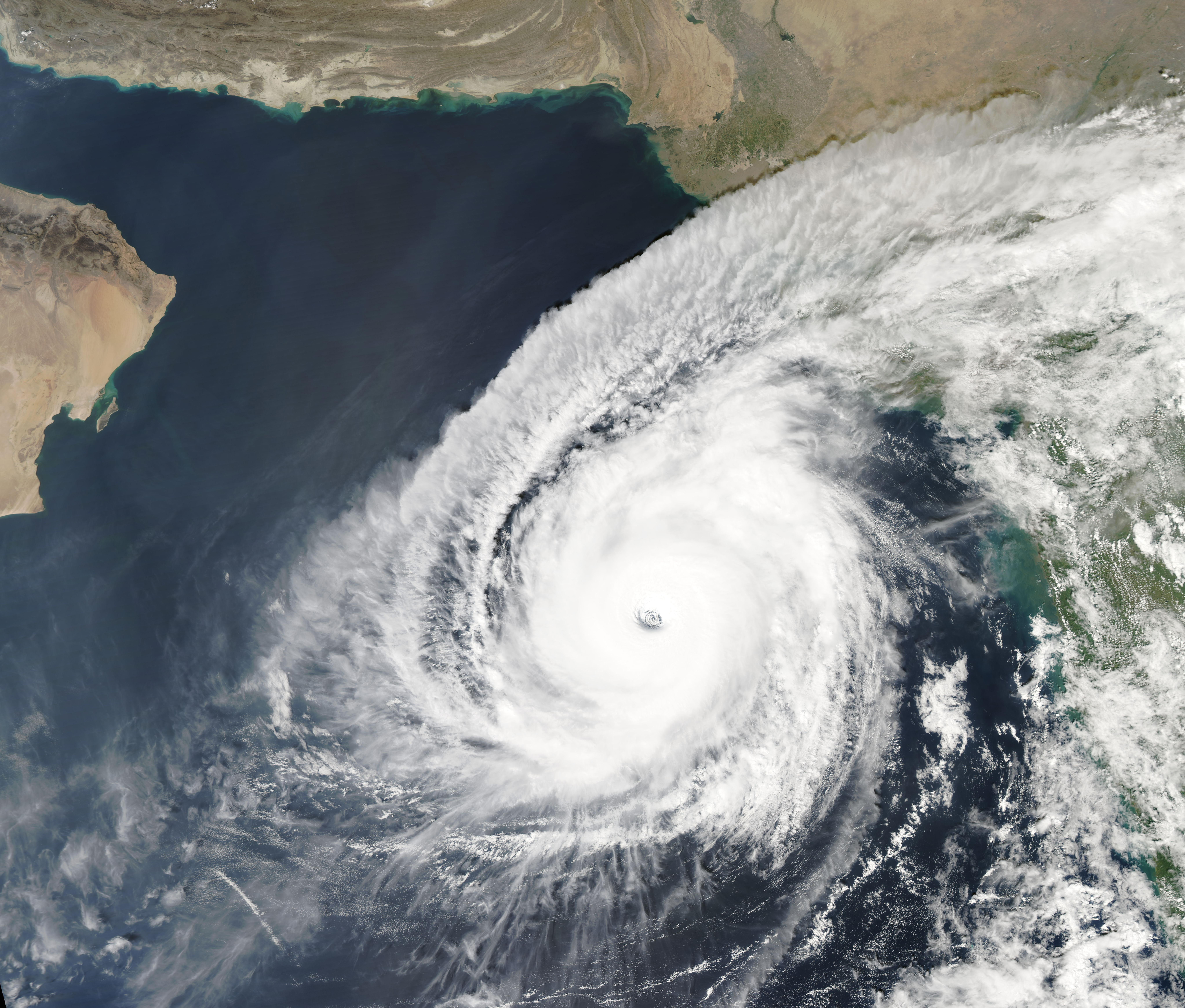
On October 27, 2019, Tropical Cyclone Kyarr spun in the Arabian Ocean as the Moderate Resolution Imaging Spectroradiometer (MODIS) on board NASA’s Aqua satellite acquired a true-color image of the well-formed, fierce storm. The image showed a large, well-formed storm with a distinct, partially cloud-filled eye. On the northeast side, convective bands carrying storms reached over India. Pakistan and Iran can be seen north west of Kyarr while the arid tip of Oman sits to the west.
Tropical Cyclone Kyarr reached peak strength on October 27, carrying maximum sustained winds of 150 mph (241 km/h) placing it as a Category 4 storm on the Saffir-Simpson Hurricane Wind Scale. This put Kyarr into the history books as the second most intense tropical cyclone on record in the Arabian Sea, according to the Joint Typhoon Warning Center (JTWC) ratings. Only Tropical Cyclone Gonu, which formed in the Arabian Sea in 2007, was stronger, reaching Category 5 status.
At 11:00 a.m. EDT (1500 UTC) on October 28, the JTWC noted that Kyarr was located near latitude 18.5 degrees north and longitude 64.4 degrees east, about 337 miles east-southeast of Masirah Island, Oman. Kyarr was moving to the west-northwest and was maintaining maximum sustained winds of 150 mph (241 km/h). The storm is expected to weaken over the next 24 hours as it moves towards Oman then curves to stay roughly parallel to Oman’s coastline through November 2.
Image Facts
Satellite:
Aqua
Date Acquired: 10/27/2019
Resolutions:
1km (2 MB), 500m (5.6 MB), 250m (4.1 MB)
Bands Used: 1,4,3
Image Credit:
MODIS Land Rapid Response Team, NASA GSFC
