
Images


January 31, 2020 - Sea Ice Moving through the Bering Sea
 Tweet
Tweet
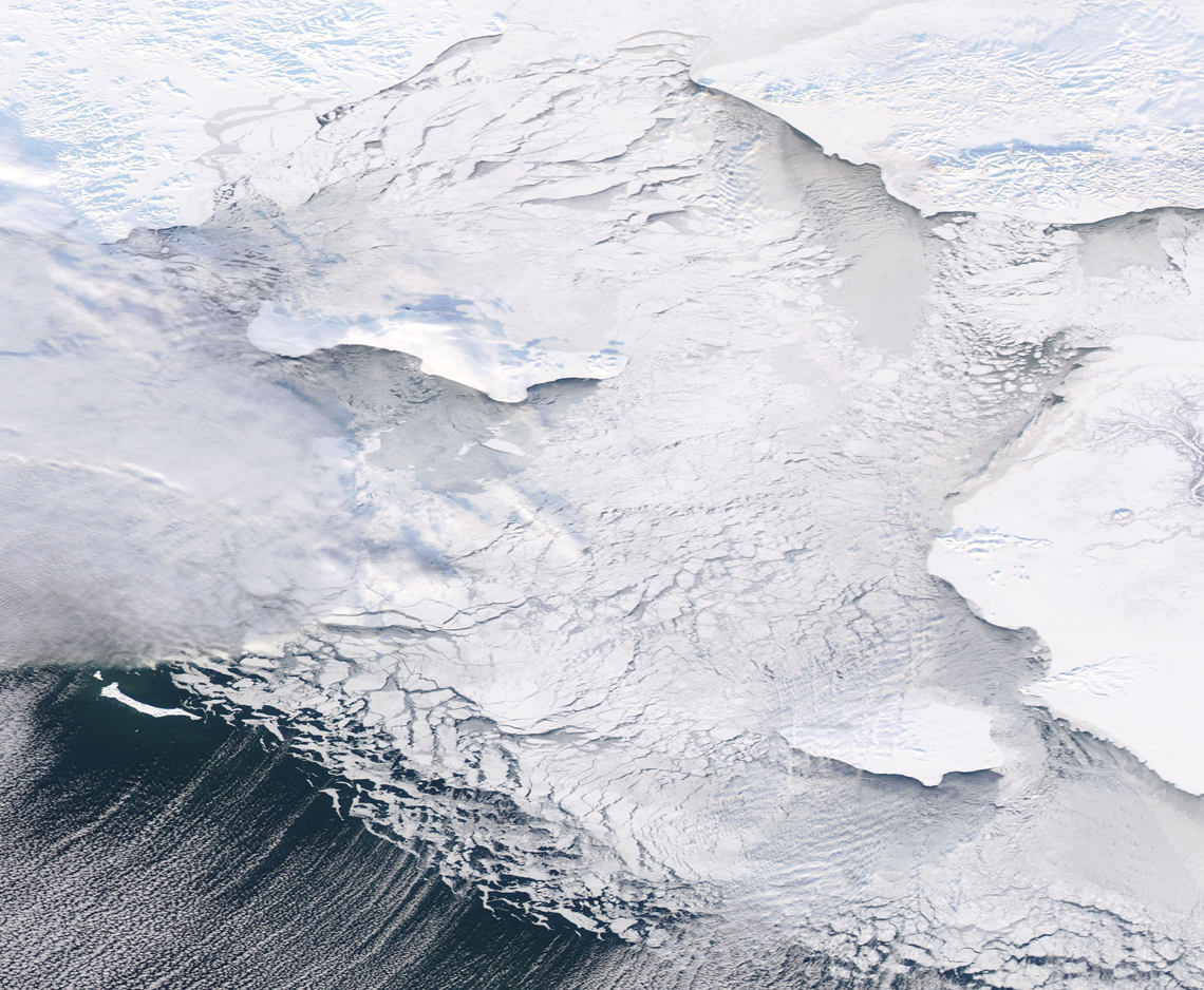
A monochromatic mosaic of shifting sea ice and shining snow greeted NASA’s Aqua satellite as it passed over the Bering Strait in late January, 2020. The Moderate Resolution Imaging Spectroradiometer (MODIS) on board that satellite acquired this true-color image on January 27.
In the northern part of the image, snow covers Russia (west) and Alaska in the United States. Just off the shores, a thin margin of solid fast ice clings to the land in some areas. Off shore, the sea ice is composed of large blocks, which get smaller further south. Where the sea ice thins and meets open water, the ice appears much like foamy filigrees because it is so thin and moves easily with surface currents.
Sea ice begins to form in the northernmost reaches of the Bering Sea when the ocean waters reach a temperature of -1.7°C (28.9°F), the freezing point of saltwater in this region. This may occur as late as November. Freezing continues as cold temperatures progress, then the ice begins to soften as the days lengthen and ocean temperatures warm in late spring. Ice may remain in the Bering Strait until June. The ice that forms in the north slides southwards, thanks to strong prevailing winds that blow generally in a north to south direction. The movement creates cracks in solid ice, which expand to form very large chunks of floating ice. As these large icebergs shift and bump into each other, and as temperatures increase, the grinding and weakening of ice creates smaller and smaller ‘bergs. Eventually, as the small bits reach warmer waters, the ice melts.
According to an article about the climate of the Bering Sea published by the National Oceanic and Atmospheric Administration (NOAA), sea ice in the Bering Sea affects water temperature, salinity and ocean currents. The formation, motion and melting of the ice at the edge play important roles in controlling the heat exchanged between the ocean and the atmosphere, and the amount of salt in the water on the Bering Sea continental shelf. The growth of sea ice also creates cold, salty water, while ice melt makes freshwater. These processes are critical to the physical conditions that influence the way the Bering Sea ecosystem works. In the northern Bering Sea, water enters the Arctic Ocean through Bering Strait, making the Bering Sea the only connection between the Arctic Ocean and the Pacific Ocean.
Image Facts
Satellite:
Aqua
Date Acquired: 1/27/2020
Resolutions:
1km (885.9 KB), 500m (2.3 MB), 250m (1.9 MB)
Bands Used: 1,4,3
Image Credit:
MODIS Land Rapid Response Team, NASA GSFC
