
Images


March 26, 2020 - Sediment in Bristol Channel and the Irish Sea
 Tweet
Tweet
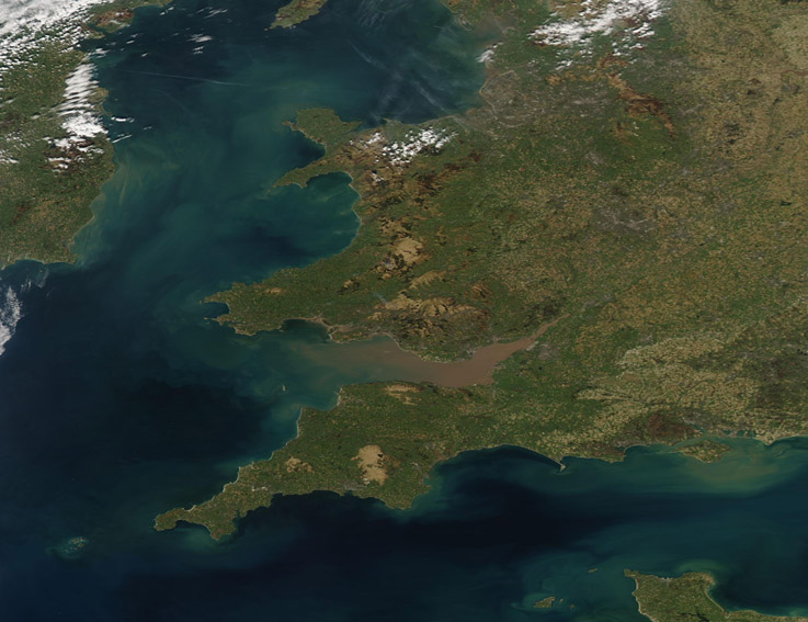
A winter and spring filled with storms brought flooding to much of the United Kingdom, with sediment sweeping out to the sea through rivers and runoff. According to the United Kingdom’s Flood Information Service, ongoing local groundwater flooding is expected to continue in part of the south of England from March 25- 29. The report states that land, roads and some properties will continue to be expected to be affected.
On March 25 the Moderate Resolution Imaging Spectroradiometer (MODIS) on board NASA’s Aqua satellite acquired a true-color image of sediment swirling in the Bristol Channel and Irish Sea.
The Irish Sea sits between the islands of Ireland and Great Britain and the Bristol Channel is located between South Wales from Devon and Somerset in southwest England. Both are shallow waterways, with the average depth of the Irish Sea only about 52 meters (170 feet). Heavy tides and currents stir sediment from the bottom of the waterways, creating swirls of suspended sediment.
Substantial rains and flooding sweep additional sediment from the land and fill rivers, such as the River Severn, which flows into Bristol Bay. All of these sources add to the swirling colors seen in this image.
Image Facts
Satellite:
Aqua
Date Acquired: 3/25/2020
Resolutions:
1km (120.7 KB), 500m (308.3 KB), 250m (585.1 KB)
Bands Used: 1,4,3
Image Credit:
MODIS Land Rapid Response Team, NASA GSFC
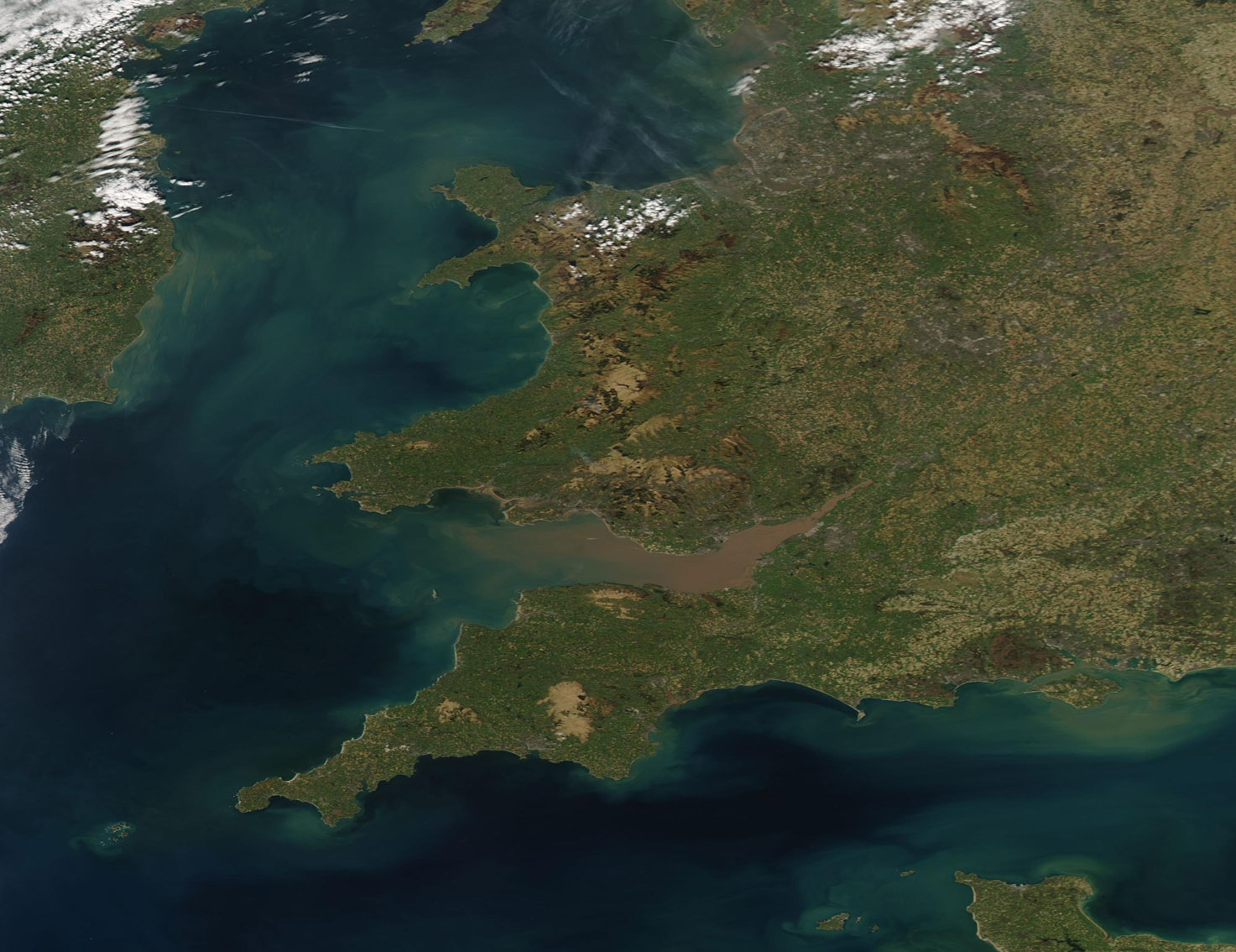
