
Images


May 7, 2020 - Lake Rukwa
 Tweet
Tweet
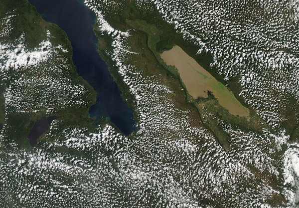
On May 5, 2020, NASA’s Aqua satellite passed over Tanzania, allowing the Moderate Resolution Imaging Spectroradiometer (MODIS) on board to acquire a true-color image of muddy Lake Rukwa.
One of Africa’s many Rift Valley Lakes, Lake Rukwa covers an area of about 1,000 square miles (2,600 square km) and has an average depth of only about 10 feet (3 m). The waters are alkaline, and levels fluctuate depending on the rainfall and inflow from surrounding rivers, with the highest water levels typically registering in October and April, during the rainy seasons. In dry seasons, the lake may become more of a swamp than a lake, with copious mud and vegetation. The largest population of crocodiles in Tanzania is said to live in Lake Rukwa.
Image Facts
Satellite:
Aqua
Date Acquired: 5/5/2020
Resolutions:
1km (130.3 KB), 500m (394.3 KB), 250m (674.7 KB)
Bands Used: 1,4,3
Image Credit:
MODIS Land Rapid Response Team, NASA GSFC
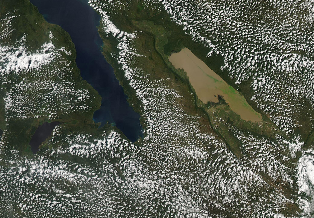
