
Images


May 28, 2020 - Caspian Sea
 Tweet
Tweet
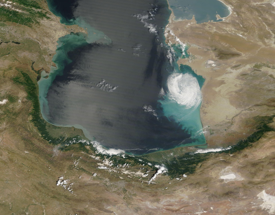
A solitary cloud hung over colorful waters of the Caspian Sea on May 27, 2020. The Moderate Resolution Imaging Spectroradiometer (MODIS) on board NASA’s Terra satellite acquired a true-color image of the scene on that same day.
The Caspian Sea, measured by surface area, is the world’s largest inland water body. It spans about 143,200 square miles and its shores touch five countries. The waters are shallow in the north, measuring just 16-20 feet (5-6 meters). In the south, the depth plunges to more than 3,300 feet (1,000 meters). The changing depth has an impact on the changing color of the waters, as sediment can be more easily suspended where water is shallow. Turbidity also is increased by runoff from land and by sediment carried by rivers into the Caspian Sea.
Salinity also changes from north to south. With no outlet, the Caspian Sea loses water only by evaporation leading, over time, increasing salinity. The largest river feeding the Caspian Sea, the Volga, pours into the northwestern section (outside of this image), carrying sediment but also fresh water. The Caspian grows more saline in the south.
Image Facts
Satellite:
Terra
Date Acquired: 5/27/2020
Resolutions:
1km (205.4 KB), 500m (511.2 KB), 250m (1022.1 KB)
Bands Used: 1,4,3
Image Credit:
MODIS Land Rapid Response Team, NASA GSFC
