
Images


June 19, 2020 - Nile River Delta
 Tweet
Tweet
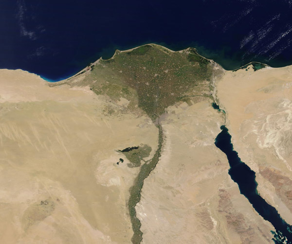
On June 15, 2020, the Moderate Resolution Imaging Spectroradiomter (MODIS) on board NASA’s Terra satellite acquired a stunning true-color image of the green Nile River and Nile River Delta against the background of arid tan sands. The Nile is the longest river in the world, extending for about 6,700 kilometers (4,163 mi) from its headwaters in the highlands of eastern Africa to the broad Delta along the Mediterranean Sea.
Roughly 95% of Egypt’s population lives within 20 km (12.4 mi) of the Nile River and its delta, while vast areas of the country remain sparsely populated or uninhabited. The teeming population competes for the oasis-like Nile landscape with agriculture. Only 3.6% of Egypt’s land is considered suitable for agriculture – and almost all that is all located close to the Nile and Nile Delta. According to the Food and Agricultural Organization of the United Nations (FAO), Egypt's total agricultural crop production has increased by more than 20 percent in the past decade. During the same period, the rate of population growth has increased at a slightly higher rate than the increase in crop production.
Image Facts
Satellite:
Terra
Date Acquired: 6/15/2020
Resolutions:
1km (91.4 KB), 500m (202.3 KB), 250m (348.2 KB)
Bands Used: 1,4,3
Image Credit:
MODIS Land Rapid Response Team, NASA GSFC
