
Images


July 18, 2020 - Libya
 Tweet
Tweet
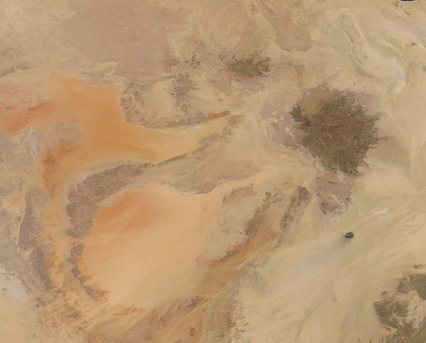
Located in northern Africa, the country of Libya sits along the Mediterranean Sea, tucked between Tunisia and Algeria in the west and Egypt in the east. The population primarily lives along the long coastline, most of which offers a warm Mediterranean climate, with rain and vegetation. However, more than 90 percent of Libya is covered in hot, dry desert, which is very sparsely populated outside of a few oases.
On July 1, 2020, the Moderate Resolution Imaging Spectroradiometer (MODIS) on board NASA’s Terra satellite acquired a true-color image of central Libya.
As seen from space, the landscape’s striking colors exhibit a wide range of desert tans. The soft-appearing, orange-tinted areas are sand seas, where loose sand moves easily with the wind. Viewed at high resolution, the orange wash can be seen to be created by lines of complex sand dunes.
A large dark area in the northwest section of the image marks the Haruj volcanic field, where layers of basalt spread across a 17,000 square mile (45,000 sq. km) plateau. It is estimated that the fields began to be built from lava flows that began roughly 6 million years ago. Long dormant, this volcanic field contains more than 120 vents, each of which contributed to shaping the basalt field.
Image Facts
Satellite:
Terra
Date Acquired: 7/1/2020
Resolutions:
1km (179.6 KB), 500m (440 KB), 250m (826.4 KB)
Bands Used: 1,4,3
Image Credit:
MODIS Land Rapid Response Team, NASA GSFC
