
Images


July 28, 2020 - Hurricane Hanna
 Tweet
Tweet
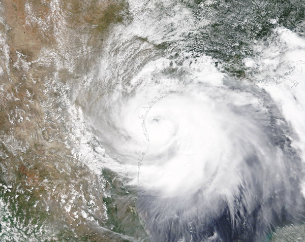
At around 5:00 p.m. Central Daylight Time on July 25, 2020, Hurricane Hanna made landfall just on Padre Island, south of Corpus Christi, Texas. The Category 1 hurricane caused flash flooding and knocked out power for tens of thousands of Texas residents.
The Moderate Resolution Imaging Spectroradiometer (MODIS) on NASA’s Terra satellite acquired this image of Hurricane Hanna on the morning of July 25. At the time this image was captured, Hanna sported a large cloud-filled eye and approaching Padre Island just to the southeast of Corpus Christi.
Hanna had sustained winds of 90 miles (145 kilometers) per hour at landfall. Preliminary rainfall totals registered 4 to 6 inches (10 to 15 centimeters) of rain around Corpus Christi, although some news media reported up to a foot in some places. On July 26, the National Weather Service in Brownsville, Texas reported a new record for rainfall of 3.46 inches (8.6 cm), breaking the old record of 2.74 inches (6.96 cm) that was set in 1890. Record rainfall was also recorded at McAllen Miller International Airport where the NWS reported 4.52 inches of rainfall on July 26, breaking the old record of 1.41 inches set in the year 2000.
After making landfall in Texas, Hanna turned towards the southwest, tracking into northeastern Mexico, where it brought drenching rains and flood conditions, especially in towns near the U.S. border. At least two deaths have been reported in Mexico from the effects of the storm.
Image Facts
Satellite:
Terra
Date Acquired: 7/25/2020
Resolutions:
1km (842.7 KB), 500m (2.7 MB), 250m (5.6 MB)
Bands Used: 1,4,3
Image Credit:
MODIS Land Rapid Response Team, NASA GSFC
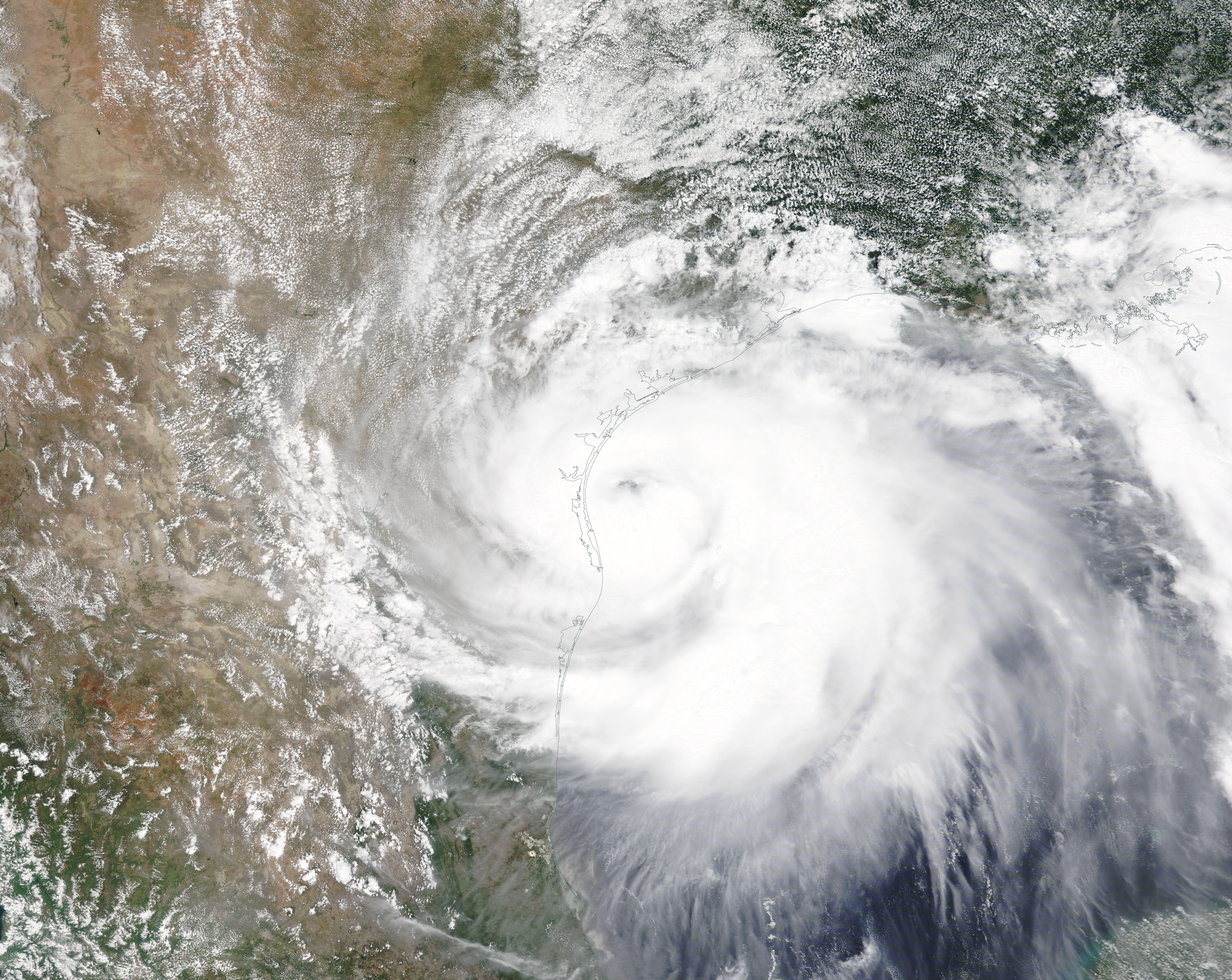
