
Images


August 21, 2020 - Fires in California
 Tweet
Tweet
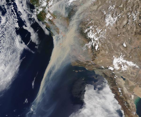
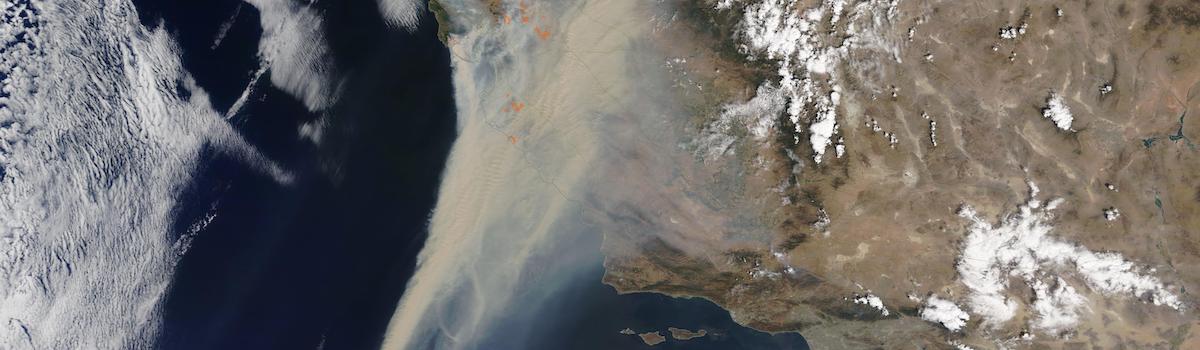
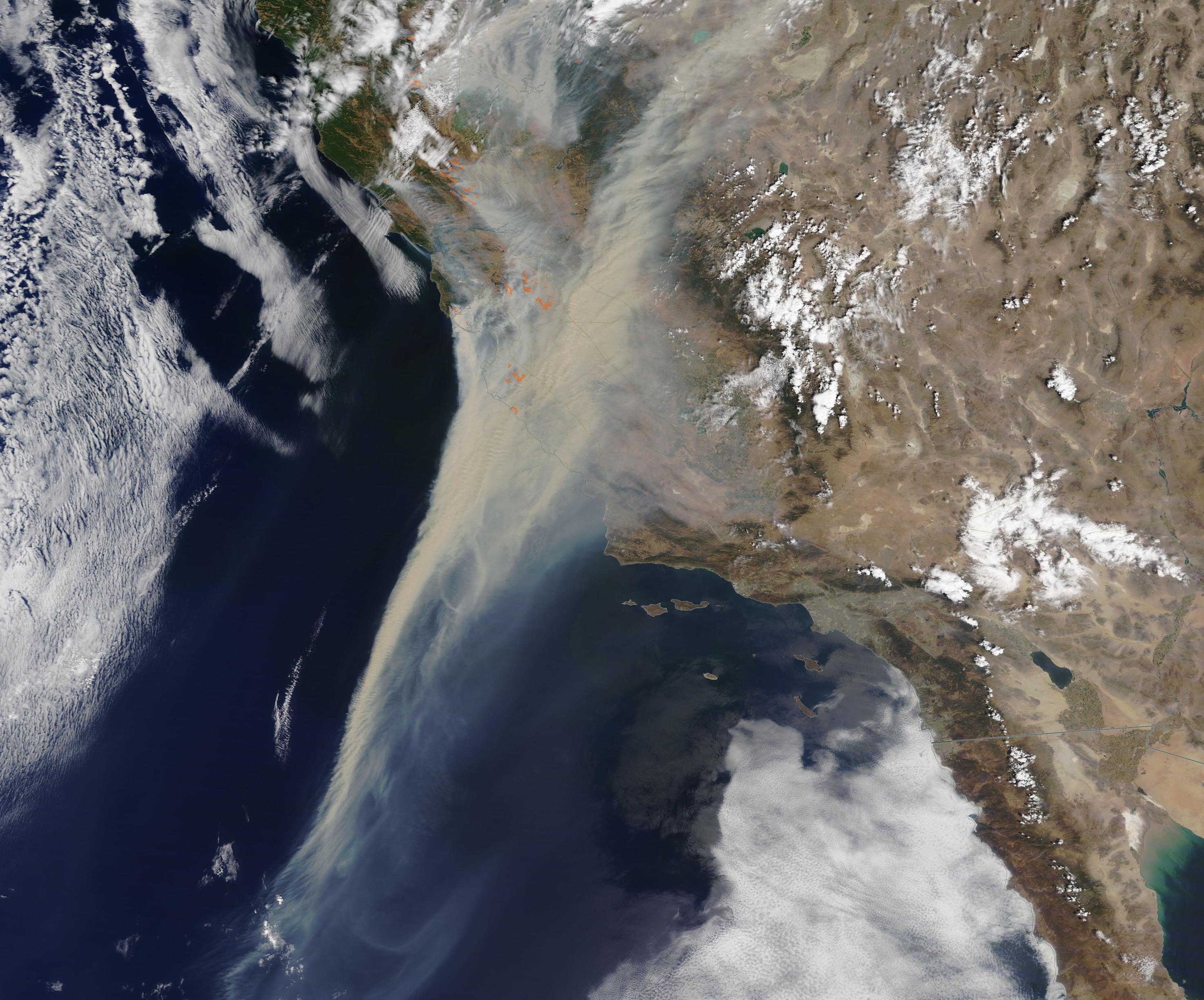
As wildfires rage across northern California, enormous smoke plumes are smothering cities and towns in the San Joaquin Valley and San Francisco Bay area. Just before noon on August 19, 2020, the Moderate Resolution Imaging Spectroradiometer (MODIS) on NASA’s Terra satellite captured this natural-color image of smoke and fire in California. Measuring from the easternmost edge visible inland to the westernmost smoke over the Pacific Ocean, the ash-laden smoke plume stretches more than 1,200 miles.
A bitter summer heat wave has scorched California, creating tinder-dry vegetation, and triggering rolling power blackouts over parts of the state. On August 16, the state appears to have set a new world high temperature record, with Death Valley registering 130˚F (54.4 ˚C). The United States National Weather Service is verifying the temperatures. The previous verified high temperature for Earth was recorded in Death Valley in 2013, registering 129.2˚F (54˚C).
With the stage set for quick ignition and growth of fire, unsettled weather created additional danger. On August 19, California Governor Gavin Newsome tweeted “CA has experienced 10,849 lightning strikes in the last 72 hours and WORLD RECORD heat temperatures. We’re currently battling 367 known fires.” About 26 of those fires were classified as major.
As of August 20, the largest fire is the SCU Lightning Complex which is made up of a number of lightning strikes across several counties: Santa Clara, Alameda, Contra Costa, San Joaquin, and Stanislaus. Ignited on August 18, these fires have burned 137,475 acres and is only five percent contained. Some residents in each of the five affected counties are under evacuation orders as over 1,000 personnel actively fight the fires in this Complex
Image Facts
Satellite:
Terra
Date Acquired: 8/19/2020
Resolutions:
1km (68.6 KB), 500m (55 KB), 250m (904.3 KB)
Bands Used: 1,4,3
Image Credit:
MODIS Land Rapid Response Team, NASA GSFC
