
Images


December 4, 2020 - Strait of Hormuz
 Tweet
Tweet
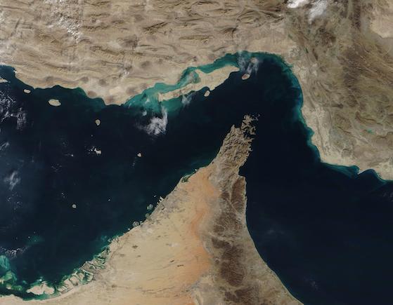
The narrow Strait of Hormuz lies between the Persian Gulf and the Gulf of Oman, separating Iran (north) from the Arabian Peninsula (south). Only about 21 miles (34 km) wide at the narrowest point and roughly 96 miles (155 km) long, about thirty percent of the world’s seaborne oil and nearly one-quarter of the liquified natural gas (LNG) supply passes through this strait — all on shipping lanes that measure only two-mile wide. It has been estimated that 21 million barrels of oil, with a value of 1.2 billion US dollars (USD), pass through the strait every day.
On December 2, 2020, the Moderate Resolution Imaging Spectroradiometer (MODIS) on board NASA’s Terra satellite acquired a true-color image of the Strait of Hormuz.
The arid landscape of Iran sits in the north, with Qeshm Island, the largest in the Persian Gulf, just off the Iranian coast. The tiny Strait of Khuran separates the island and the mainland and bounds a wetland of international importance, recognized by Ramsar. These wetlands provide critical habitat to two globally threatened species: the Dalmatian Pelican and the Green sea turtle. In the south, the rocky and rugged Musandam Peninsula juts into the Strait of Hormuz. The tip of the peninsula is filled by the Musandam Governate, an exclave of Oman. To the south, the land on the peninsula belongs to the United Arab Emirates.
Image Facts
Satellite:
Terra
Date Acquired: 12/2/2020
Resolutions:
1km (33.6 KB), 500m (115.8 KB), 250m (352.6 KB)
Bands Used: 1,4,3
Image Credit:
MODIS Land Rapid Response Team, NASA GSFC
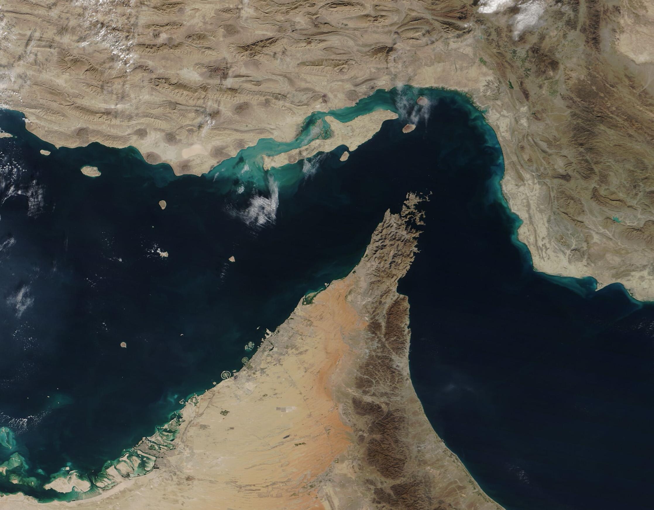
