
Images


February 16, 2021 - Hainan, China
 Tweet
Tweet
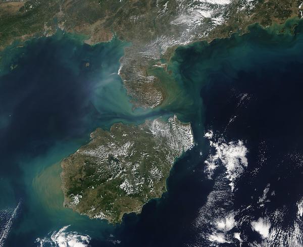
On February 12, 2021, the Moderate Resolution Imaging Spectroradiometer (MODIS) on board NASA’s Terra satellite acquired a true-color image of Hainan, China.
Sometimes promoted by travel companies as China’s largest tropical island, Hainan sits in the South China Sea and is separated from Guangdong Province on the mainland by the Qiongzhou Strait. The island’s largest city and capital, Haikou, can be found on the northern coast while the popular beaches of Sanya sit on the southern coast.
Hainan’s warm, humid climate promotes the growth of tropical crops such as rice, sweet potato, sugar cane, peanuts, and tea. Other important crops include rubber, coconut, pepper, coffee, cocoa, cashew, pineapples, and bananas. Given the sea-side location, the economy benefits from a rich fishery.
Tropical rainforest still exists in parts of Hainan. Fortunately, the government has begun to preserve parts of it in national forests as well as encourage conservation of the natural assets on the island. The Bawangling National Nature Reserve on the western side of the island is home to the Hainan black-crested gibbon, which has the distinction of the title of the world’s most critically endangered primate. This species was once found across about half of China but had disappeared from the mainland by the late 1950s. At that time, about two thousand remained on Hainan. Today the total number of is estimated to be about thirty animals.
Image Facts
Satellite:
Terra
Date Acquired: 2/12/2021
Resolutions:
1km (53.1 KB), 500m (53.1 KB), 250m (534.1 KB)
Bands Used: 1,4,3
Image Credit:
MODIS Land Rapid Response Team, NASA GSFC
