
Images


March 12, 2021 - Ice Breakup on Green Bay
 Tweet
Tweet
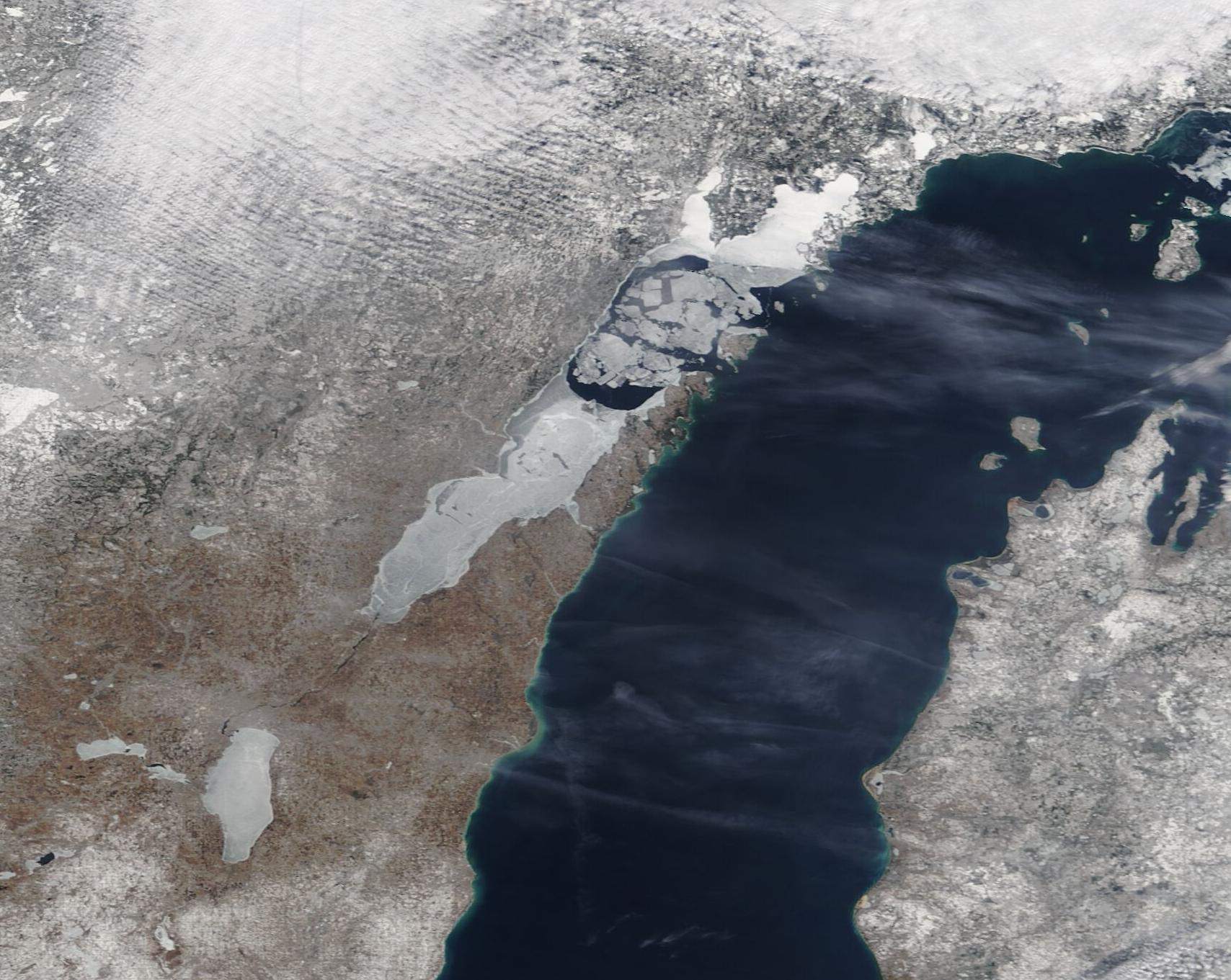
As winter comes to northeastern Wisconsin and the Upper Peninsula of Michigan, a certain excitement fills the chilly air—especially among the hardy fisher-folk who can’t wait to set up a shack and drop a line over ice-crusted Green Bay. Usually, parts of Green Bay are frozen-up enough to support ice fishing by mid-December and thick ice continues through late February. The winter of 2020-2021 was an exception.
According to the Great Lake’s ice report published by the National Oceanic and Atmospheric Administration (NOAA) on March 4, temperatures in the western Great Lakes region averaged between 4 and 6 degrees above normal in December 2020 and January 2021. On January 20, local media (wbay.com) ran a story out of Dyckesville, Wisconsin warning of thin ice, especially in the northern Bay. The story stated that there had already been one rescue on the ice, and that there had been reports of several ATVs and snowmobiles had gone through thin ice.
A frigid mass of Arctic air swept over the region in early February, dropping average temperatures between 8 and 10 degrees below normal in the western lakes. These cold days led to a rapid freeze-up of most of Green Bay. By early March, with the sun angle increasing and warming the waters of the Bay and the temperatures once again on the rise, ice breakup was well underway. Gusty winds over Green Bay and Lake Michigan in the first week of March also aided the breakup.
On March 8, 2021, the Moderate Resolution Imaging Spectroradiometer (MODIS) on board NASA’s Terra satellite acquired a true-color image of Green Bay. Large chunks of ice are floating on nearly-open water between Escanaba State Forest and Washington Island, in Wisconsin. To the east, western Lake Michigan appears completely ice free.
Image Facts
Satellite:
Terra
Date Acquired: 3/8/2021
Resolutions:
1km (152.1 KB), 500m (425.3 KB), 250m (311.3 KB)
Bands Used: 1,4,3
Image Credit:
MODIS Land Rapid Response Team, NASA GSFC
