
Images


May 21, 2021 - Angola
 Tweet
Tweet
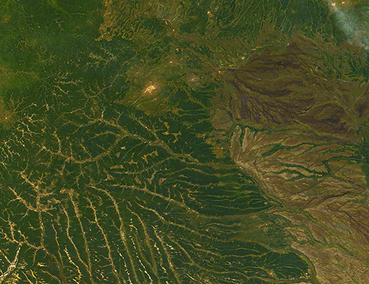
The fifth largest country in Africa, Angola sits along the southwestern coast tucked between Namibia (south) and the Democratic Republic of the Congo (northeast). Roughly eight times the size of the U.S. state of Georgia or slightly less than twice the size of the state of Texas, Angola spans 481,354 square miles (1,246,700 square km) and enjoys a 618-mile- (1,600-km-)long coastline on the South Atlantic. The coastal plain is narrow and rises quickly to a high interior plateau, which covers most of the country.
Forests cover a bit more than 54 percent of the land while about 45 percent of the land is used in agriculture, mostly permanent pasture. The petroleum industry has become a major industry, as Angola owns large oil reserves. The primary mineral export is diamonds—according to a survey completed in 2016, Angola ranked as the sixth-largest diamond producer in the world, with an annual production of nine million carats.
On May 19, 2021, the Moderate Resolution Imaging Spectroradiometer (MODIS) on board NASA’s Terra satellite acquired a true-color image of eastern Angola. The heavily forested high plateau is cut by a number of rivers. The tan-toned smudge near the center of the image is Leune, an inland town with an airport and industry.
Image Facts
Satellite:
Terra
Date Acquired: 5/18/2021
Resolutions:
1km (312.3 KB), 500m (904.3 KB), 250m (2.8 MB)
Bands Used: 1,4,3
Image Credit:
MODIS Land Rapid Response Team, NASA GSFC
