
Images


June 9, 2021 - Amur River between China and Russia
 Tweet
Tweet
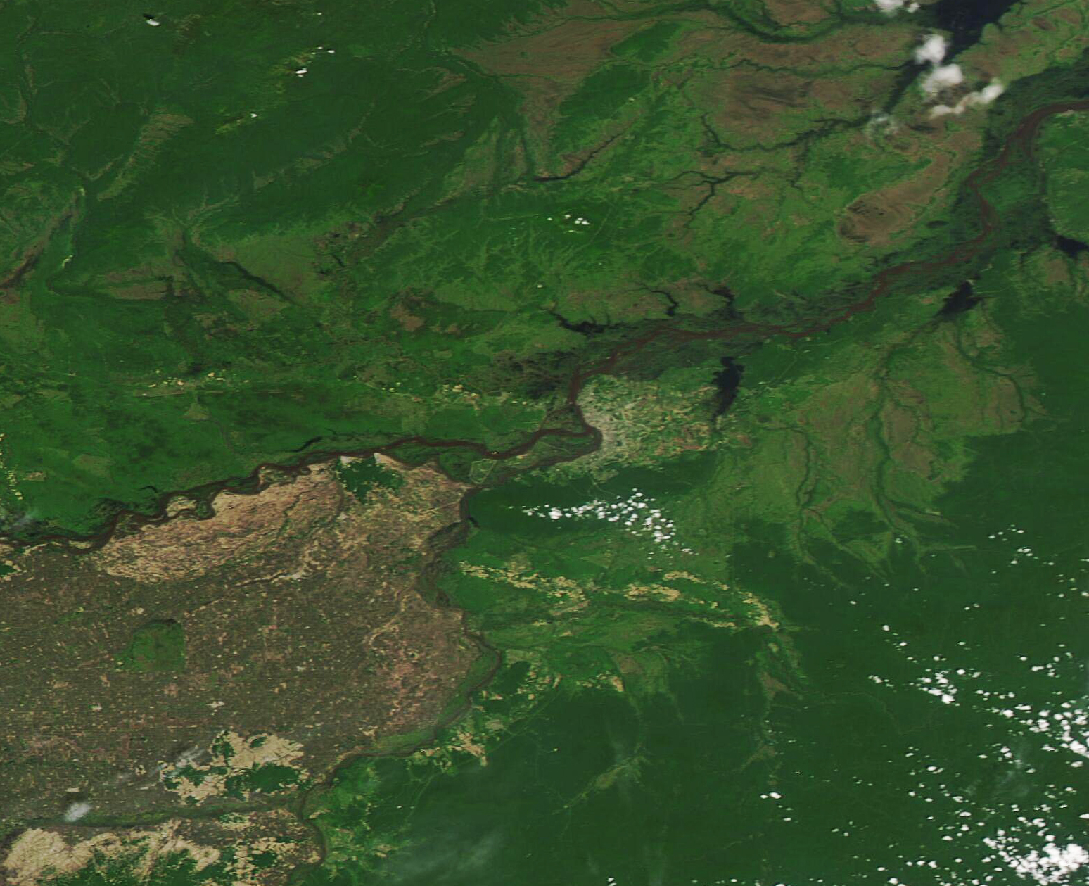
The Amur River, also known as the Heilongjiang River, rises in Russia east of Lake Baikal as the Shika River flows into the Argun River. The tenth-longest river in the world, the Amur flows about 1,800 mi (2,897 km) from this confluence (or 2,761 miles/4,440 km if the Argun is included) and has a drainage basin of roughly 1,855,000 square km (716,220 square miles). As the Amur curves to the east and then southeast, it forms the border between China’s Heilongjiang province and southeastern Siberia, Russia.
The Amur River’s water levels change dramatically throughout the year. Heavy summer (monsoon) rains typically pour down in July and August, causing flooding along the river. Sometimes rapid ice and snow melt in the springtime can cause floods as early as late April or May. In 2021, reports of flooding along the Amur River began to emerge in mid-May as a combination of rain and snow melt filled the riverbanks to overflowing, particularly in Khabarovsk Krai in eastern Russia. According to news reports, as of June 7 flooding continued along the Amur River, with the crest approaching the city of Komsomolsk-on-Amur, which is located on the river in Khabarovsk Krai.
On June 8, 2021, the Moderate Resolution Imaging Spectroradiometer (MODIS) on board NASA’s Aqua satellite acquired a true-color image of the Amur River separating Russia (north) from China (south). The swollen rivers of the region are easily visualized, including the large Amur River.
The land of Heilongjiang province, sitting south of the Amur River, is colored in the tans and light greens of active agricultural land, in contrast to most of Russia which is swathed in rich greens of forest and grasslands. Cement-colored spots dot the landscape in Heilongjiang, each marking a city or town while fewer cities are seen in Russia. A large area of tans and grays where The Amur meets the Ussuri River marks the city of Khabarovsk, the administrative center of Khabarovsk Krai. It sits only 19 miles (30 km) from the China-Russia border.
Image Facts
Satellite:
Aqua
Date Acquired: 6/8/2021
Resolutions:
1km (305.8 KB), 500m (801.8 KB), 250m (434.9 KB)
Bands Used: 1,4,3
Image Credit:
MODIS Land Rapid Response Team, NASA GSFC
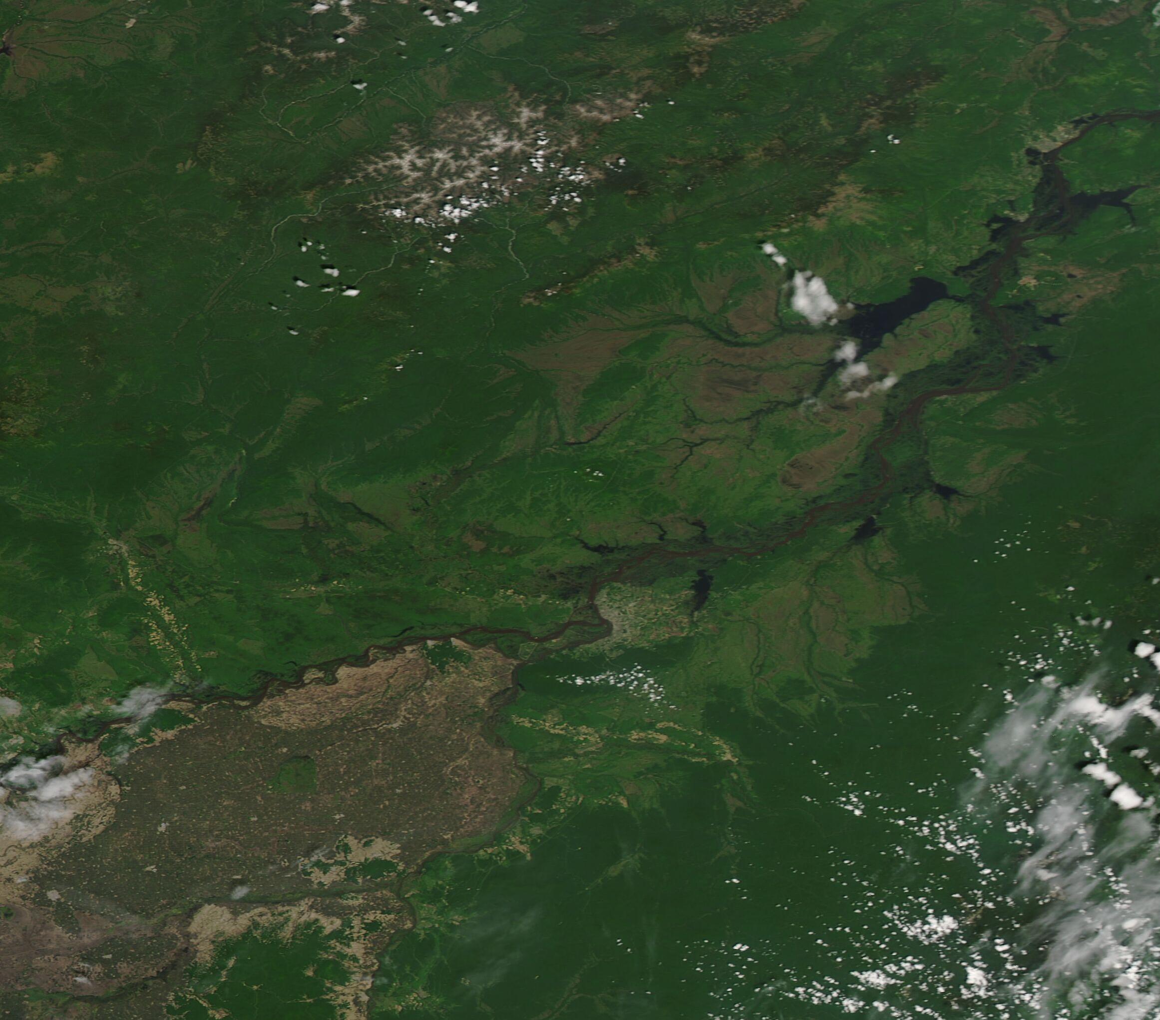
