
Images


June 12, 2021 - Fires in Africa
 Tweet
Tweet
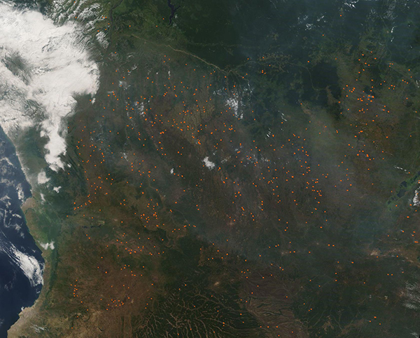
Central Africa’s fire season was off to a strong start in early June 2021.
The Moderate Resolution Imaging Spectroradiometer (MODIS) on board NASA’s Terra satellite acquired this true-color image of hundreds of fires and a shroud of smoke over the region on June 11. Each red hot spot marks an area where the thermal bands on the MODIS instrument detected high temperatures. When combined with typical smoke, as in this image, such hot spots mark actively burning fire.
This image spans about 1,500 miles from the Atlantic coast inland almost to near the eastern border of Zambia, and includes Angola, The Democratic Republic of the Congo, and Zambia. Angola appears to have most of the fires, although the number of hotspots in The Democratic Republic of the Congo are nearly a match in number. Most of the fires appear to be in forest or at the edges of forest, although many also sit in what looks like agricultural patches.
Agricultural burning is a common practice in this region, and many of these fires have probably been set intentionally to manage crop or pasture lands. The agricultural fire season in Central Africa tends to begin in late May or June and peak in August.
Image Facts
Satellite:
Terra
Date Acquired: 6/10/2021
Resolutions:
1km (249 KB), 500m (887.1 KB), 250m (3 MB)
Bands Used: 1,4,3
Image Credit:
MODIS Land Rapid Response Team, NASA GSFC
