
Images


July 7, 2021 - Bolivia
 Tweet
Tweet
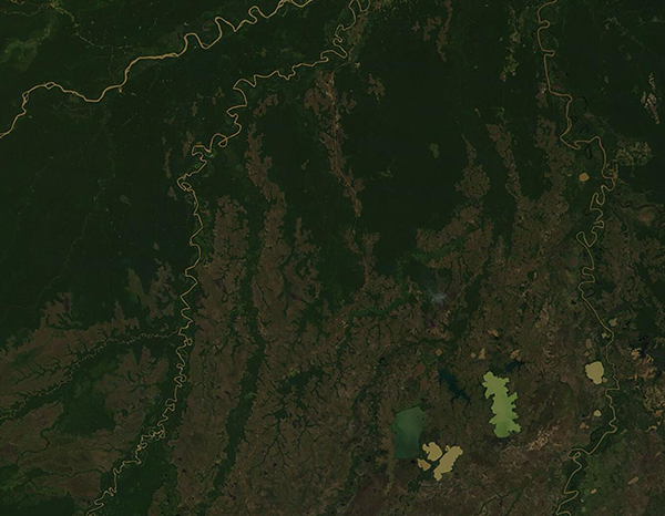
On July 6, 2021, the Moderate Resolution Imaging Spectroradiometer (MODIS) on board NASA’s Terra satellite acquired a true-color image of northeastern Bolivia.
As a land that contains tropical rainforest, semi-arid lowland, and a vast tropical savanna, it is no surprise that northeastern Bolivia is exquisitely rich in biodiversity. More than 270 species of mammal, 213 species of amphibian, 204 species of reptiles, 496 species of fish, and 1,254 species of birds have been identified at just one large National Park in this region.
Although more than a full month into the dry season (which begins in May), the major rivers and lakes of the region remain filled with water. The rivers seen in this image, from northwest (upper left) to southeast (lower right) are the Rio Madre de Dios, Rio Beni, Rio Mamoré, and Rio Guapore (also known as Rio Itenez).
The broad lowland plains of the region are known as the Moxos Plains (Llanos de Moxos) and the Beni Savanna. The Llanos de Moxos is unique for the presence of many shallow and flat-bottomed lakes that are oriented roughly parallel to each other. Three of these lakes seen in this image are Lago Rogaguado (western most), Lago Ginebra, and Laguna Las Abras (east). The lakes are surrounded by a large system of wetlands.
Not only are the wetlands and savanna in this region biologically diverse and important ecologically, but they also contain a record of diverse indigenous human habitation dating to before pre-Columbian times. According to the World Wildlife Fund, the Llanos de Moxos ecoregion holds thousands of archaeological earthworks, including raised agricultural fields, mounds, platforms, causeways, dikes, canals, and even fish weirs.
Image Facts
Satellite:
Terra
Date Acquired: 7/6/2021
Resolutions:
1km (97.2 KB), 500m (273.8 KB), 250m (652.8 KB)
Bands Used: 1,4,3
Image Credit:
MODIS Land Rapid Response Team, NASA GSFC
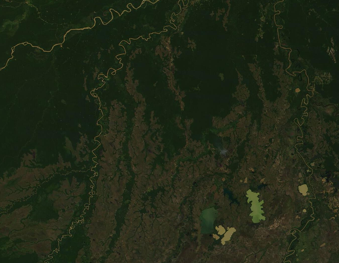
