
Images


July 10, 2021 - Cook Strait, New Zealand
 Tweet
Tweet
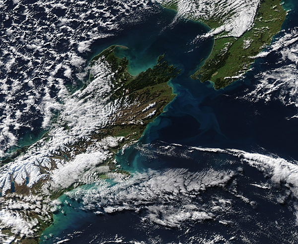
A patch of clear sky allowed the Moderate Resolution Imaging Spectroradiometer (MODIS) on board NASA’s Aqua satellite to acquire a dramatic view of the Cook Strait on July 8, 2021. Several banks of clouds stretch over the South Pacific Ocean and the western coast of New Zealand’s North Island while cloud overlies the snow atop the rugged ridges of the mountains on South Island. Open-celled clouds hover over the Tasman Sea.
Approximately 20 miles (32 km) long and only 14 miles (22.5 km) wide at the narrowest point, the small Cook Strait remains a formidable body of water. This narrow strip of sea, which separates the North and South Islands of New Zealand, has a reputation as one of the world’s roughest stretches of water. The two islands lie within the “Roaring Forties”, a belt of strong winds that circle the globe at about 40 degrees south. The gusting westerlies hit the islands and their mountainous terrain, and are forced into to the strait, which acts something like a huge wind tunnel. While ferries safely cross the Strait, on windy days the three-hour trip from Wellington Harbor, North Island, and Queen Charlotte Sound in the South Island has been described as “something like riding a bucking bronco”-a trip not for the faint of heart.
Image Facts
Satellite:
Aqua
Date Acquired: 7/8/2021
Resolutions:
1km (768.6 KB), 500m (2 MB), 250m (1.6 MB)
Bands Used: 1,4,3
Image Credit:
MODIS Land Rapid Response Team, NASA GSFC
