
Images


July 27, 2021 - Typhoon In-Fa makes landfall in China
 Tweet
Tweet
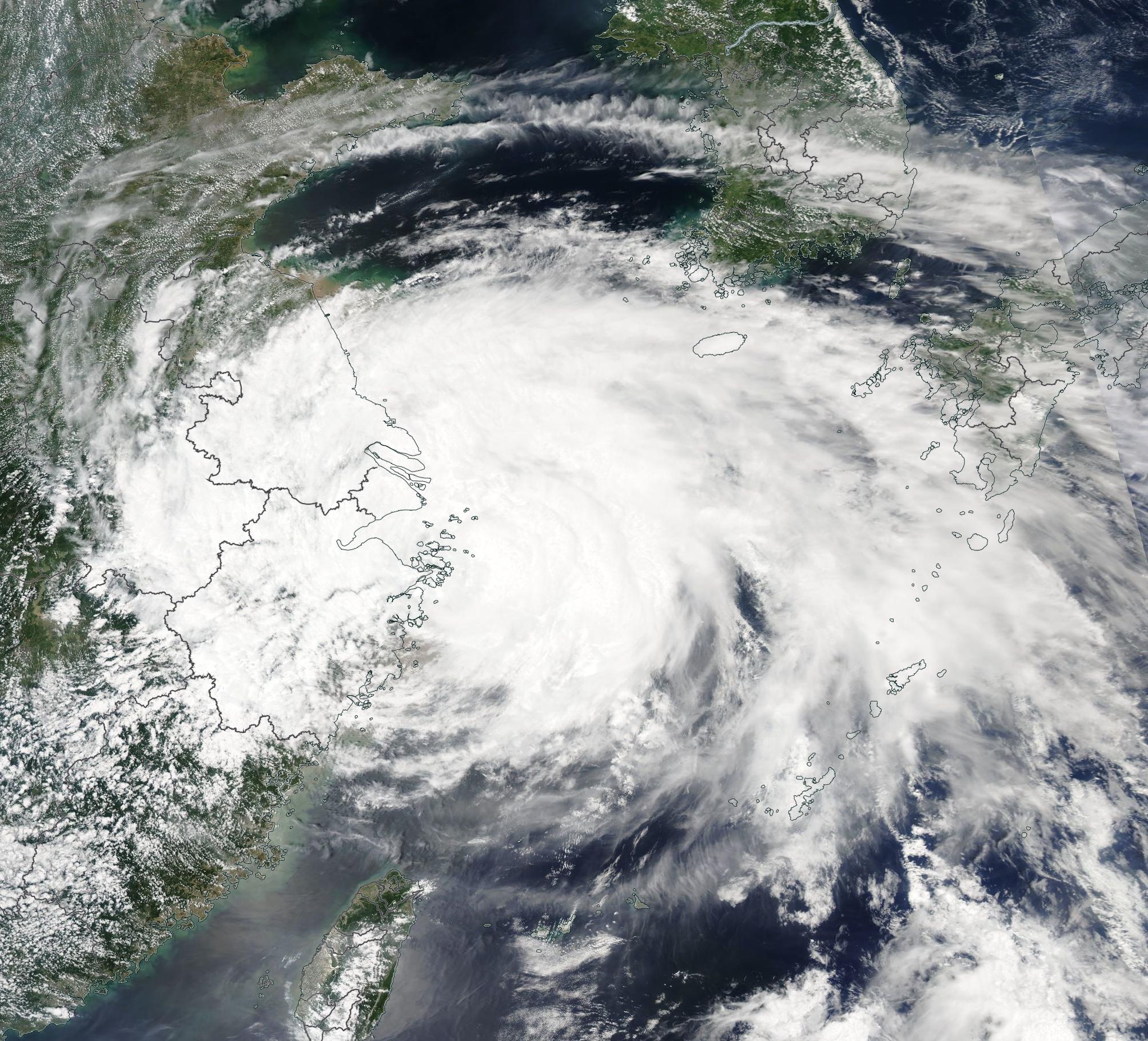
On July 25, 2021, the Moderate Resolution Imaging Spectroradiometer (MODIS) on board NASA’s Aqua satellite acquired a dramatic true-color image of Typhoon In-fa battering China as it made its first landfall in Zhoushan City, Zhejiang Province. At landfall, In-fa was packing winds of up to 85 mph (137 km/h)—the equivalent of a Category 1 storm on the Saffir-Simpson Hurricane Wind Scale. The city is located on Zhoushan Island at the southern mouth of Hangzhou Bay. After crossing Zhoushan Island, Typhoon In-fa made a second landfall in Pinghu, a city just south of Shanghai. At that time, maximum sustained winds registered about 74 mph (119 km/h), which is a strong tropical storm.
According to the South China Morning Post, about 4,700 trees had fallen on the streets and power outages had affected Pudong and Minhang districts. Torrential rain and storm surge caused flooding both in Zhoushan and the mainland, with 30 meteorological monitoring stations across Shanghai recorded over 70 mm (2.8 in) of rain in just 12 hours. About 320,000 people had been evacuated from Shanghai ahead of landfall, and about 1,800 ships had been moved from the path of the storm. Typhoon In-fa also caused cancellations of all flights in and near Shanghai on July 25, with hundreds more grounded on the morning of July 26.
Typhoon In-fa has weakened quickly over land, but still will bring heavy rain to inland China for several days.
Image Facts
Satellite:
Aqua
Date Acquired: 7/25/2021
Resolutions:
1km (637.7 KB), 500m (2.1 MB), 250m (6.2 MB)
Bands Used: 1,4,3
Image Credit:
MODIS Land Rapid Response Team, NASA GSFC
