Images
August 6, 2021 - Tropical Storm Nida
Tweet
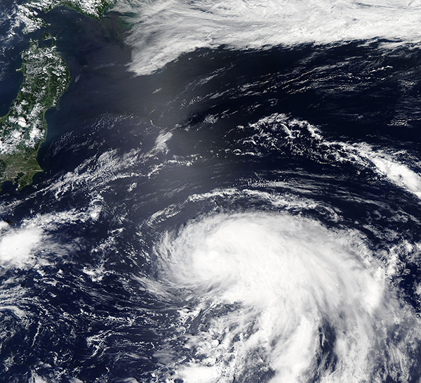
On August 5, 2021, Tropical Storm Nida became the eleventh named cyclone of the Pacific typhoon season. The Moderate Resolution Imaging Spectroradiometer (MODIS) on board NASA’s Terra satellite acquired a true-color image of the newly-formed cyclone on that same day that showed an elongated storm with most convective bands to the east of a cloud-filled center.
At 5:00 p.m. EDT (2100 UTC) on August 5, the Joint Typhoon Warning Center advised that Tropical Storm Nida was carrying maximum sustained winds of 46 mph (74 km/h) and was located about 490 miles (789 km) east of Yokosuka, Japan. Nida is expected to continue tracking generally northeastward through August 6, then shift more eastward. Although conditions favor strengthening through August 6, the storm will be facing increasing vertical wind shear and colder waters so is expected to weaker after that time.
Tropical Storm Nida does not pose direct hazards to land, but as part of a chain of three tropical storms and one tropical depression stretched across the western Pacific Ocean east of China and Japan, weather conditions will be decidedly windy and soggy across the region. The other systems are Tropical Depression 12W, Tropical Storm Mirinae, and Tropical Storm Lupit.
Image Facts
Satellite:
Aqua
Date Acquired: 8/5/2021
Resolutions:
1km (2.9 MB), 500m (8 MB), 250m (5.5 MB)
Bands Used: 1,4,3
Image Credit:
MODIS Land Rapid Response Team, NASA GSFC


