
Images


November 21, 2021 - Springtime in the Andes
 Tweet
Tweet
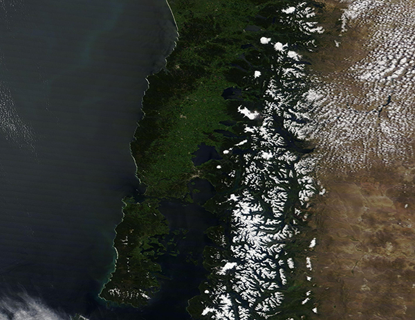
On November 16, 2021, the Moderate Resolution Imaging Spectroradiometer (MODIS) on board NASA’s Terra satellite acquired a true-color image of a sunny spring day over the Andes Mountains of South America.
The Andes stretch along the spine of the continent, crossing seven countries along the western coast of South America. This section of the Andes sits in the central region. The border between Argentina (east) and Chile (west) runs through the highest peaks of the mountains. The moisture blowing off of the South Pacific Ocean spurs green growth on the western side of the mountains while, shaded by the tall mountains, less moisture falls to the east. This creates a rain shadow in east and a very different ecosystem in the east—and the differences between verdant green and grassy brown is easily seen from space.
Each winter, snow accumulates over the Andes, and in September or October the winter’s snowpack begins to melt. The accumulated snowpack provides the primary source of water for communities at lower altitudes. Streams deliver the melt water to populated areas of central-western Argentina and central Chile, where it is particularly important for cities’ water supply, power generation, and agriculture.
Image Facts
Satellite:
Terra
Date Acquired: 11/16/2021
Resolutions:
1km (355.1 KB), 500m (893.9 KB), 250m (579.7 KB)
Bands Used: 1,4,3
Image Credit:
MODIS Land Rapid Response Team, NASA GSFC
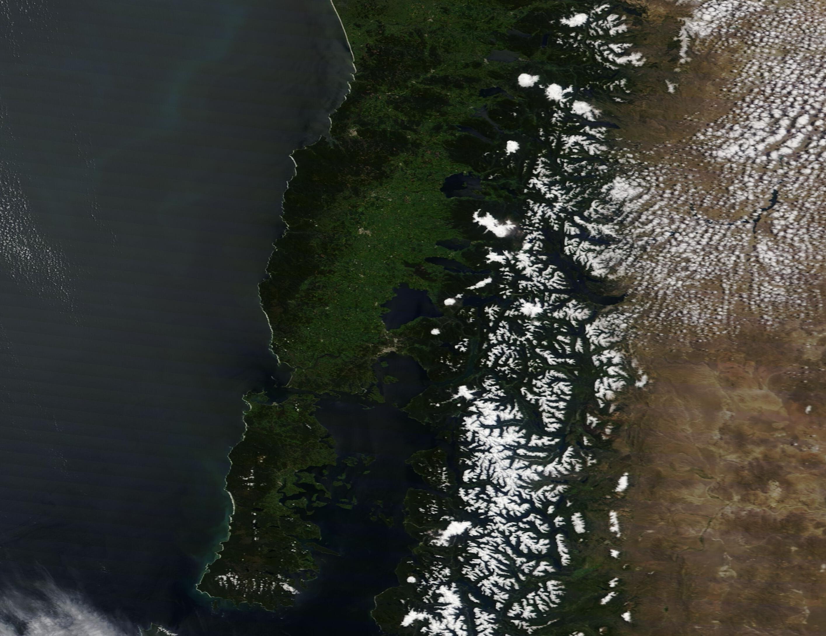
