Images
February 3, 2022 - Tropical Cyclone Batsirai
Tweet
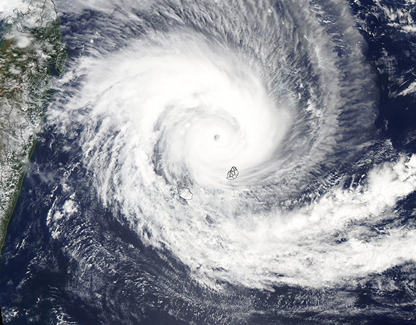
Just two weeks after being soaked by flooding rain from Tropical Storm Ana, citizens of Madagascar braced for the arrival of another potent cyclone. The Moderate Resolution Imaging Spectroradiometer (MODIS) on NASA’s Aqua satellite acquired this true-color image of Tropical Cyclone Batsirai on February 2, 2022. Around the time this image was acquired, Batsirai had sustained winds of 235 kilometers (145 miles) per hour, placing it in Category 4 on the Saffir-Simpson Hurricane Wind Scale.
Tropical Cyclone Batsirai is moving south-westward over the Indian Ocean and is expected to pass north of Mauritius and Réunion on February 2-3 local time, with maximum sustained winds between 195-215 km/h. (121-134 mph), or a strong Category 3/weak Category 4 storm. As of February 2, reports from Mauritius note heavy rainfall and strong winds have reached the island and have already caused flight disruptions. Forecasts from the U.S. Joint Typhoon Warning Center suggest the cyclone is likely to weaken somewhat before make landfall in central-eastern Madagascar late on February 4.
Image Facts
Satellite:
Aqua
Date Acquired: 2/2/2022
Resolutions:
1km (523.6 KB), 500m (1.6 MB), 250m (4.5 MB)
Bands Used: 1,4,3
Image Credit:
MODIS Land Rapid Response Team, NASA GSFC


