
Images


February 26, 2022 - Snow in the Mountain States
 Tweet
Tweet
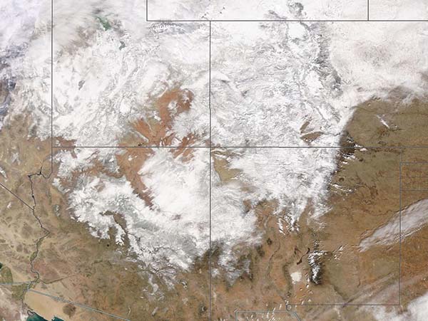
A coast-to-coast storm swept across the United States from February 20-25, 2022, leaving a swath of snow and ice along its path. Starting in the Pacific Northwest, temperatures rose ahead of the storm’s frontal system, then took a deep dive—as much as 50˚F was recorded in some locations in the Mid-Atlantic. Following the frigid air snow, freezing rain, and ice followed. By February 25, the storm was tormenting the Northeast, causing numerous accidents and flight cancellations as it made its way towards the Atlantic Ocean.
From February 20-22, the mountainous regions of the U.S. West were feeling the wrath of the storm, which dropped heavy snow on the high elevations. By the morning of February 22, more than a foot of snow had fallen in parts of the San Juan Mountains, which run through southwestern Colorado and northwestern New Mexico. The National Weather Service noted these Colorado snow totals on the morning of February 23: Meeker Park and Molas Pass recorded 12 inches (30.5 cm), Wolf Creek Pass accumulated 17 in (43.2 cm), and the town of Sawpit came in the winner with 18.8 inches (47.8 cm). Sawpit is a small town in San Miguel County, near the town of Telluride.
The Moderate Resolution Imaging Spectroradiometer (MODIS) on board NASA’s Terra satellite acquired a true-color image of fresh snow across the Mountain States. The area near the center of the image, where four states come together, is known as the “Four Corners”. Utah sits in the northwest corner. Moving clockwise, the other three states are Colorado, New Mexico, and Arizona. Idaho sits west of Utah and a small portion of southern Wyoming can be seen north of Utah and Colorado, with a bit of Nebraska visible in the northeast.
Image Facts
Satellite:
Terra
Date Acquired: 2/24/2022
Resolutions:
1km (285.4 KB), 500m (1 MB), 250m (2.4 MB)
Bands Used: 1,4,3
Image Credit:
MODIS Land Rapid Response Team, NASA GSFC
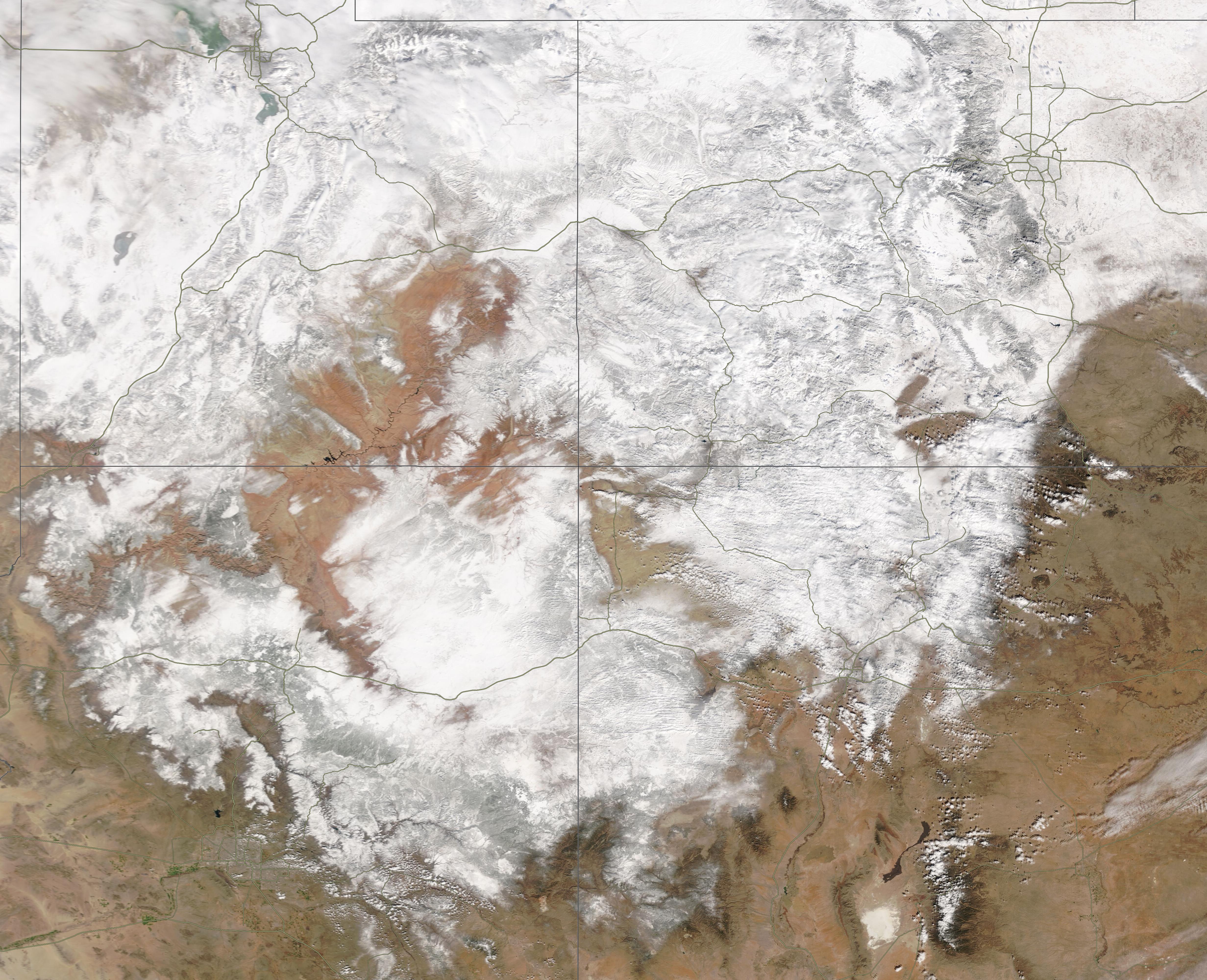
