
Images


March 4, 2022 - Sea Ice and Cloud Streets in the Labrador Sea
 Tweet
Tweet
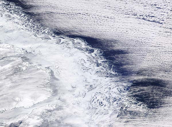
Ice and cloud combined to create a fanciful scene over the Labrador Sea between Canada and Greenland in early March 2022. The Moderate Resolution Imaging Spectroradiometer (MODIS) on board NASA’s Terra satellite acquired this true-color image on March 2.
Ice hugs the snow-covered coast of Newfoundland and Labrador, Canada, where the frigid off-shore winds chill the relatively fresh near-coast water, allowing the formation of floating sea ice. The water is shallower and less saline than in the open sea, thus ice will form more easily here. The swirling filigrees at the sea ice edge are areas where the ice is thin and more easily moved by winds and currents.
To the east, a large bank of cloud lines up in parallel bands, a pattern known as cloud streets. These are formed when strong winds push a mass of cold and dry air across a relatively warm and moist body of water. As the cold air mass moves over the water, it quickly gains moisture necessary to form clouds. The clouds line up in organized rows parallel to the direction of the wind.
Image Facts
Satellite:
Terra
Date Acquired: 3/2/2022
Resolutions:
1km (252.2 KB), 500m (542.8 KB), 250m (1.8 MB)
Bands Used: 1,4,3
Image Credit:
MODIS Land Rapid Response Team, NASA GSFC
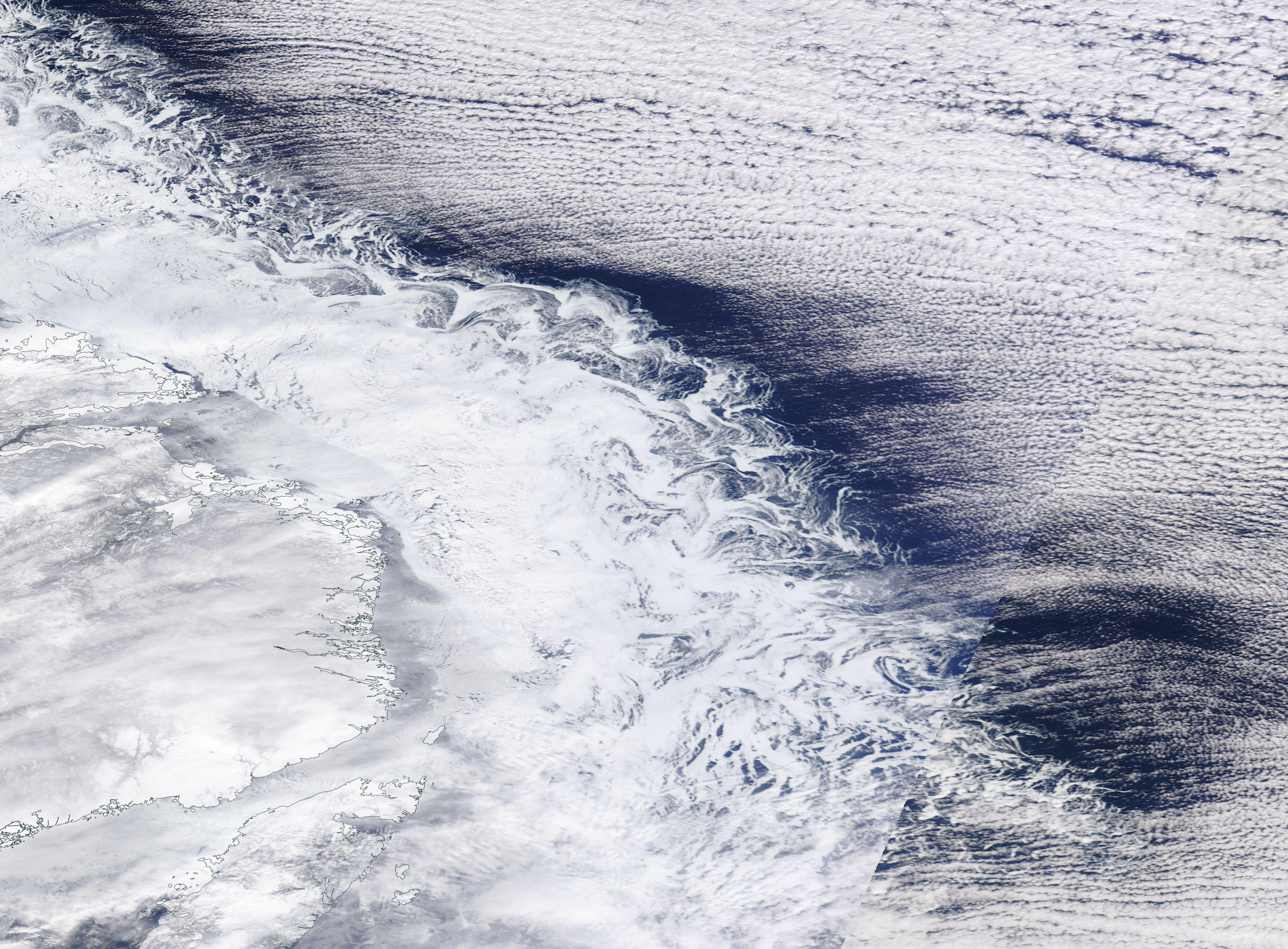
