
Images


March 13, 2022 - Sediment in the Río de la Plata
 Tweet
Tweet
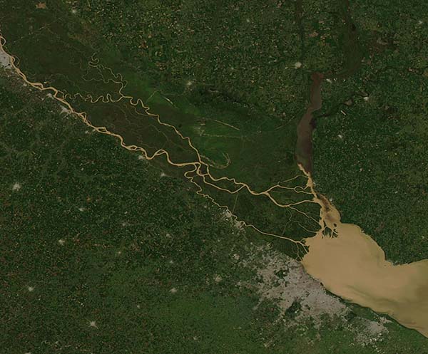
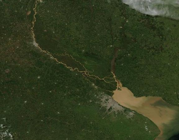
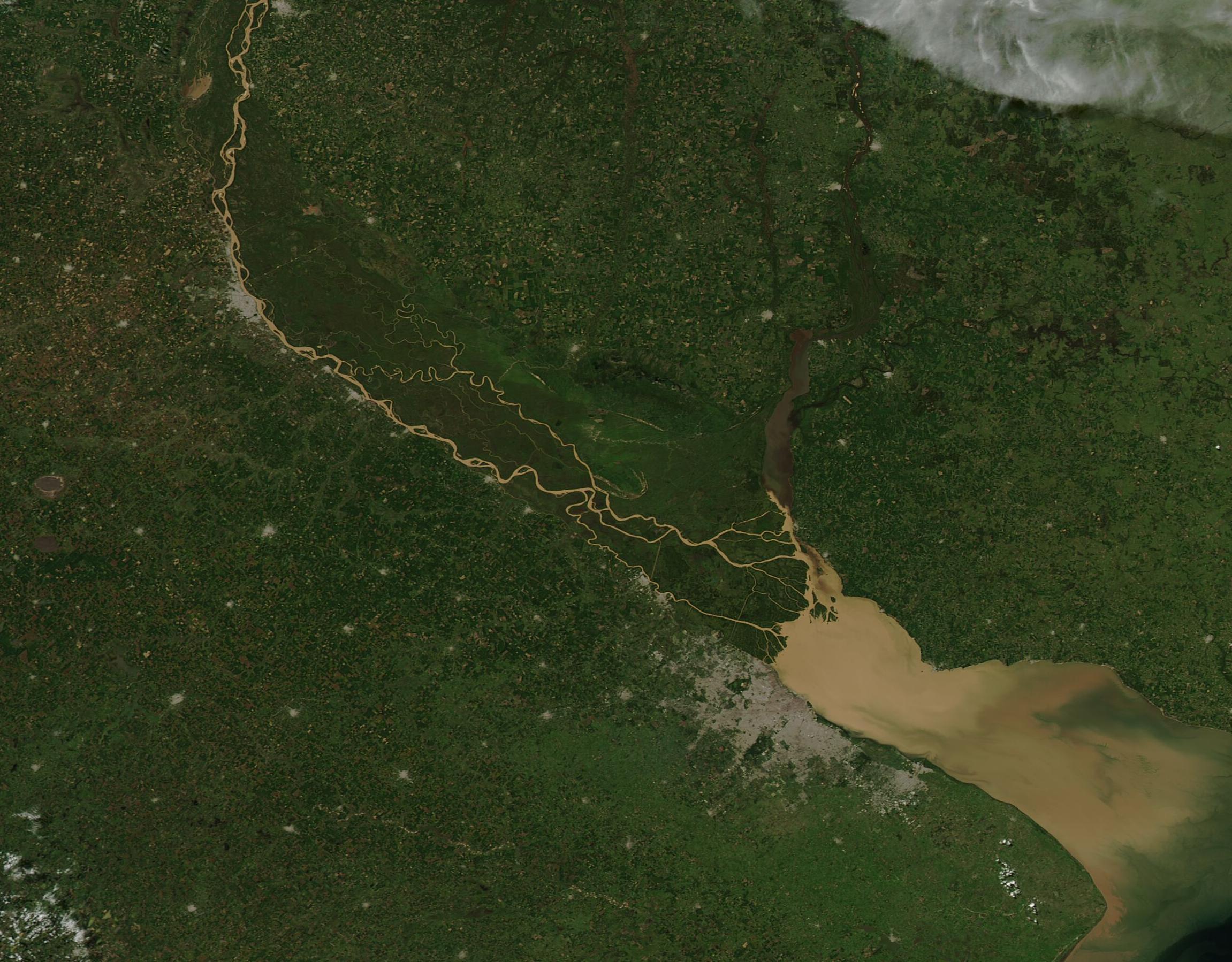
On March 8, 2022. The Moderate Resolution Imaging Spectroradiometer (MODIS) on board NASA’s Aqua satellite acquired a true-color image of muddy water pouring into the Río de la Plata, a funnel-shaped estuary that sits between Uruguay (north) and Argentina (south) and connects with the South Atlantic Ocean.
The silt-laden Paranà River separates into multiple channels as it courses through the large labyrinth of trees and marsh known as the Paranà River Delta. The Paranà River carries most of the sediment into the Río de la Plata, and also provides about three-quarters of the fresh water that flows into the estuary. Topsoil running off agricultural fields and flowing into the Paranà as a result of rainstorms likely produced the heavy load of brown sediment carried by this river.
The other major river feeding Río de la Plata is the Uruguay River, which can be seen flowing from the north, carrying very little sediment. The large area of gray sitting on the southern coast of the Río de la Plata marks the city of Buenos Aires, the capital and largest city of Argentina.
Image Facts
Satellite:
Aqua
Date Acquired: 3/8/2022
Resolutions:
1km (38 KB), 500m (573.8 KB), 250m (573.8 KB)
Bands Used: 1,4,3
Image Credit:
MODIS Land Rapid Response Team, NASA GSFC
On March 8, 2022. The Moderate Resolution Imaging Spectroradiometer (MODIS) on board NASA’s Aqua satellite acquired a true-color image of muddy water pouring into the Río de la Plata, a funnel-shaped estuary that sits between Uruguay (north) and Argentina (south) and connects with the South Atlantic Ocean. The silt-laden Paranà River separates into multiple channels as it courses through the large labyrinth of trees and marsh known as the Paranà River Delta. The Paranà River carries most of the sediment into the Río de la Plata, and also provides about three-quarters of the fresh water that flows into the estuary. Topsoil running off agricultural fields and flowing into the Paranà as a result of rainstorms likely produced the heavy load of brown sediment carried by this river.
The other major river feeding Río de la Plata is the Uruguay River, which can be seen flowing from the north, carrying very little sediment. The large area of gray sitting on the southern coast of the Río de la Plata marks the city of Buenos Aires, the capital and largest city of Argentina.
Image Facts
Satellite:
Aqua
Date Acquired: 3/8/2022
Resolutions:
1km (38 KB), 500m (573.8 KB), 250m (573.8 KB)
Bands Used: 1,4,3
Image Credit:
MODIS Land Rapid Response Team, NASA GSFC
