
Images


March 24, 2022 - Clear Skies over Europe
 Tweet
Tweet
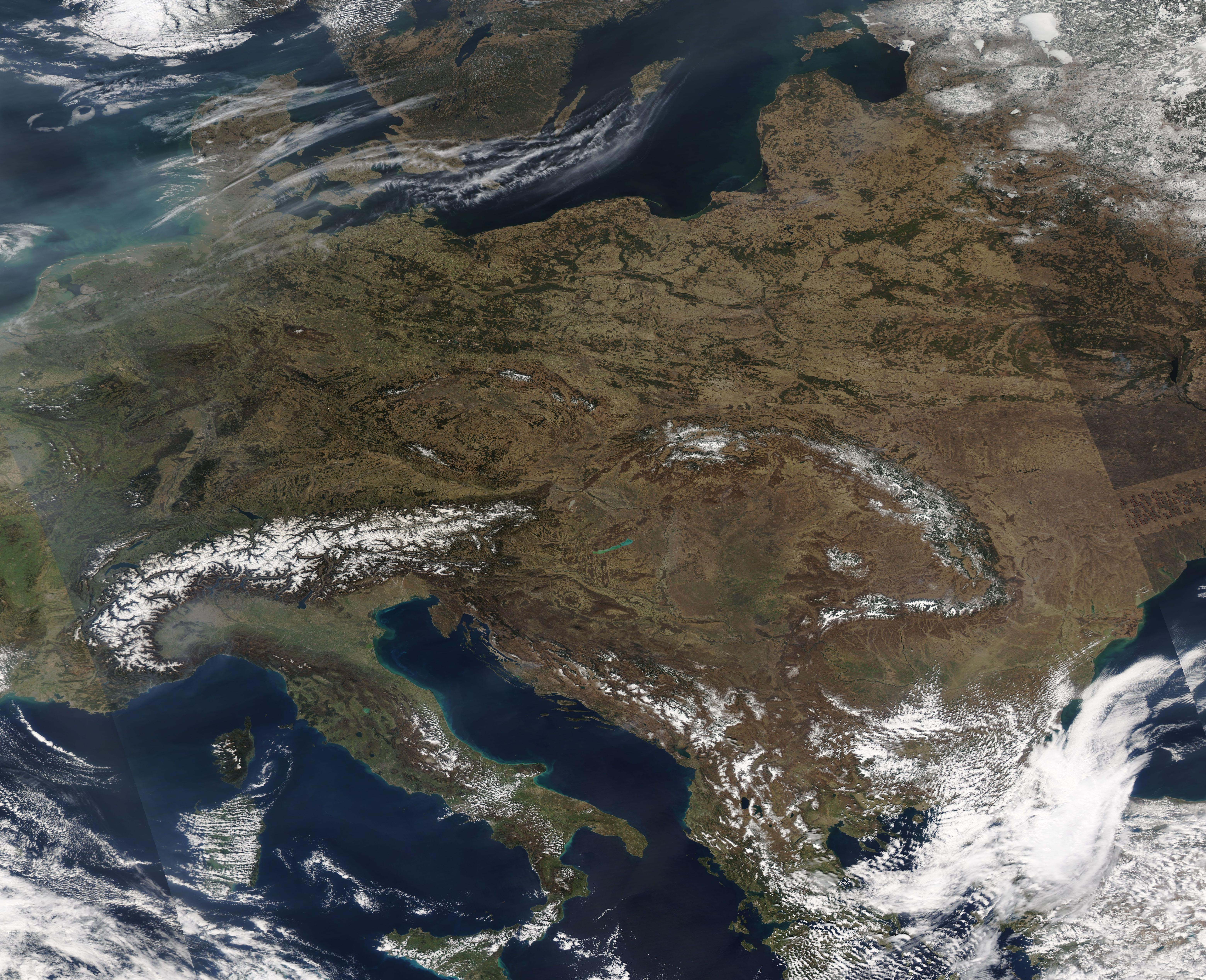
On March 22, 2022, the Moderate Resolution Imaging Spectroradiometer (MODIS) on board NASA’s Terra satellite acquired a true-color image of a gorgeous clear-sky early spring day over much of Europe. The image stretches more than 2,000 km (1,240 mi) from France (west) to Ukraine (east) and about 2,200 km (1,367 mi) from Estonia (north) to Turkey (south), and all under cloud-free skies except for a small area in the southeast.
The high elevation of many of the most notable mountain ranges of Europe are topped with snow. The Alps, Europe’s highest and most extensive mountain range, is shared by eight countries, including Switzerland, Monaco, Italy, France, Liechtenstein, Austria, Germany, and Slovenia. The Apennines run along the spine of Italy and, just across the Adriatic Sea, the Dinaric Alps rise near the coast roughly parallel to the Apennines. The Carpathian Mountains, a horse-shoe shaped mountain range in Eastern Europe, stretch across the Czech Republic, Poland, Romania, Slovakia, Hungary, and Ukraine. Running southeast from the Carpathians to the Black Sea, and partially covered by cloud in this image, are the Balkan Mountains. A frozen lake, which appears bright white near the upper right (northeast) corner of the image is Lake Piepsi/Chudskoe, a lake shared by Estonia (west) and Russia (east).
Image Facts
Satellite:
Terra
Date Acquired: 3/22/2022
Resolutions:
1km (1.2 MB), 500m (3.9 MB),
Bands Used: 1,4,3
Image Credit:
MODIS Land Rapid Response Team, NASA GSFC
