
Images


March 25, 2022 - Ice on Missouri River and Lake Sakakawea
 Tweet
Tweet
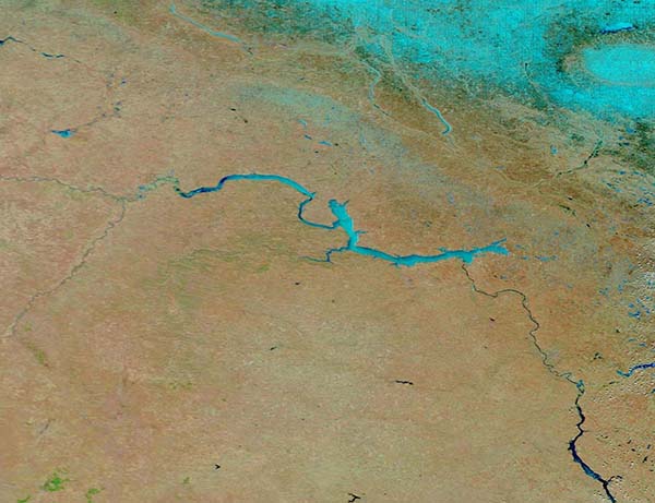
Frozen lakes and snow on the ground gave evidence that winter-like temperatures continued in parts of North Dakota through the early days of spring 2022.
The Moderate Resolution Imaging Spectroradiometer (MODIS) on board NASA’s Terra satellite acquired a false-color image that highlighted snow and ice on March 23. This type of false-color image combines visible and shortwave infrared light (Bands 7,2,1). Here, vegetation appears green, snow and ice appear bright blue, open water are navy blue, and unvegetated land is brown. It is clear that, although much of the Missouri River (especially southeast of the lake) appears ice-free, both Lake Sakakawea and the northern reaches of the Missouri River bear a large covering of ice. A thin swath of snow sits north of the lake and, further north, deeper snow covers the ground.
Lake Sakakawea is named—in the Hidatsa language—for the Shoshone woman generally known as Sacagawea, or “Bird Woman.” In 1805 –1806, she accompanied the Lewis and Clark Expedition as an interpreter and guide.
The lake was created in 1954 following the completion of Garrison Dam (not shown) on the Missouri River. With a surface area of approximately 148,924 hectares (368,000 acres) and length of 286 kilometers (178 miles), Lake Sakakawea is one of the largest artificial reservoirs in the United States. The lake provides excellent ice fishing, and when the “ice is nice”, there are 114 access points on the lake for hardy fishermen to enjoy that winter sport.
Image Facts
Satellite:
Terra
Date Acquired: 3/23/2022
Resolutions:
1km (54 KB), 500m (146 KB), 250m (407.3 KB)
Bands Used: 7,2,1
Image Credit:
MODIS Land Rapid Response Team, NASA GSFC
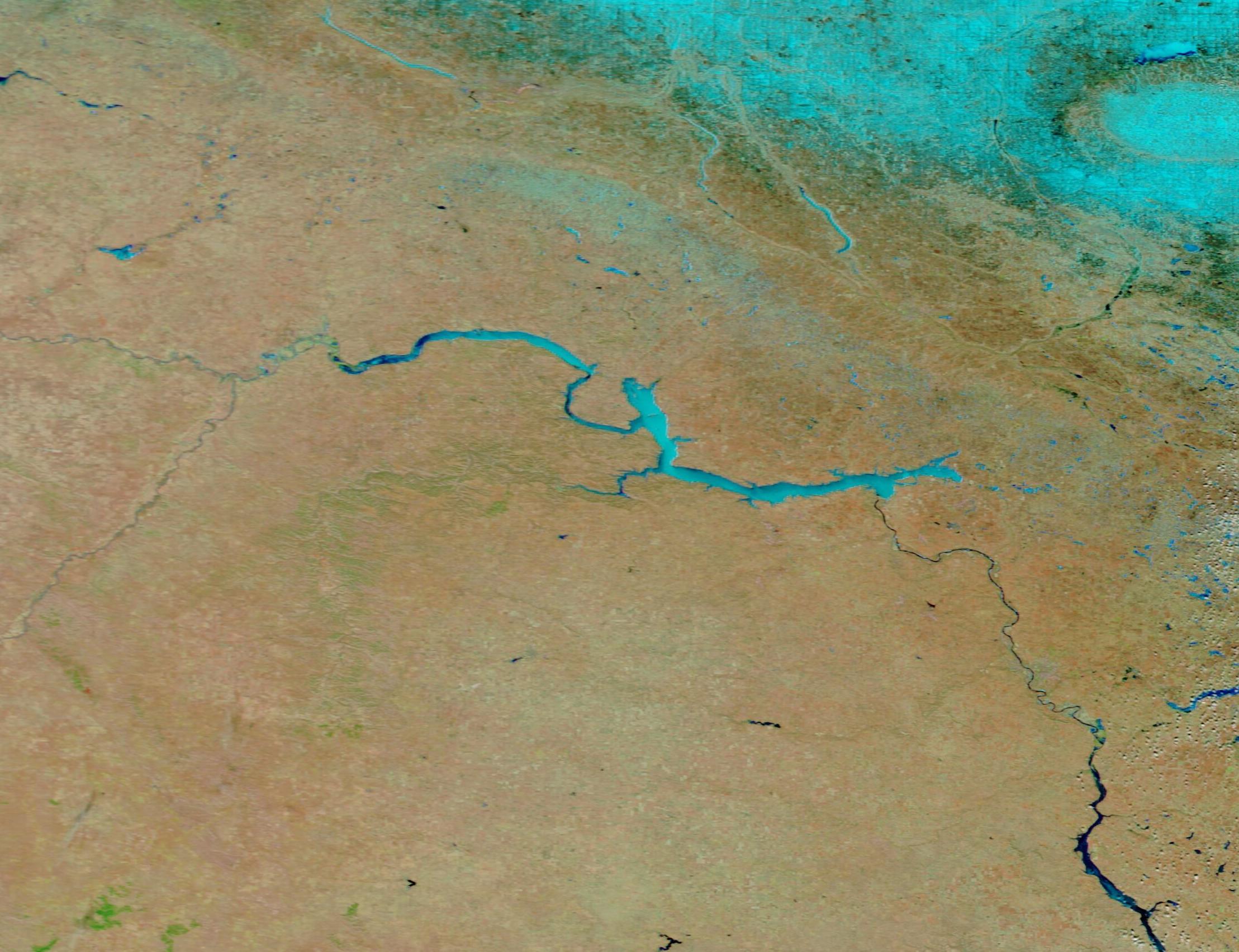
