
Images


March 30, 2022 - Cuba
 Tweet
Tweet
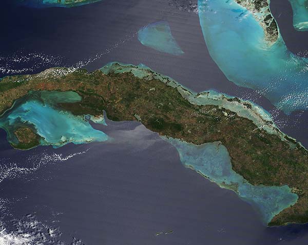
The island nation of Cuba sits in the Caribbean Sea just 90 miles (150 km) south of the tip of Florida, United States. The country is made up of about 1,6000 islands, islets, and cays and is part of the group of islands known as the Greater Antilles. Besides Cuba, the Greater Antilles included Hispaniola, Jamaica, and Puerto Rico. The largest island, Cuba, takes the name of the nation and stretches 780 mi (1,250 km) long and 119 mi (191 km) wide, yet squeezes to a mere 19 mi (31 km) at the narrowest point. The second- largest island, Isla de la Juventud (Isle of Youth) sits off the southwestern coast of the island of Cuba.
The Moderate Resolution Imaging Spectroradiometer (MODIS) on NASA’s Terra satellite captured a gorgeous true-color image centered on Cuba on March 28, 2022. The island itself appears a mix of brown and green, shades created primarily by a patchwork of plains filled with agricultural fields still in winter senescence, green pastures, and rolling hills covered in vegetation. The country also possesses relatively large stretches of mangrove forest along several coastal locations.
Offshore, glowing turquoise tints mark areas of shallow water, including many coral reefs and sea grass marshes. About one-quarter of the planet’s marine species depend on the food and shelter provided by tropical coral reefs, a habitat that spans only about one percent of the ocean floor. The Caribbean Sea is rich in coral reefs, including those around Cuba.
North of Cuba, the deep water of the Florida Strait appears dark blue in comparison to the shallower, turquoise water covering the Cay Sal Bank and Bahama Banks of the Bahamas. Both of these platforms formed as carbonate minerals—produced by certain types of bacteria and sea organisms—were deposited on the ocean floor over millions of years.
A silvery-toned area seen across much of the image is an optical phenomenon known as sun glint. This occurs when sunlight reflects off the surface of water at the same angle that a satellite sensor views it. The result is a mirror-like specular reflection of sunlight off the water and back at the satellite sensor, and an area of silvery-gray in a MODIS image. The parallel lines across the sunglint region are only artifact, and do not represent any natural phenomenon.
Image Facts
Satellite:
Terra
Date Acquired: 3/28/2022
Resolutions:
1km (77.5 KB), 500m (171 KB), 250m (448.7 KB)
Bands Used: 1,4,3
Image Credit:
MODIS Land Rapid Response Team, NASA GSFC
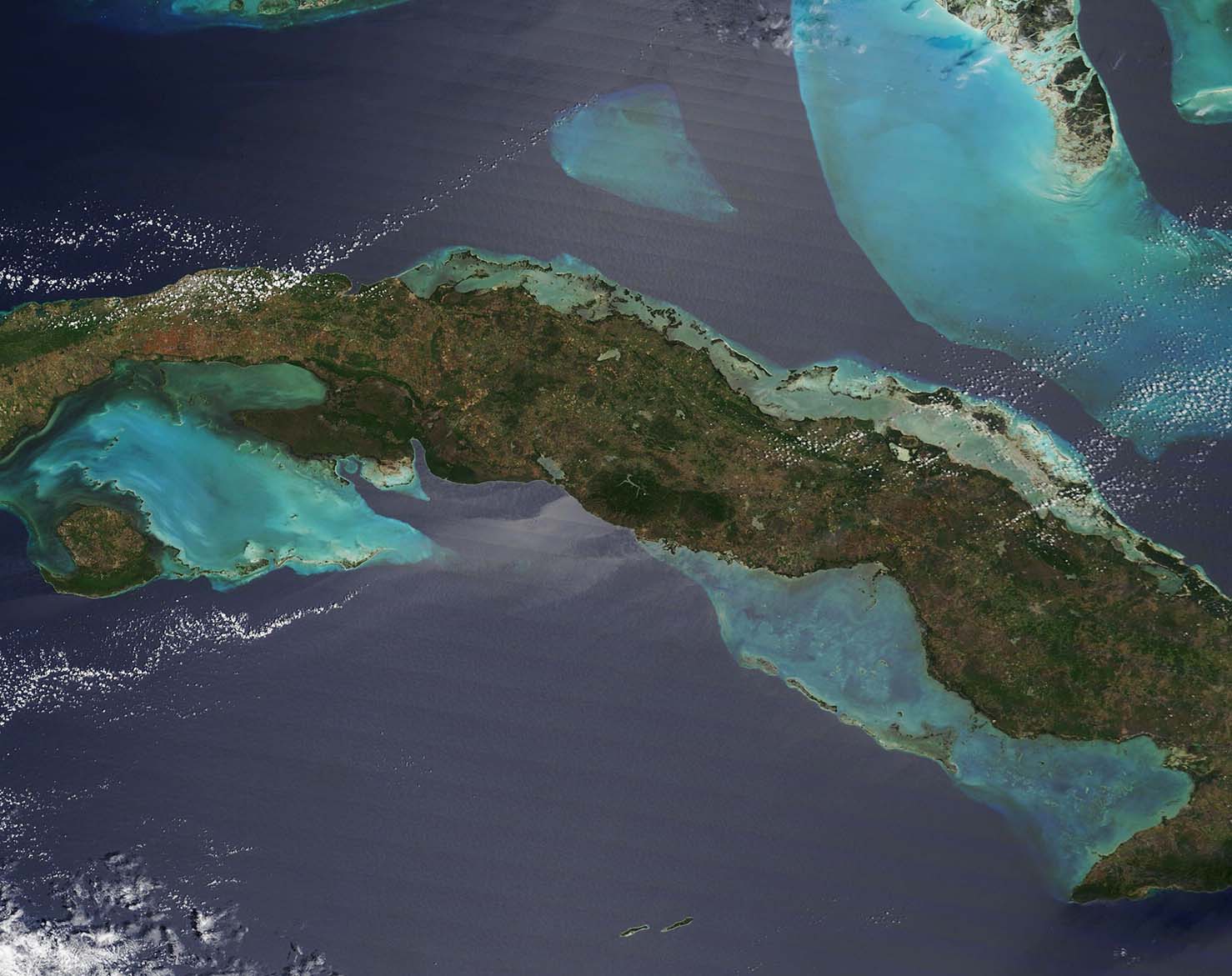
