
Images


April 20, 2022 - Taklamakan Shrouded in Dust
 Tweet
Tweet
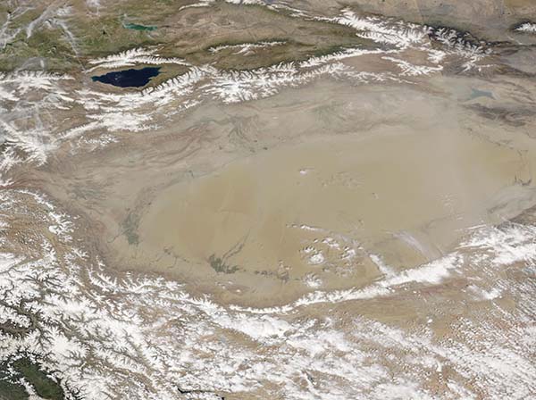
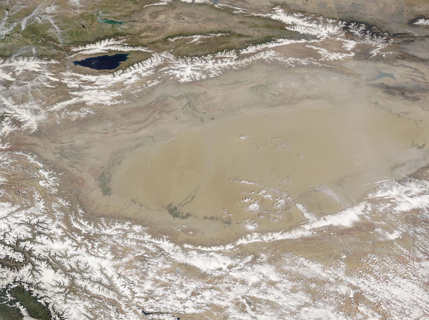
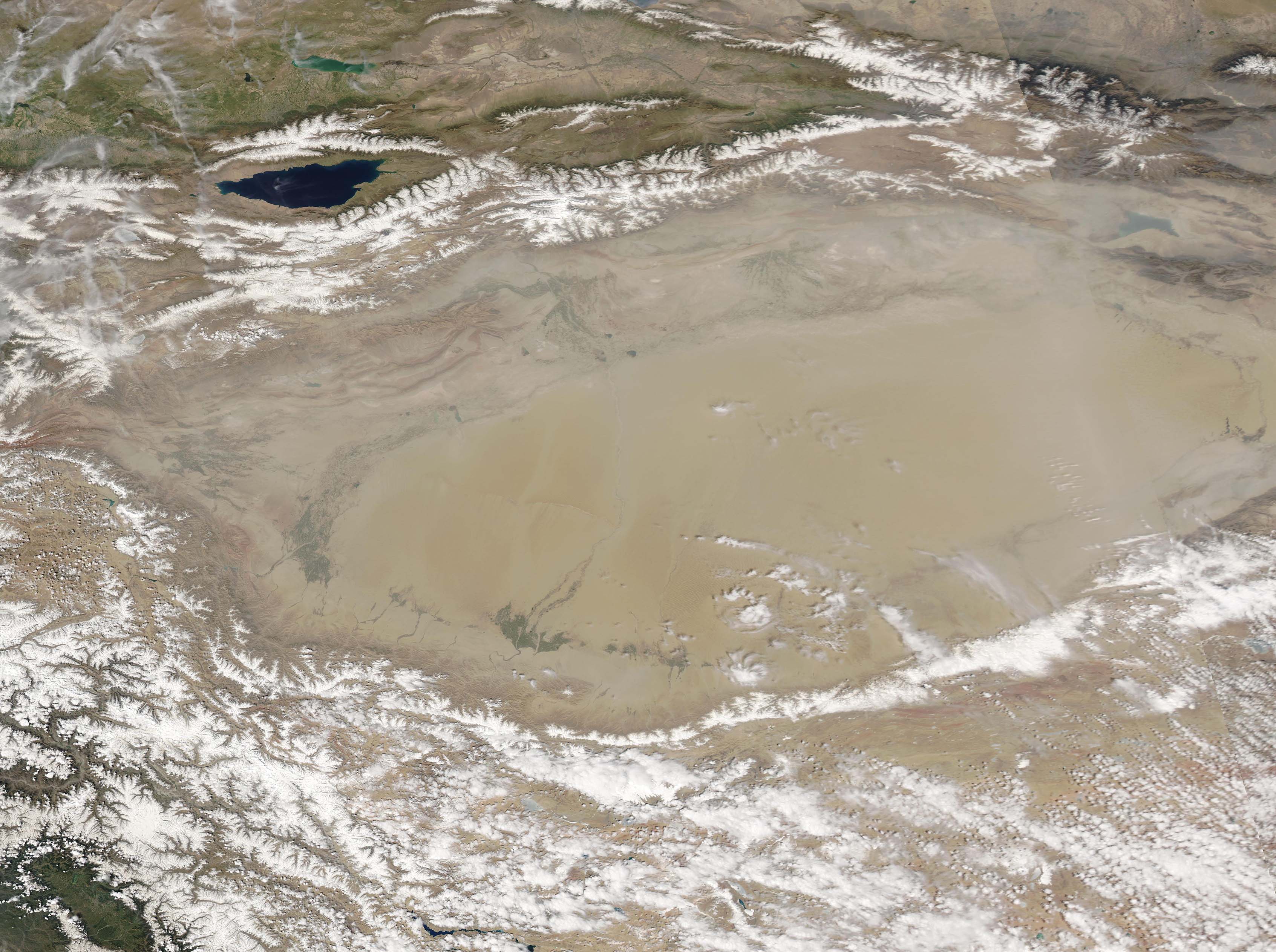
Sitting in western China and cradled on three sides by tall mountain ranges, the Taklamakan Desert is one of the most barren and driest areas on Earth. Created by the rain shadow of the surrounding mountains, parts of the Taklamakan receive only 10 millimeters (0.4 inches) of rainfall in an entire year. It is also the world’s second largest shifting sand desert, with about 85 percent of its area filled with towering sand dunes, measuring up to 200-300 meters (650 to 900 feet) that move with the prevailing winds. Thanks to its location close to frigid Siberia, the Taklamakan Desert experiences some of the Earth’s record cold temperatures in winter. Even in summer, nighttime temperatures remain chilly. Thanks to the topography, strong winds frequently blow across the expansive desert. And these winds create massive sandstorms, especially in the spring and summer.
On April 18, 2022, the Moderate Resolution Imaging Spectroradiometer (MODIS) on board NASA’s Aqua satellite acquired a true-color image of the Taklamakan Desert veiled by a large dust storm. Snow tops the Kunlun Shan mountains to the south and the Tian Shan mountains to the north. Lake Issyk-Kul sits in the Tian Shan mountains of eastern Kyrgyzstan. The air over the mountains is dust-free, allowing a crisp, clear view of the landscape. In sharp contrast, dust covers the entire area over the Taklamakan Desert and, in the east, a band of dust completely obscures the land from view.
Image Facts
Satellite:
Aqua
Date Acquired: 4/18/2022
Resolutions:
1km (296.4 KB), 500m (852.3 KB), 250m (3.1 MB)
Bands Used: 1,4,3
Image Credit:
MODIS Land Rapid Response Team, NASA GSFC
