
Images


April 30, 2022 - North Carolina
 Tweet
Tweet
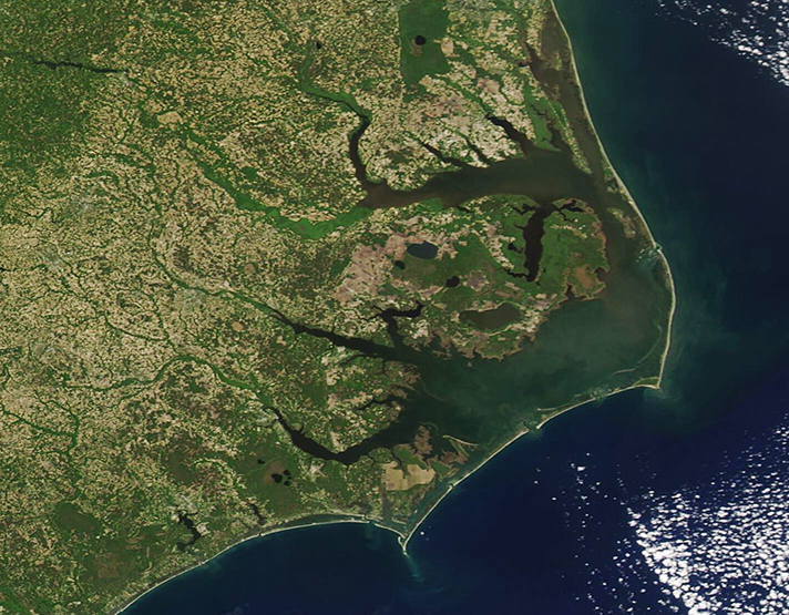
On April 28, 2022, the Moderate Resolution Imaging Spectroradiometer (MODIS) on board NASA’s Aqua satellite acquired a true-color image of coastal North Carolina.
Sitting halfway between Florida and New York States, North Carolina’s landscape is divided into three regions: the Mountains in the west, the Piedmont in the center, and the eastern Coastal Plain (also known as coastal tidewater). The broad, flat tidewater region is rich agricultural land. With farmland making up about 8.4 million acres of North Carolina’s land, and agribusiness providing 17.5 percent of total jobs in the state, the size and numbers of the state’s 46,000 farms are the largest in the expansive of the tidewater. North Carolina is the number 1 producer of sweet potatoes in the United States, the number two producer of turkeys, the third-ranking producer of hogs and pigs, and produces a wide variety of other crops, including cucumbers, peanuts, upland cotton, bell peppers, and burley tobacco. In this spring-time image, agricultural cropland and fields appear light tan.
At the far eastern edge of the tidewater lies the Outer Banks, a chain of narrow barrier islands that glisten with sandy beaches. These islands sweep southward along the Atlantic Coast from the border with Virginia in three long arcs that are divided by two capes, Cape Hatteras and Cape Lookout. Roanoke Island, sitting just behind the Atlantic Outer Banks, is the site of the first English settlement in the New World, which was founded in 1585 and subsequently failed. In 1587 a second colony was settled, but that, too, disappeared by 1590.
Behind the Outer Banks, North Carolina’s land is filled with vast marshlands and several large rivers, making this section of the United States one of the wettest areas in the nation. The large Pamlico Sound fills most of the area between the mainland and the Outer Banks, and three of the larger rivers cutting into the mainland, from north to south, are the Albemarle Sound, the Pamlico River, and the Neuse River.
Image Facts
Satellite:
Aqua
Date Acquired: 4/28/2022
Resolutions:
1km (149.5 KB), 500m (378.5 KB), 250m (864.2 KB)
Bands Used: 1,4,3
Image Credit:
MODIS Land Rapid Response Team, NASA GSFC
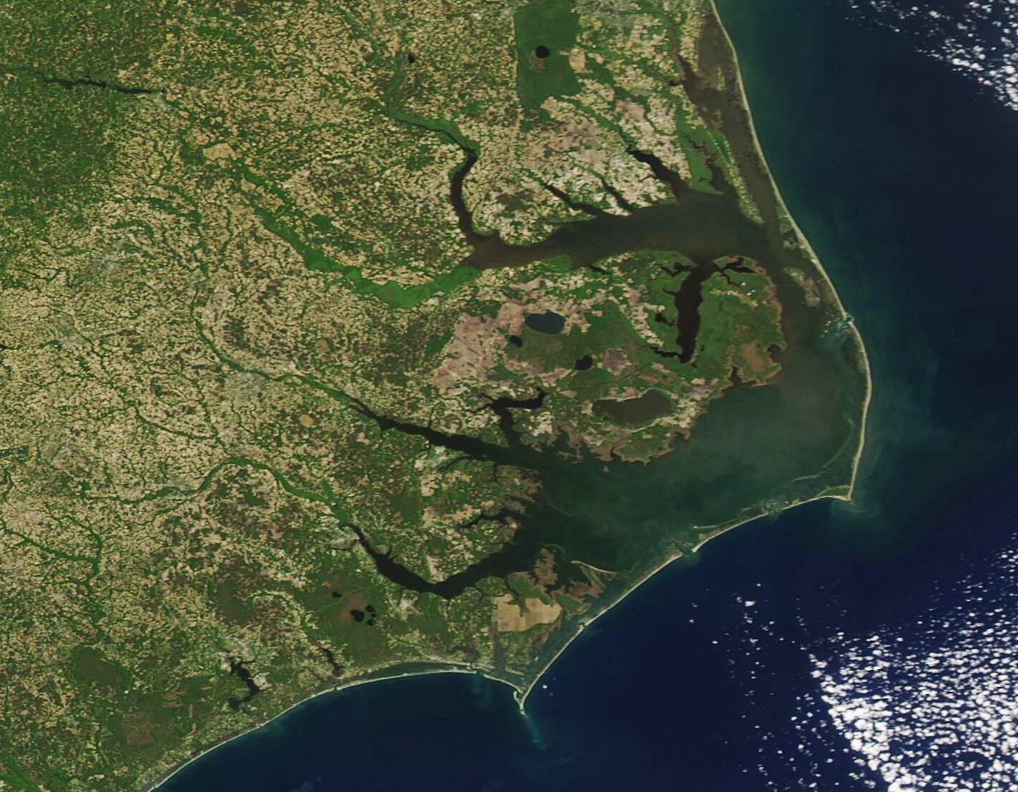
